MyTopo
Beaver River New York US Topo Map
Couldn't load pickup availability
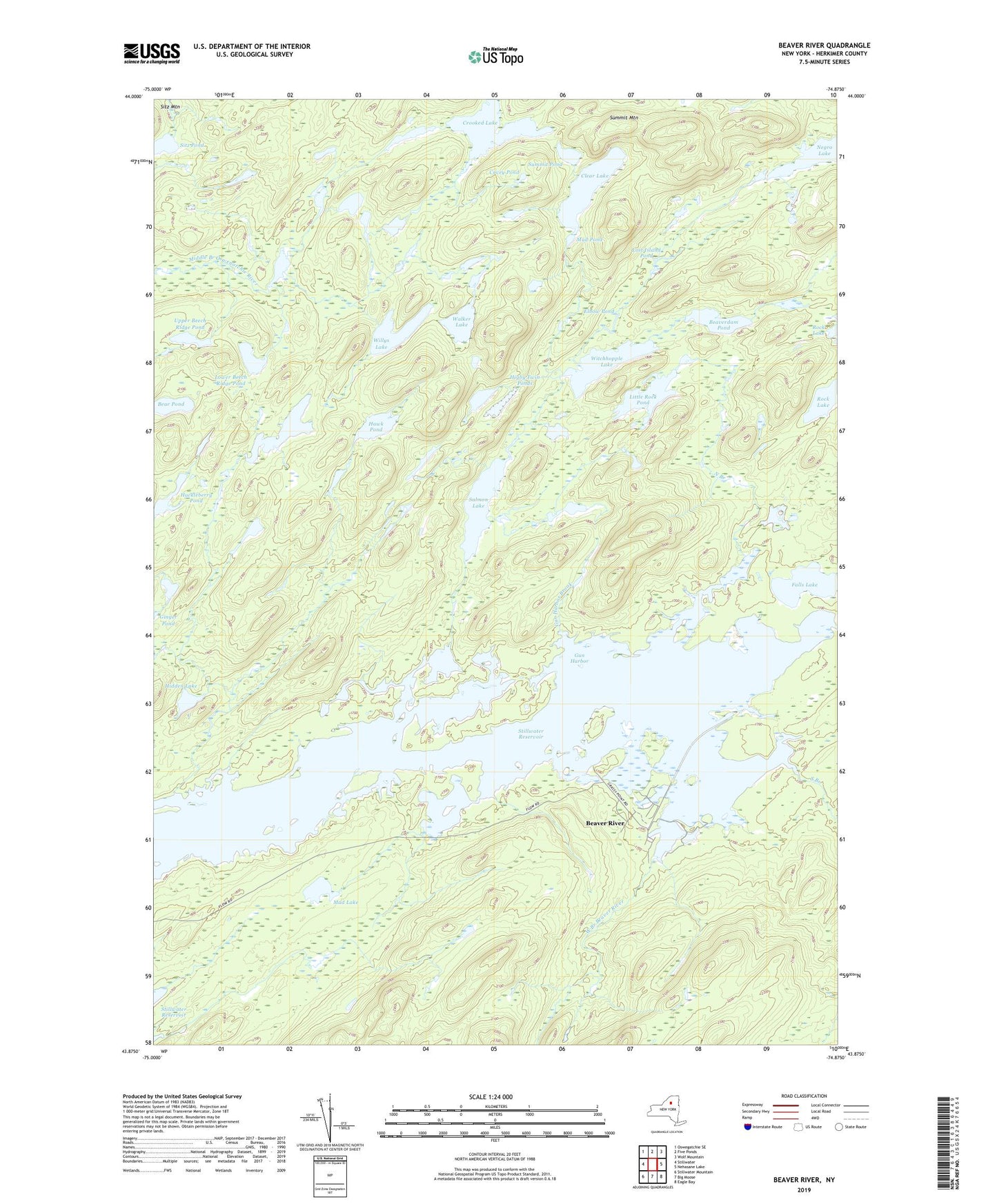
2023 topographic map quadrangle Beaver River in the state of New York. Scale: 1:24000. Based on the newly updated USGS 7.5' US Topo map series, this map is in the following counties: Herkimer. The map contains contour data, water features, and other items you are used to seeing on USGS maps, but also has updated roads and other features. This is the next generation of topographic maps. Printed on high-quality waterproof paper with UV fade-resistant inks.
Quads adjacent to this one:
West: Stillwater
Northwest: Oswegatchie SE
North: Five Ponds
Northeast: Wolf Mountain
East: Nehasane Lake
Southeast: Eagle Bay
South: Big Moose
Southwest: Stillwater Mountain
This map covers the same area as the classic USGS quad with code k43074h7.
Contains the following named places: Beaver River, Beaverdam Pond, Big Burnt Lake, Clear Lake, Covey Pond, Crooked Lake, Dismal Pond, Elbow Pond, Falls Lake, Gun Harbor, Gun Harbor Brook, Hawk Pond, Hidden Lake, Higby Twin Ponds, Huckleberry Pond, Little Rock Pond, Loon Lake, Lost Island Pond, Lower Beech Ridge Pond, Mud Lake, Mud Pond, Norridge Trail, Norridgewock Lake, North Branch, Salmon Lake, Salmon Lake Trail, Sitz Pond, South Branch, Stillwater Reservoir, Summit Mountain, Summit Pond, Trout Pond, Upper Beech Ridge Pond, Walker Lake, West Branch Beaver River, Willys Lake, Witchhopple Lake