MyTopo
Oswegatchie New York US Topo Map
Couldn't load pickup availability
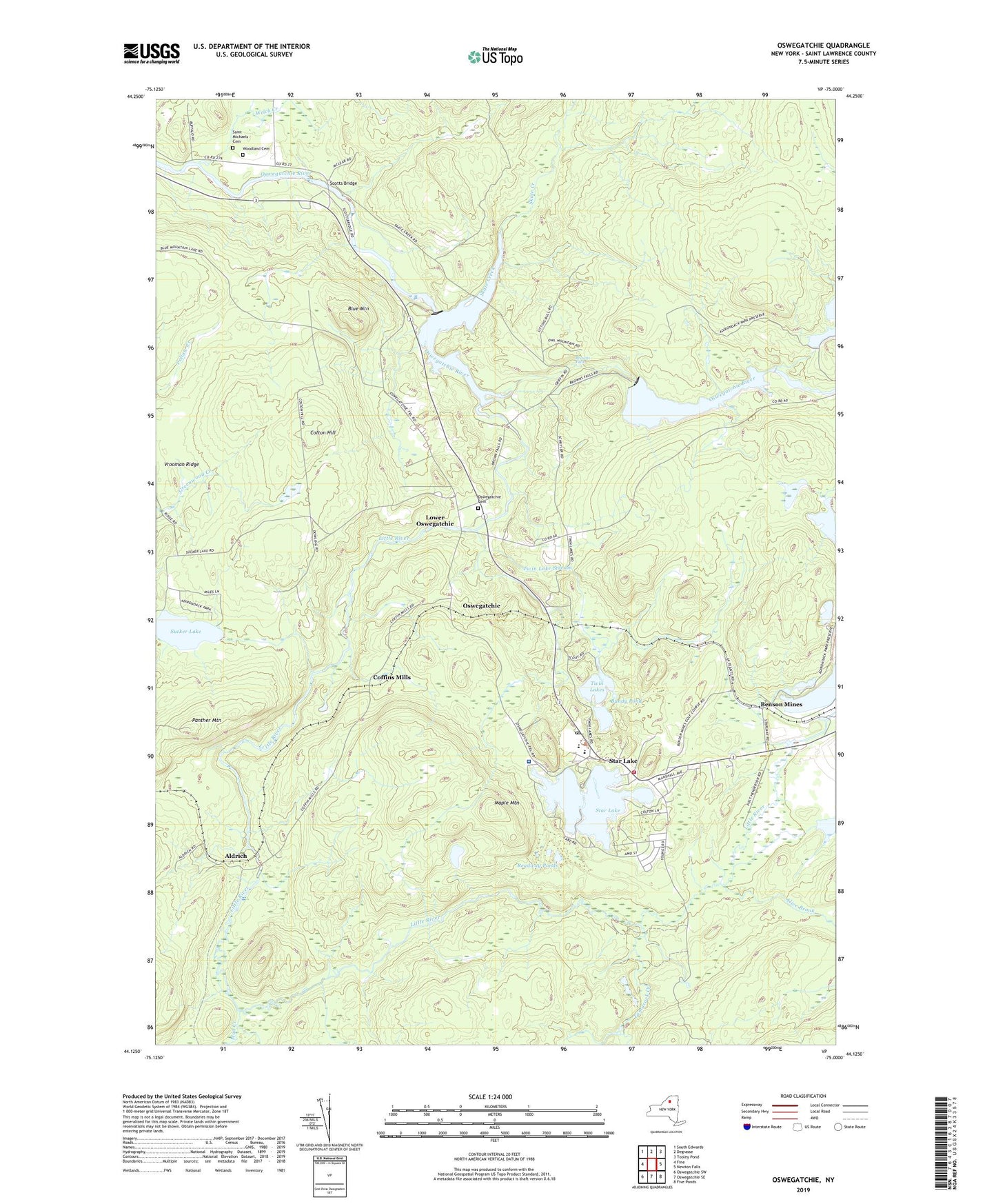
2023 topographic map quadrangle Oswegatchie in the state of New York. Scale: 1:24000. Based on the newly updated USGS 7.5' US Topo map series, this map is in the following counties: St. Lawrence. The map contains contour data, water features, and other items you are used to seeing on USGS maps, but also has updated roads and other features. This is the next generation of topographic maps. Printed on high-quality waterproof paper with UV fade-resistant inks.
Quads adjacent to this one:
West: Fine
Northwest: South Edwards
North: Degrasse
Northeast: Tooley Pond
East: Newton Falls
Southeast: Five Ponds
South: Oswegatchie SE
Southwest: Oswegatchie SW
This map covers the same area as the classic USGS quad with code o44075b1.
Contains the following named places: Aldrich, Alice Brook, Benson Mines, Blue Mountain, Browns Fall Powerplant, Browns Falls, Bundy Pond, Clifton - Fine Municipal Golf Course, Clifton Fine Hospital, Coffins Mills, Colton Hill, First Baptist Church, Flat Rock Powerplant, Little River, Lower Oswegatchie, Maple Mountain, Mud Creek, Oswegatchie, Oswegatchie Cemetery, Oswegatchie Gap Filler Annex, Panther Mountain, Readway Ponds, Saint Huberts Church, Saint Michaels Cemetery, Scotts Bridge, Skate Creek, Star Lake, Star Lake Census Designated Place, Star Lake Fire Department, Star Lake Post Office, Sucker Lake, Tamarack Creek, Town of Fine, Twin Lake Stream, Twin Lakes, Vrooman Ridge, Welch Creek, Woodland Cemetery, ZIP Code: 13670