MyTopo
Florence New York US Topo Map
Couldn't load pickup availability
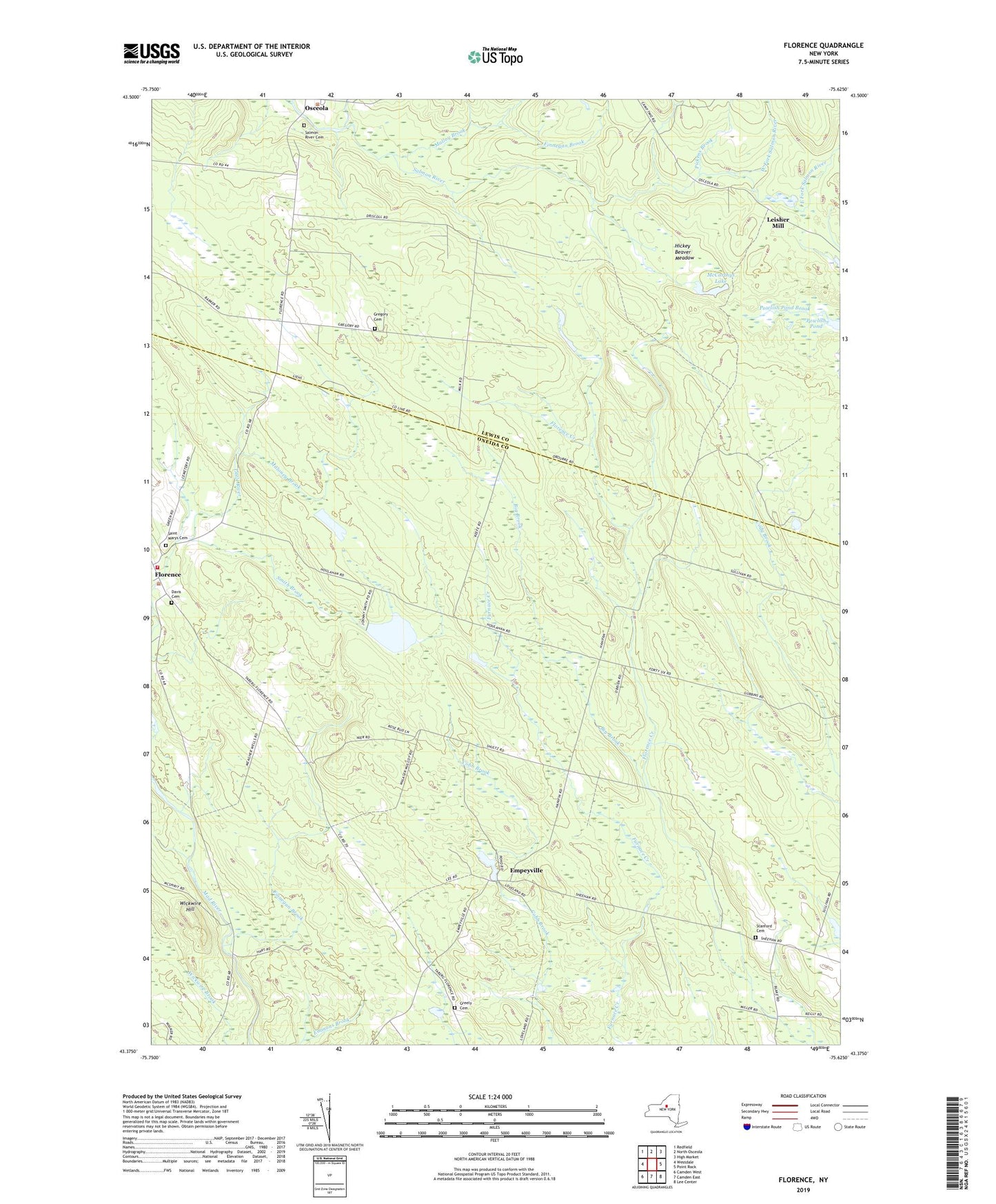
2019 topographic map quadrangle Florence in the state of New York. Scale: 1:24000. Based on the newly updated USGS 7.5' US Topo map series, this map is in the following counties: Oneida, Lewis. The map contains contour data, water features, and other items you are used to seeing on USGS maps, but also has updated roads and other features. This is the next generation of topographic maps. Printed on high-quality waterproof paper with UV fade-resistant inks.
Quads adjacent to this one:
West: Westdale
Northwest: Redfield
North: North Osceola
Northeast: High Market
East: Point Rock
Southeast: Lee Center
South: Camden East
Southwest: Camden West
Contains the following named places: Big Brook, Cowles Creek, Davis Cemetery, East Fork Salmon River, Empeyville, Fall Brook, Finnegan Brook, Florence, Florence Volunteer Fire Department, Forty Six Corners, Greely Cemetery, Hanifin Corners, Hickey Beaver Meadow, Leisher Mill, Malloy Brook, Maloney Brook, McCarthys Lake, Mount Pleasant Cemetery, Pickens Brook, Powlish Pond, Saint Marys Church, Saint Marys Church Cemetery, Salmon River Cemetery, School Number 1, School Number 11, School Number 14, School Number 15, School Number 5, School Number 8, School Number 9, Smith Brook, Stanford Cemetery, Swancott Lookout Tower, Thompson Corners, Town of Florence, West Fork Salmon River, Wickwire Hill, ZIP Code: 13316