MyTopo
Camden West New York US Topo Map
Couldn't load pickup availability
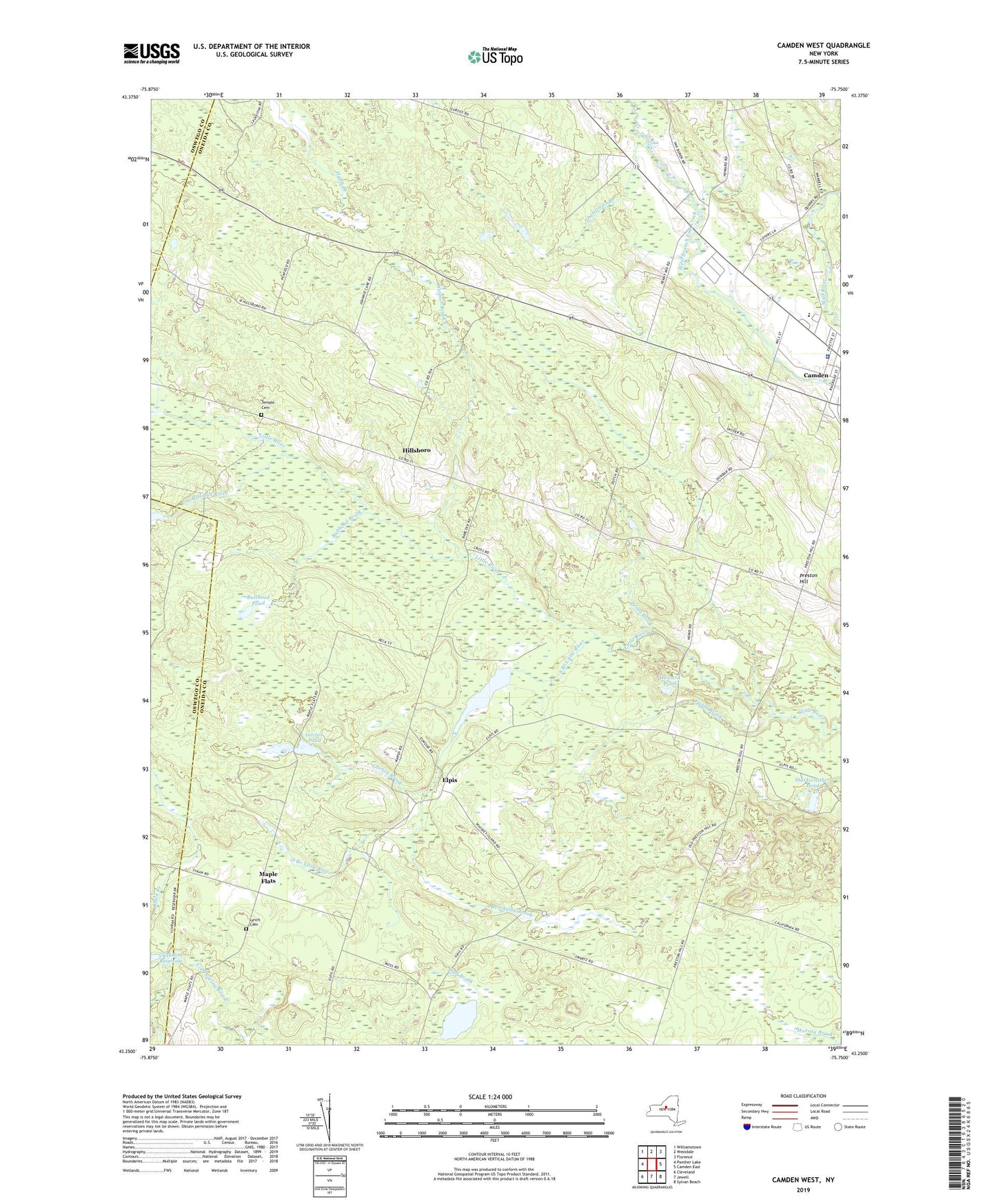
2023 topographic map quadrangle Camden West in the state of New York. Scale: 1:24000. Based on the newly updated USGS 7.5' US Topo map series, this map is in the following counties: Oneida, Oswego. The map contains contour data, water features, and other items you are used to seeing on USGS maps, but also has updated roads and other features. This is the next generation of topographic maps. Printed on high-quality waterproof paper with UV fade-resistant inks.
Quads adjacent to this one:
West: Panther Lake
Northwest: Williamstown
North: Westdale
Northeast: Florence
East: Camden East
Southeast: Sylvan Beach
South: Jewell
Southwest: Cleveland
This map covers the same area as the classic USGS quad with code o43075c7.
Contains the following named places: Brockway Brook, Brockway Corners, Bullhead Brook, Bullhead Pond, Camden High School, Camden Pit, Cleveland Reservoir, Elpis, Fields Brook, Gorton Brook, Gorton Pond, Hillsboro, Howard Pond, Lynch Cemetery, Maple Flats, Pierce Brook, Preston Hill, School Number 12, School Number 2, School Number 3, School Number 4, School Number 6, Servants Baptist Church, South Branch Little River, Starkweather Pond, Temple Cemetery, Temple School, The Abundant Life Community Church, Thompsons Branch, Thompsons Corner, Town of Camden, Trout Brook, West Branch Little River, Wetmor Brook, ZIP Code: 13042