MyTopo
Lee Center New York US Topo Map
Couldn't load pickup availability
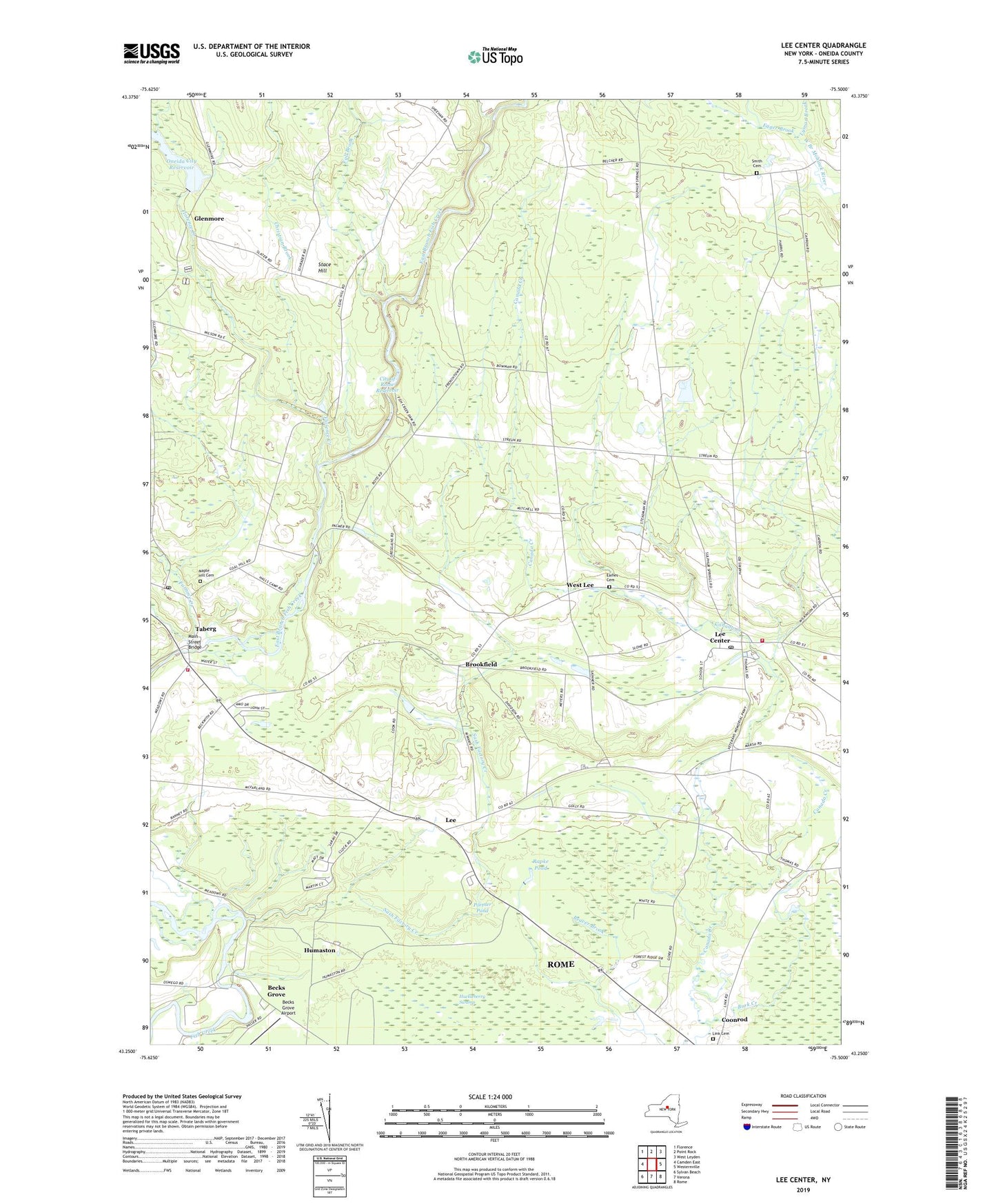
2023 topographic map quadrangle Lee Center in the state of New York. Scale: 1:24000. Based on the newly updated USGS 7.5' US Topo map series, this map is in the following counties: Oneida. The map contains contour data, water features, and other items you are used to seeing on USGS maps, but also has updated roads and other features. This is the next generation of topographic maps. Printed on high-quality waterproof paper with UV fade-resistant inks.
Quads adjacent to this one:
West: Camden East
Northwest: Florence
North: Point Rock
Northeast: West Leyden
East: Westernville
Southeast: Rome
South: Verona
Southwest: Sylvan Beach
This map covers the same area as the classic USGS quad with code o43075c5.
Contains the following named places: Beaver Creek Golf Club, Becks Grove, Becks Grove Airport, Brookfield, Burk Creek, Christian Brook, City of Rome Reservoir, Collins Mobile Home Park, Eames Cemetery, Egger Brook, Fall Brook, Florence Creek, Furnace Creek, Glenmore, Huckleberry Swamp, Humaston, Hyde Pond, Lee, Lee Center, Lee Center Fire Department, Lee Center Post Office, Lee Valley Church, Leisure Village, Link Cemetery, Lyman Brook, Main Street Bridge, Maple Hill Cemetery, Oneida City Reservoir, Oneida County Water Treatment Plant, Portner Pond, Rapke Pond, Rome Country Club, Saint Josephs Church, Saint Patrick's Catholic Church, Sash Factory Creek, School Number 1, School Number 11, School Number 12, School Number 15, School Number 16, School Number 17, School Number 2, School Number 3, School Number 4, School Number 5, School Number 7, School Number 8, School Number 9, Smith Cemetery, Stace Hill, Taberg, Taberg Post Office, Taberg Sewer District Wastewater Treatment Plant, Taberg United Methodist Church, Taberg Volunteer Fire Company, Town of Annsville, Town of Lee, West Lee, ZIP Codes: 13363, 13471