MyTopo
Freedom New York US Topo Map
Couldn't load pickup availability
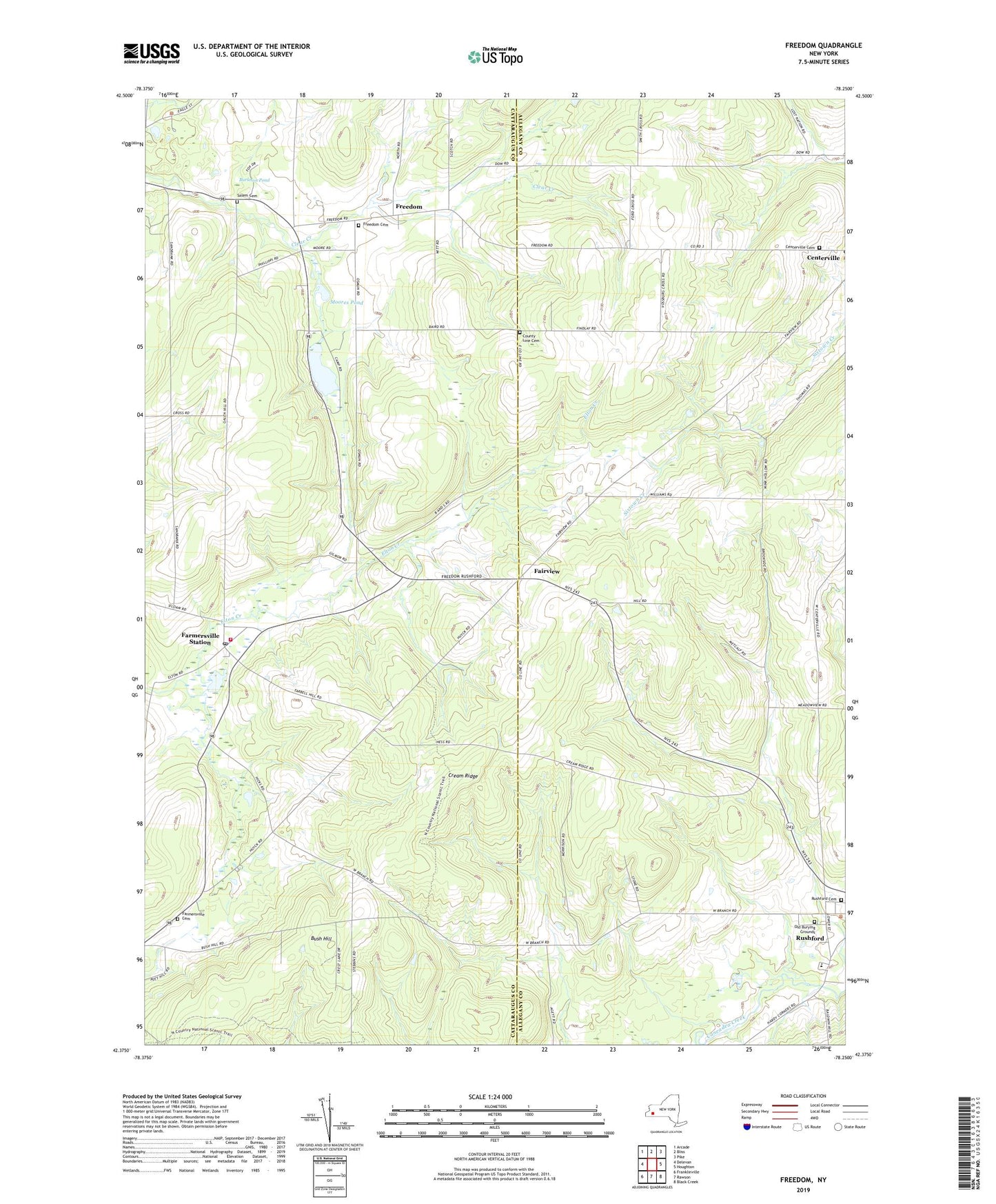
2019 topographic map quadrangle Freedom in the state of New York. Scale: 1:24000. Based on the newly updated USGS 7.5' US Topo map series, this map is in the following counties: Cattaraugus, Allegany. The map contains contour data, water features, and other items you are used to seeing on USGS maps, but also has updated roads and other features. This is the next generation of topographic maps. Printed on high-quality waterproof paper with UV fade-resistant inks.
Quads adjacent to this one:
West: Delevan
Northwest: Arcade
North: Bliss
Northeast: Pike
East: Houghton
Southeast: Black Creek
South: Rawson
Southwest: Franklinville
Contains the following named places: Burleson Pond, Bush Hill, Centerville Cemetery, Central School, County Line Cemetery, Cream Ridge, Crystal Lake, Edelweiss Farms, Fairview, Farmersville Cemetery, Farmersville Center Community Church, Farmersville Station, Farmersville Station Post Office, Farmersville Volunteer Fire Department, Freedom, Freedom Cemetery, Freedom Mobile Home Park, Moores Pond, Old Burying Grounds, Rushford, Rushford Cemetery, Rushford Census Designated Place, Rushford Elementary School, Salem Cemetery, Salem Church, Scouthaven Camp, Town of Rushford, ZIP Codes: 14060, 14065, 14777