MyTopo
Ellery Center New York US Topo Map
Couldn't load pickup availability
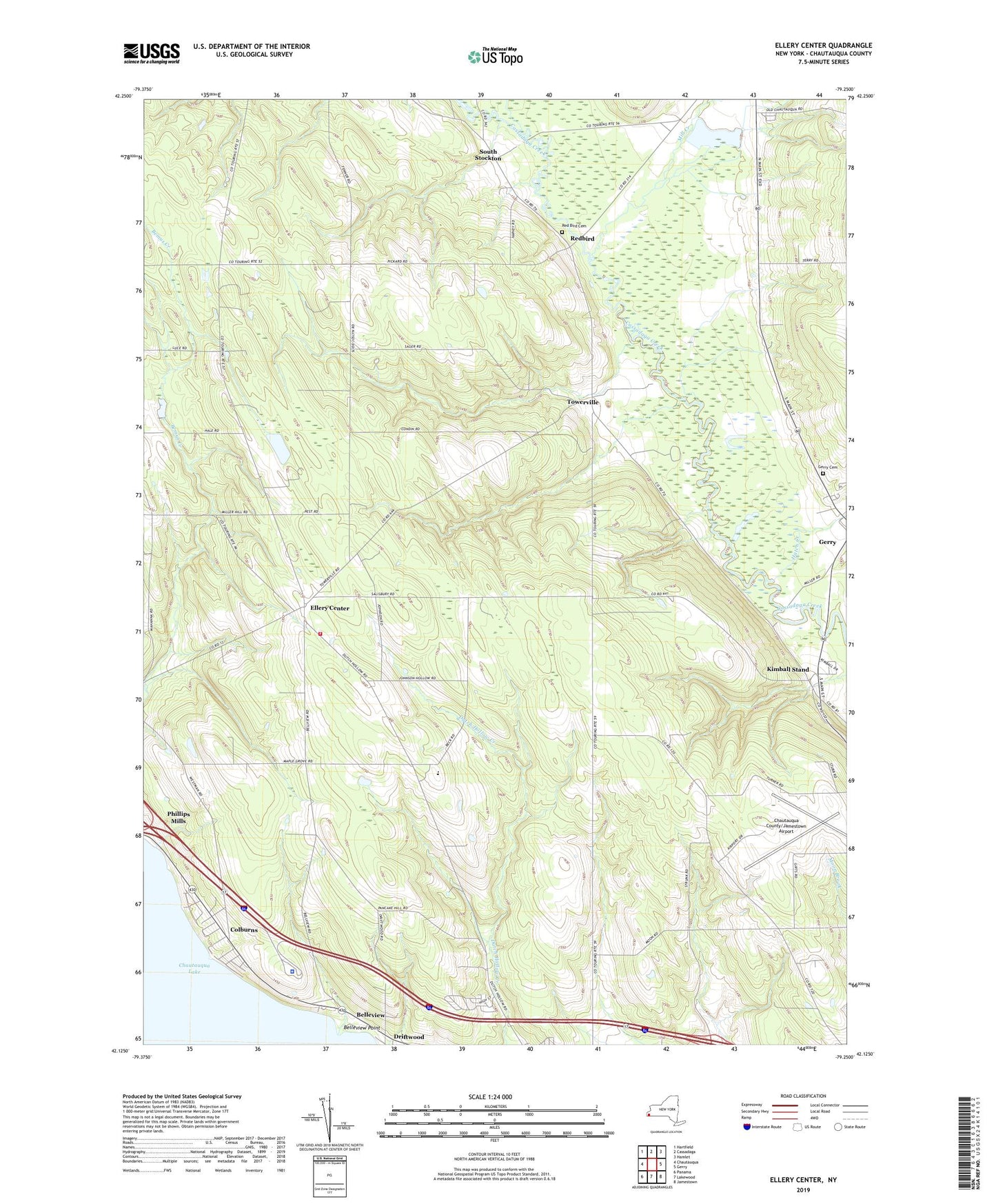
2023 topographic map quadrangle Ellery Center in the state of New York. Scale: 1:24000. Based on the newly updated USGS 7.5' US Topo map series, this map is in the following counties: Chautauqua. The map contains contour data, water features, and other items you are used to seeing on USGS maps, but also has updated roads and other features. This is the next generation of topographic maps. Printed on high-quality waterproof paper with UV fade-resistant inks.
Quads adjacent to this one:
West: Chautauqua
Northwest: Hartfield
North: Cassadaga
Northeast: Hamlet
East: Gerry
Southeast: Jamestown
South: Lakewood
Southwest: Panama
This map covers the same area as the classic USGS quad with code o42079b3.
Contains the following named places: Arnold Bay, Belleview, Belleview Point, Bergquist Adult Home, Chautauqua County Landfill, Chautauqua County/Jamestown Airport, Colburns, Ellery Baptist Church, Ellery Center, Ellery Center Volunteer Fire Department, Free Methodist Church of Gerry, Gerry Cemetery, Hatch Creek, Jamestown Speedway, Jones Corners, Kimball Stand, Maple Grove Junior - Senior High School, Mill Creek, New York State Police Troop A Zone 3 Ellery Station, Peterson Farm, Phillips Mills, Red Bird Cemetery, Redbird, Saint Timothy Lutheran Church, South Stockton, Towerville, Town of Ellery, Wolcott Dairy, ZIP Code: 14712