MyTopo
Glenfield New York US Topo Map
Couldn't load pickup availability
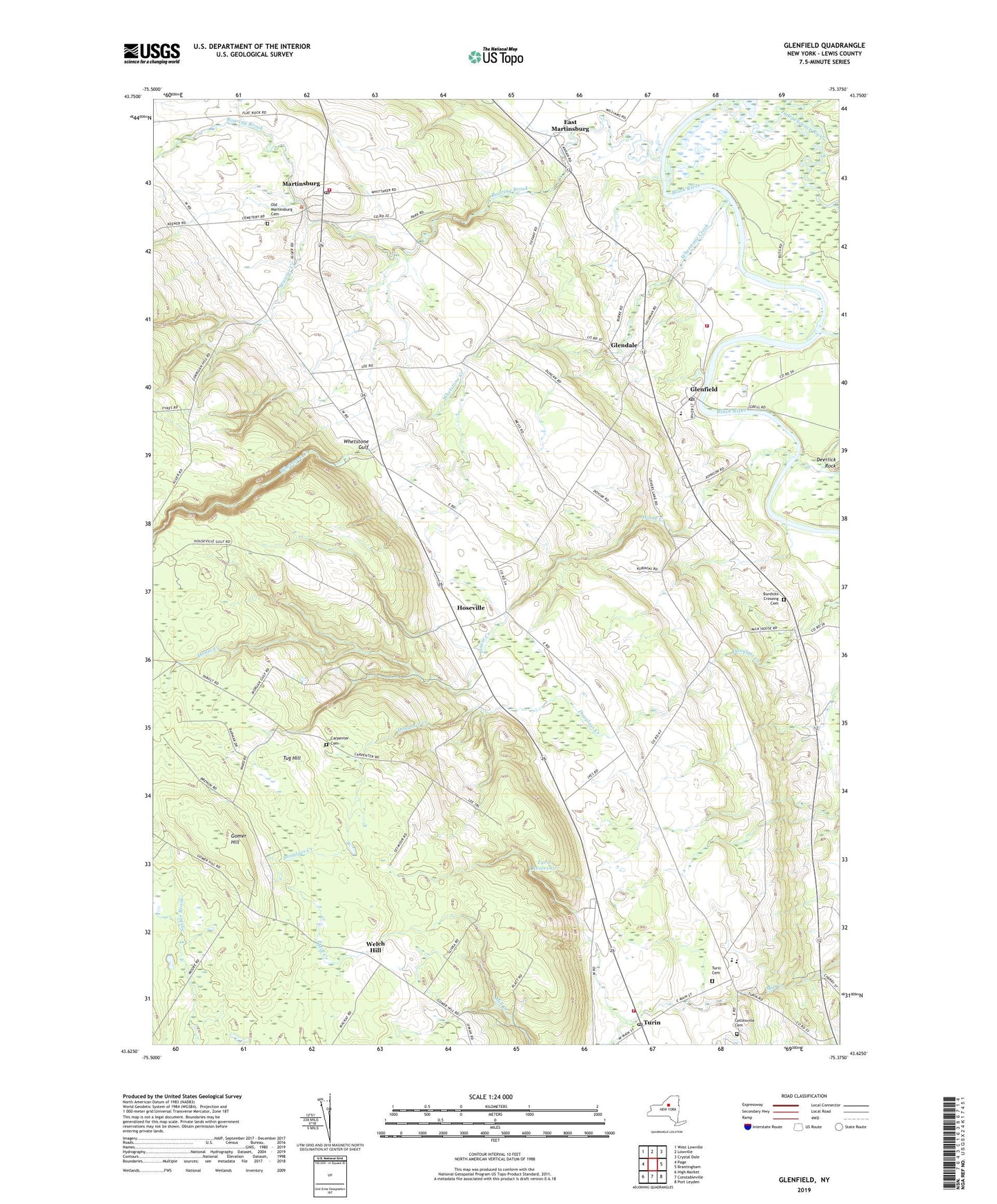
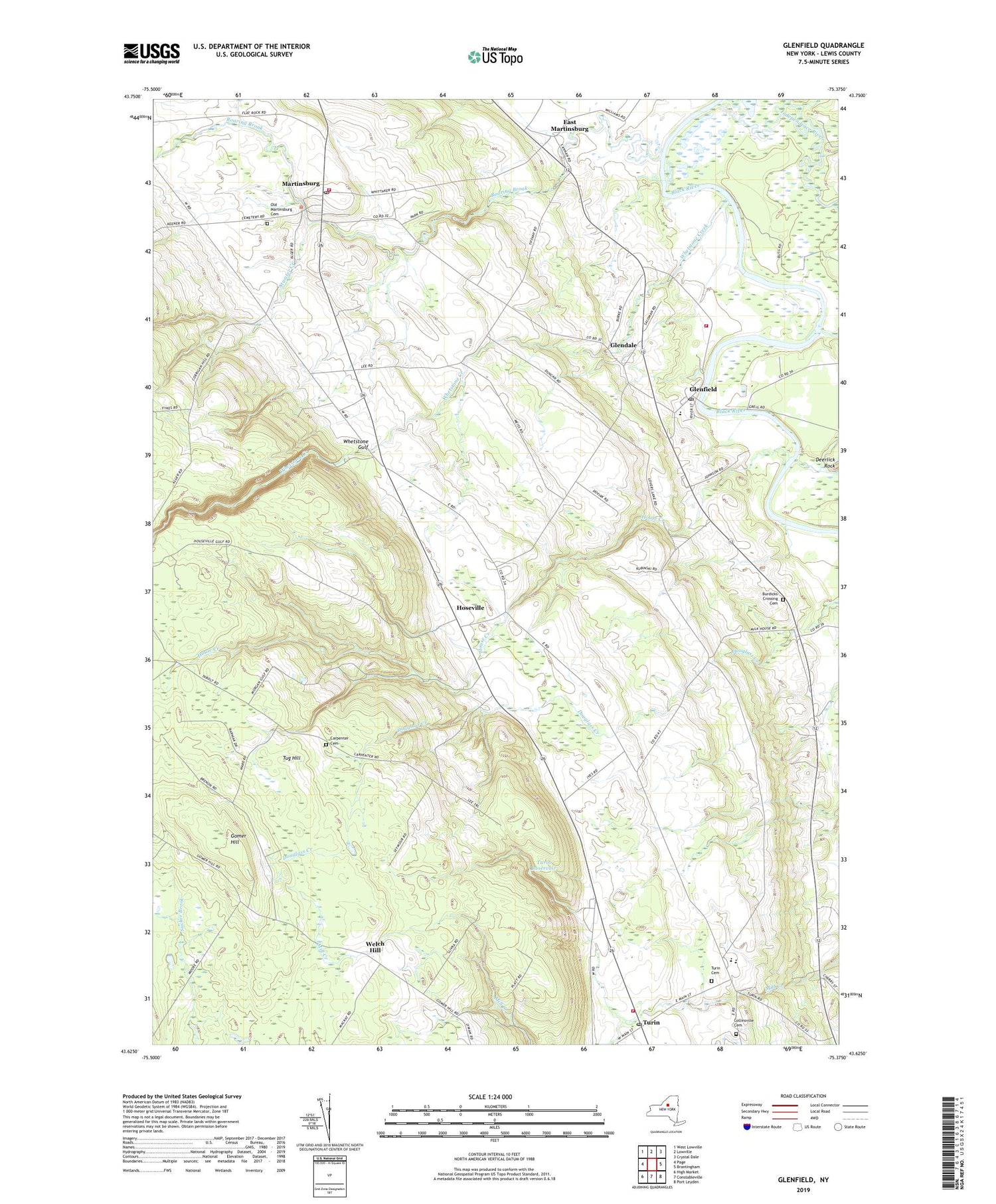
2019 topographic map quadrangle Glenfield in the state of New York. Scale: 1:24000. Based on the newly updated USGS 7.5' US Topo map series, this map is in the following counties: Lewis. The map contains contour data, water features, and other items you are used to seeing on USGS maps, but also has updated roads and other features. This is the next generation of topographic maps. Printed on high-quality waterproof paper with UV fade-resistant inks.
Quads adjacent to this one:
West: Page
Northwest: West Lowville
North: Lowville
Northeast: Crystal Dale
East: Brantingham
Southeast: Port Leyden
South: Constableville
Southwest: High Market
Contains the following named places: 3G Volunteer Fire Company Glenfield Station 1, Atwater Creek, Burdicks Crossing Cemetery, Carpenter Cemetery, Collinsville Cemetery, Deerlick Rock, East Martinsburg, Gen Martin High School, Glendale, Glenfield, Glenfield Post Office, Glenfield Sewage Treatment Plant, Gomer Hill, Hoseville, House Creek, Independence River, Marks Farms, Martinsburg, Martinsburg Cemetery, Martinsburg Post Office, Martinsburg Volunteer Fire Department, Otter Creek, Roaring Brook, Saint Hedwigs Church, South Lewis High School, South Lewis Methodist Church, South Lewis Middle School, Tabolt Corners, Town of Turin, Turin, Turin Cemetery, Turin Fire Volunteer Fire Company, Turin Highlands Golf Course, Turin Post Office, Turin Reservoir, Valley Brook Drive-In, Village of Turin, Welch Hill, Whetstone Creek, Whetstone Gulf, Whetstone Gulf State Park, Whitaker Falls, Whittaker Falls Park, ZIP Codes: 13404, 13473