MyTopo
Griffin New York US Topo Map
Couldn't load pickup availability
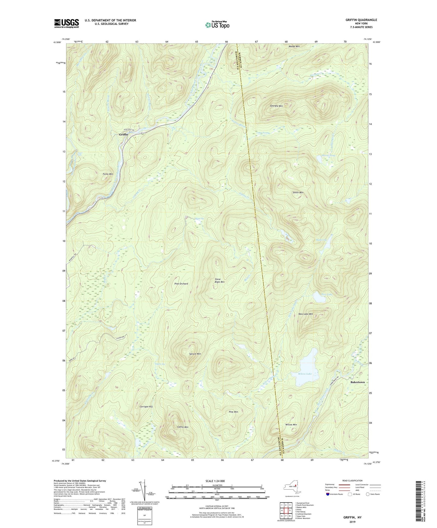
2019 topographic map quadrangle Griffin in the state of New York. Scale: 1:24000. Based on the newly updated USGS 7.5' US Topo map series, this map is in the following counties: Hamilton, Warren. The map contains contour data, water features, and other items you are used to seeing on USGS maps, but also has updated roads and other features. This is the next generation of topographic maps. Printed on high-quality waterproof paper with UV fade-resistant inks.
Quads adjacent to this one:
West: Wells
Northwest: Kunjamuk River
North: South Pond Mountain
Northeast: Bakers Mills
East: Harrisburg
Southeast: Ohmer Mountain
South: Hope Falls
Southwest: Cathead Mountain
Contains the following named places: Auger Falls, Bakertown, Cattle Mountain, Corrigan Hill, Cotter Brook, Cotter Swamp, Dayton Creek, East Vly, Extract Brook, Forks Mountain, Georgia Creek, Georgia Mountain, Girards Sugarbush, Griffin, Jimmy Creek, Macomber Creek, Masher Vly, New Lake, New Lake Mountain, New Lake Outlet, Pine Mountain, Pine Orchard, Shiras Pond, Smith Mountain, South Brook, Spruce Mountain, Steve Bigle Mountain, Taylor Vly, Towers Brook, Wilcox Lake, Wilcox Mountain, Windfall