MyTopo
Cathead Mountain New York US Topo Map
Couldn't load pickup availability
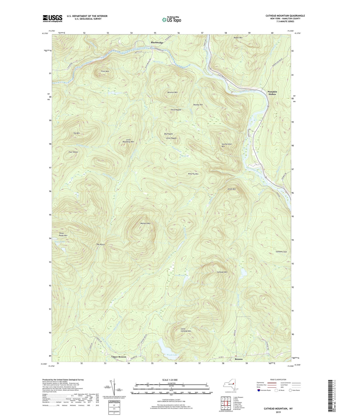
2023 topographic map quadrangle Cathead Mountain in the state of New York. Scale: 1:24000. Based on the newly updated USGS 7.5' US Topo map series, this map is in the following counties: Hamilton. The map contains contour data, water features, and other items you are used to seeing on USGS maps, but also has updated roads and other features. This is the next generation of topographic maps. Printed on high-quality waterproof paper with UV fade-resistant inks.
Quads adjacent to this one:
West: Whitehouse
Northwest: Lake Pleasant
North: Wells
Northeast: Griffin
East: Hope Falls
Southeast: Northville
South: Jackson Summit
Southwest: Caroga Lake
Contains the following named places: Abner Brook, Benson, Big Popple, Blackbridge, Cathead Mountain, Coulombe Creek, Devorse Creek, Devorse Mountain, Doig Creek, Finch Mountain, Four Staves, Grant Lake, Groff Creek, Groff Mountain, Jack Green Creek, Jacksons Seat, Jimmy Creek, King Vly, King Vly Creek, King Vly Mountain, Little Cathead Mountain, Little Popple, Little Roundtop Mountain, Moose Mountain, Petes Creek, Pumpkin Hollow, Remington Creek, Rooney Hill, Sacandaga Public Campsite, Southerland Mountain, The Notch, Third Popple, Three Ponds, Three Ponds Mountain, Town of Benson, Vly Creek, Vly Mountain, Wallace Mountain, West Branch Sacandaga River, Woods Lake