MyTopo
Wells New York US Topo Map
Couldn't load pickup availability
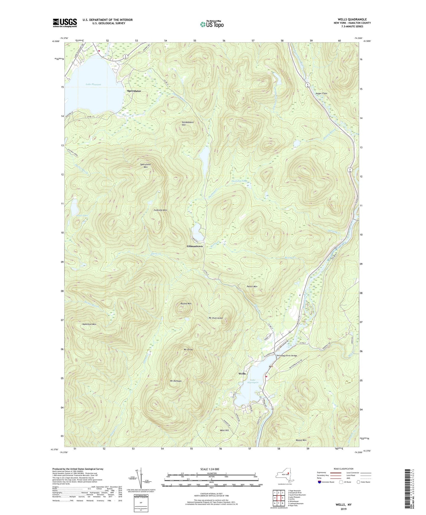
2023 topographic map quadrangle Wells in the state of New York. Scale: 1:24000. Based on the newly updated USGS 7.5' US Topo map series, this map is in the following counties: Hamilton. The map contains contour data, water features, and other items you are used to seeing on USGS maps, but also has updated roads and other features. This is the next generation of topographic maps. Printed on high-quality waterproof paper with UV fade-resistant inks.
Quads adjacent to this one:
West: Lake Pleasant
Northwest: Page Mountain
North: Kunjamuk River
Northeast: South Pond Mountain
East: Griffin
Southeast: Hope Falls
South: Cathead Mountain
Southwest: Whitehouse
This map covers the same area as the classic USGS quad with code k43074d3.
Contains the following named places: Auger Flats, Beatty Creek, Bostrups Landing Seaplane Base, Camp of the Woods, Charley Lake, Cherry Brook, Cutknife Mountain, Dunning Creek, Dunning Pond, East Branch Sacandaga River, Elbow Creek, Gilman Lake, Gilmantown, Guideboard Hill, Hamilton Mountain, Hamilton Mountain Fire Tower Trail, Johnson Vly Stream, Lake Algonquin, Mill Creek, Mount Dunham, Mount Orrey, Mount Overrocker, Pettit Mountain, Round Mountain, Sacandaga River Bridge, Saint Ann Church, Sand Lake, Shanty Brook, Speculator, Speculator Fire Department, Speculator Mountain, Town of Wells, Wells, Wells Census Designated Place, Wells Fire Department, Wells Post Office, Wells Quarry, Wells United Methodist Church, Wells Volunteer Ambulance Corps, Wells Wesleyan Church, West Hill, ZIP Code: 12190