MyTopo
Henderson New York US Topo Map
Couldn't load pickup availability
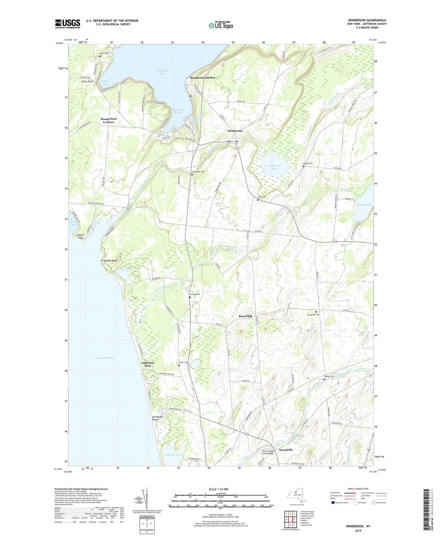
2023 topographic map quadrangle Henderson in the state of New York. Scale: 1:24000. Based on the newly updated USGS 7.5' US Topo map series, this map is in the following counties: Jefferson. The map contains contour data, water features, and other items you are used to seeing on USGS maps, but also has updated roads and other features. This is the next generation of topographic maps. Printed on high-quality waterproof paper with UV fade-resistant inks.
Quads adjacent to this one:
West: Stony Point
Northwest: Point Peninsula
North: Henderson Bay
Northeast: Sackets Harbor
East: Adams
Southeast: Sandy Creek
South: Ellisburg
This map covers the same area as the classic USGS quad with code o43076g2.
Contains the following named places: Alexander Corners, Aspinwall Corners, Bigelow Cemetery, Bishop Cemetery, Bishop Street, Black Pond, Carpenter Cemetery, Clark Cemetery, Cornell's Marina, Crystal Lake, Deer Run Dairy, Dodge Farms, El Dorado Beach, Gallea Cemetery, Graham Creek Canal, Hammond Corners, Harbor View Marina, Harbor's End Marina, Henderson, Henderson Census Designated Place, Henderson Fire District Building, Henderson Harbor, Henderson Harbor Post Office, Henderson Pond, Henderson Post Office, Henderson United Methodist Church, Hungerford Corners, Jefferson Park, Lake Ontario Mariners Marina, Little Stony Creek, North Cemetery, North Sandy Creek Bridge, Queen of Heaven Church, Rural Hill, Sawyer Point, Scotts Corners, Sheland Farms, Southwich Beach, Southwich Beach State Park, Stoney Creek Marina, Stony Creek, Stowles Cemetery, Town of Henderson, Whites Bay, Woodside Cemetery, Woodville, ZIP Codes: 13650, 13651