MyTopo
Ellisburg New York US Topo Map
Couldn't load pickup availability
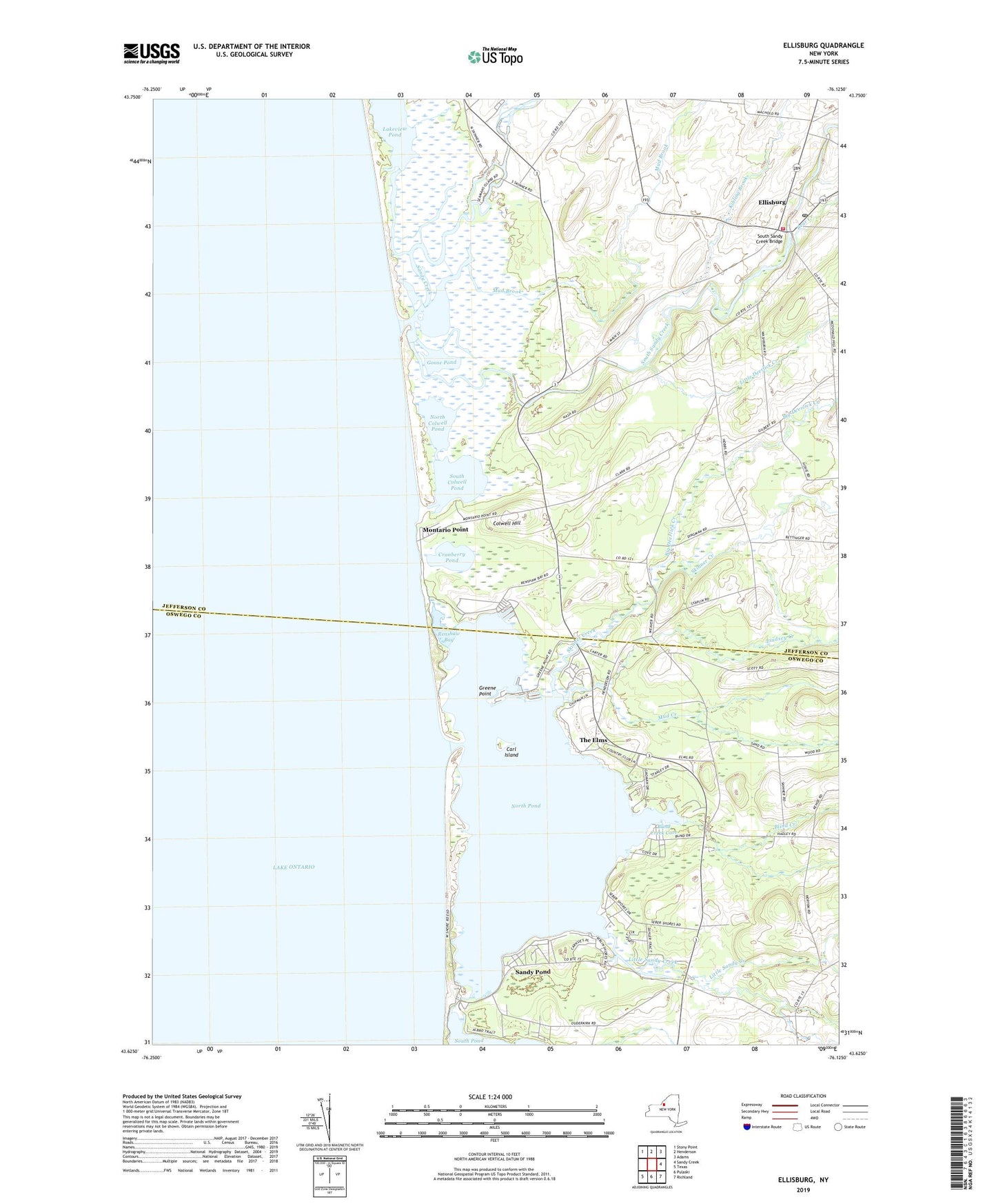
2023 topographic map quadrangle Ellisburg in the state of New York. Scale: 1:24000. Based on the newly updated USGS 7.5' US Topo map series, this map is in the following counties: Jefferson, Oswego. The map contains contour data, water features, and other items you are used to seeing on USGS maps, but also has updated roads and other features. This is the next generation of topographic maps. Printed on high-quality waterproof paper with UV fade-resistant inks.
Quads adjacent to this one:
Northwest: Stony Point
North: Henderson
Northeast: Adams
East: Sandy Creek
Southeast: Richland
South: Pulaski
Southwest: Texas
This map covers the same area as the classic USGS quad with code o43076f2.
Contains the following named places: Bartlett Marina, Bear Creek, Big Deerlick Creek, Blind Creek, Blind Creek Cove, Brennan's Bay Campground, Brennan's Bay Marina, Carl Island, Colwell Hill, Cranberry Pond, Doubledale Farm, Eastman Farms, Ellisburg, Ellisburg Free Library, Ellisburg Post Office, Ellisburg Volunteer Fire Department, Elms Golf Club, Floodwood Pond, Freemans Marina, Goodenough Church, Goose Pond, Greene Point, Greene Point Marina, Kibling Brook, Lakeview Pond, Lindsey Creek, Little Deerlick Creek, Little Sandy Creek, Montario Point, Mud Brook, Mud Creek, North Colwell Pond, North Landing, North Pond, Reiters Marina, Renshaw Bay, Sandy Creek, Sandy Pond, Sandy Pond Corners, School Number 11, School Number 12, School Number 13, School Number 20, School Number 8, Seber Shore Marina, Skinner Creek, South Colwell Pond, South Sandy Creek, South Sandy Creek Bridge, The Elms, Village of Ellisburg