MyTopo
Hinckley New York US Topo Map
Couldn't load pickup availability
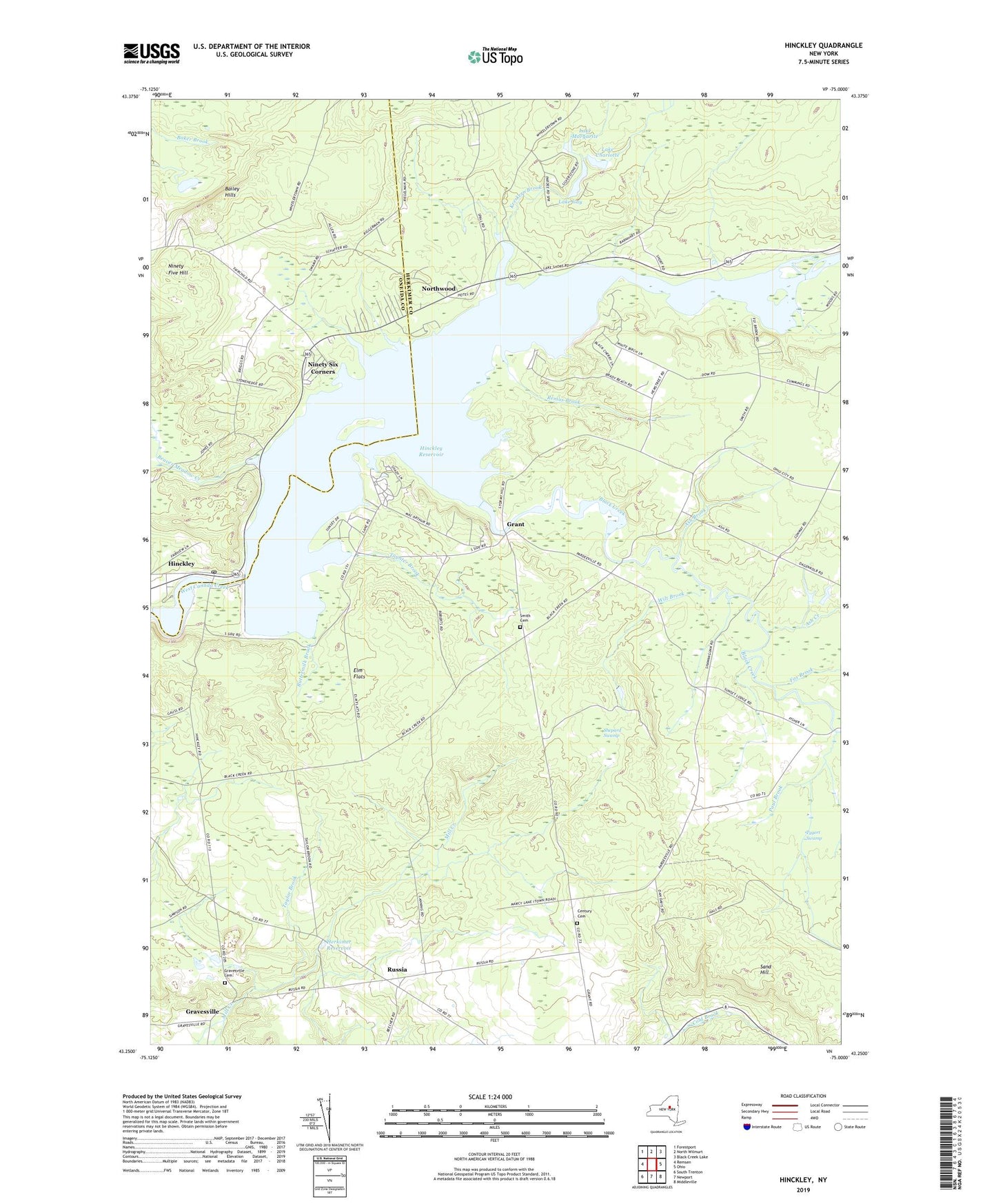
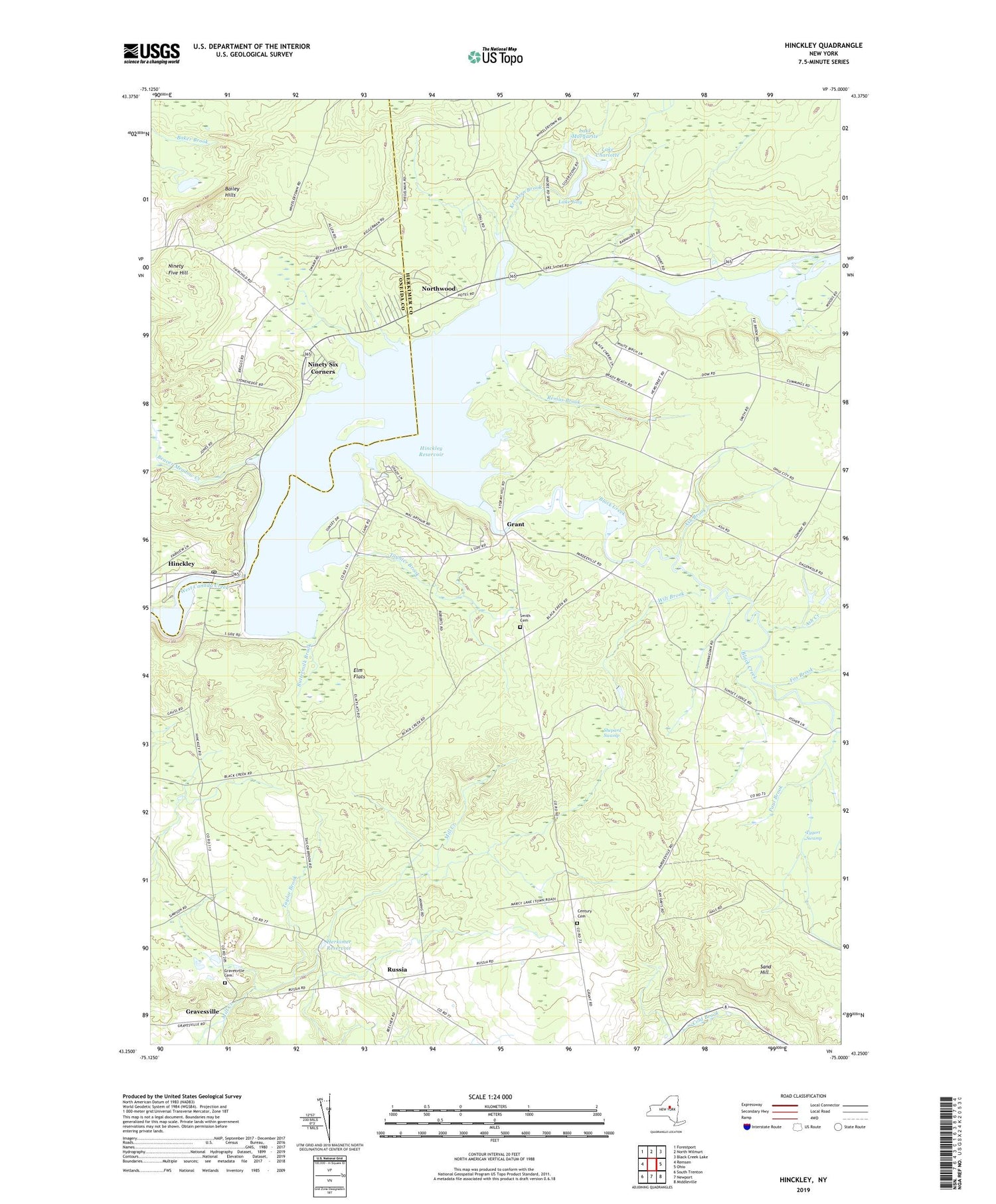
2019 topographic map quadrangle Hinckley in the state of New York. Scale: 1:24000. Based on the newly updated USGS 7.5' US Topo map series, this map is in the following counties: Herkimer, Oneida. The map contains contour data, water features, and other items you are used to seeing on USGS maps, but also has updated roads and other features. This is the next generation of topographic maps. Printed on high-quality waterproof paper with UV fade-resistant inks.
Quads adjacent to this one:
West: Remsen
Northwest: Forestport
North: North Wilmurt
Northeast: Black Creek Lake
East: Ohio
Southeast: Middleville
South: Newport
Southwest: South Trenton
Contains the following named places: Ash Brook, Ash Creek, Bailey Hills, Baileys Mobile Home Park, Beaver Meadow Creek, Black Creek, Buttermilk Brook, Century Cemetery, Elm Flats, Fox Brook, Grant, Gravesville, Gravesville Cemetery, Herkimer Reservoir, Hinckley, Hinckley Post Office, Hinckley Reservoir, Kreskern Brook, Lake Charlotte, Lake Gay, Lake Margarite, Ninety Five Hill, Ninety Six Corners, Northwood, Pardeeville Corners, Paul Brook, Remus Brook, Russia, Sand Hill, School Number 4, Shepard Swamp, Taylor Brook, Taynter Brook, Thomas Pond, Town of Russia, Tygert Swamp, Wilt Brook, Woodin Corners, Woodin Corners Cemetery, ZIP Code: 13352