MyTopo
Ohio New York US Topo Map
Couldn't load pickup availability
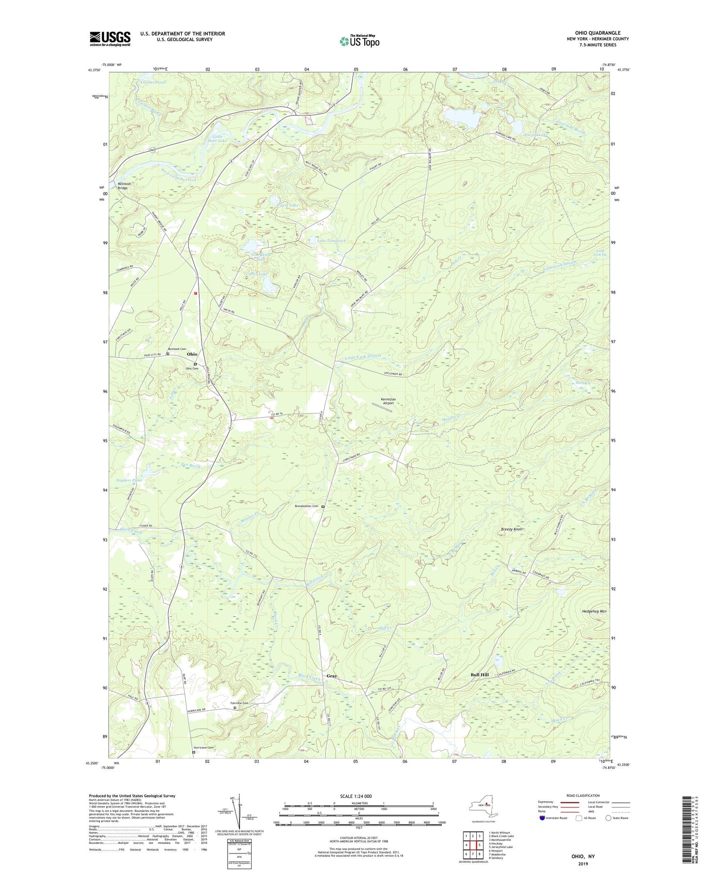
2023 topographic map quadrangle Ohio in the state of New York. Scale: 1:24000. Based on the newly updated USGS 7.5' US Topo map series, this map is in the following counties: Herkimer. The map contains contour data, water features, and other items you are used to seeing on USGS maps, but also has updated roads and other features. This is the next generation of topographic maps. Printed on high-quality waterproof paper with UV fade-resistant inks.
Quads adjacent to this one:
West: Hinckley
Northwest: North Wilmurt
North: Black Creek Lake
Northeast: Morehouseville
East: Jerseyfield Lake
Southeast: Salisbury
South: Middleville
Southwest: Newport
This map covers the same area as the classic USGS quad with code k43074c7.
Contains the following named places: Atwood Lake, Black Creek Reservoir, Black Creek State Forest, Breezy Knoll, Brondstatter Cemetery, Bull Hill, California Trail, Concklin Brook, Curtis Lake, Fairview Cemetery, Figert Lake, Fourmile Brook, Gray, Hedgehog Mountain, Hurricane Cemetery, Jones Creek, Kermizian Airport, Lake Tamarack, Little Deer Lake, Little York Stream, Maurice F Luther Memorial Park, McIntosh Bridge, McIntosh Cemetery, Mill Creek, Mounts Creek, North Branch Mill Creek, Ohio, Ohio Cemetery, Poland Volunteer Fire Company Station 2, Reising School, Snyders Pond, Spectacle Lake, Thorp Vly, Tom Kettle Lake, Turner School, Vly Brook, Wilmurt Corners, ZIP Code: 13324