MyTopo
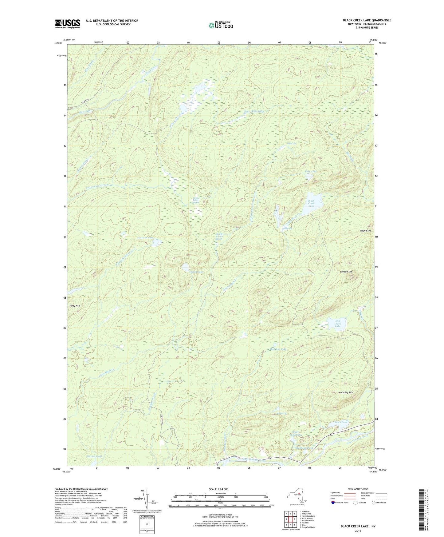
Black Creek Lake New York US Topo Map
Couldn't load pickup availability
2023 topographic map quadrangle Black Creek Lake in the state of New York. Scale: 1:24000. Based on the newly updated USGS 7.5' US Topo map series, this map is in the following counties: Herkimer. The map contains contour data, water features, and other items you are used to seeing on USGS maps, but also has updated roads and other features. This is the next generation of topographic maps. Printed on high-quality waterproof paper with UV fade-resistant inks.
Quads adjacent to this one:
West: North Wilmurt
Northwest: McKeever
North: Bisby Lakes
Northeast: Honnedaga Lake
East: Morehouseville
Southeast: Jerseyfield Lake
South: Ohio
Southwest: Hinckley
Contains the following named places: Black Creek Lake, Bullhead Pond, Burp Lake, Cotton Lake, Crosby Vly, Finches Pond, Forty Mountain, Herkimer County, Lawson Top, Mad Tom Brook, Mad Tom Lake, McCauley Mountain, Middle Branch Little Black Creek, Middle Branch Marsh, Mill Creek Lake, North Branch Lake, Ohio Gorge, Party Trail, Pooler Vly, Swan Lake, Town of Ohio, Twin Lakes, Twin Lakes Inlet, Twin Lakes Marsh, Twin Lakes Trail, Wells Vly, White Lead Lake, Wilmurt, Wilmurt School