MyTopo
South Trenton New York US Topo Map
Couldn't load pickup availability
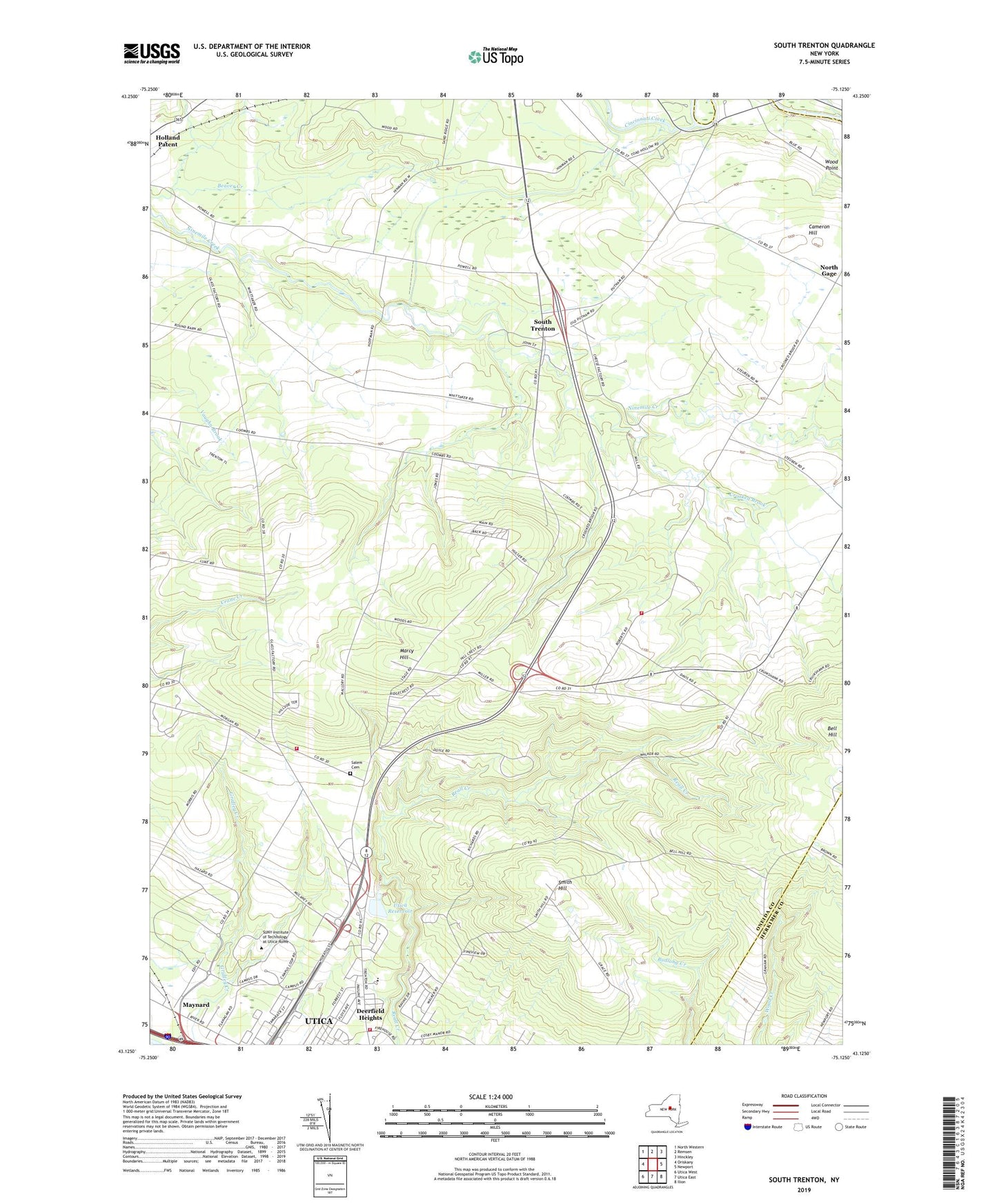
2023 topographic map quadrangle South Trenton in the state of New York. Scale: 1:24000. Based on the newly updated USGS 7.5' US Topo map series, this map is in the following counties: Oneida, Herkimer. The map contains contour data, water features, and other items you are used to seeing on USGS maps, but also has updated roads and other features. This is the next generation of topographic maps. Printed on high-quality waterproof paper with UV fade-resistant inks.
Quads adjacent to this one:
West: Oriskany
Northwest: North Western
North: Remsen
Northeast: Hinckley
East: Newport
Southeast: Ilion
South: Utica East
Southwest: Utica West
This map covers the same area as the classic USGS quad with code o43075b2.
Contains the following named places: Atanasoffs Tree Farm, Broadacres Nursing Home, Cameron Hill, Cincinnati Creek, Crooked Brook, Deerfield Elementary School, Deerfield Heights, Deerfield Volunteer Fire Company 1 Station 1, Deerfield Volunteer Fire Company 1 Station 2, Green Acres, Horatio Mall Shopping Center, Marcy Hill, Maynard Fire Department Station 2, North Gage, Riverside Mall Shopping Center, Saint Vincent Mission, Salem Cemetery, Salem Church, School Number 10, School Number 4, School Number 5, School Number 7, School Number 9, Smith Hill, South Trenton, South Trenton Presbyterian Church, State University of New York Institue of Technology, Town of Deerfield, Utica Reservoir, WEIF-FM (Utica), WLZW-FM (Utica), Wood Point, WOUR-FM (Utica), WRCK-FM (Utica), WUNY-FM (Utica), WUTR-TV (Utica), ZIP Codes: 13304, 13502