MyTopo
Jay Mountain New York US Topo Map
Couldn't load pickup availability
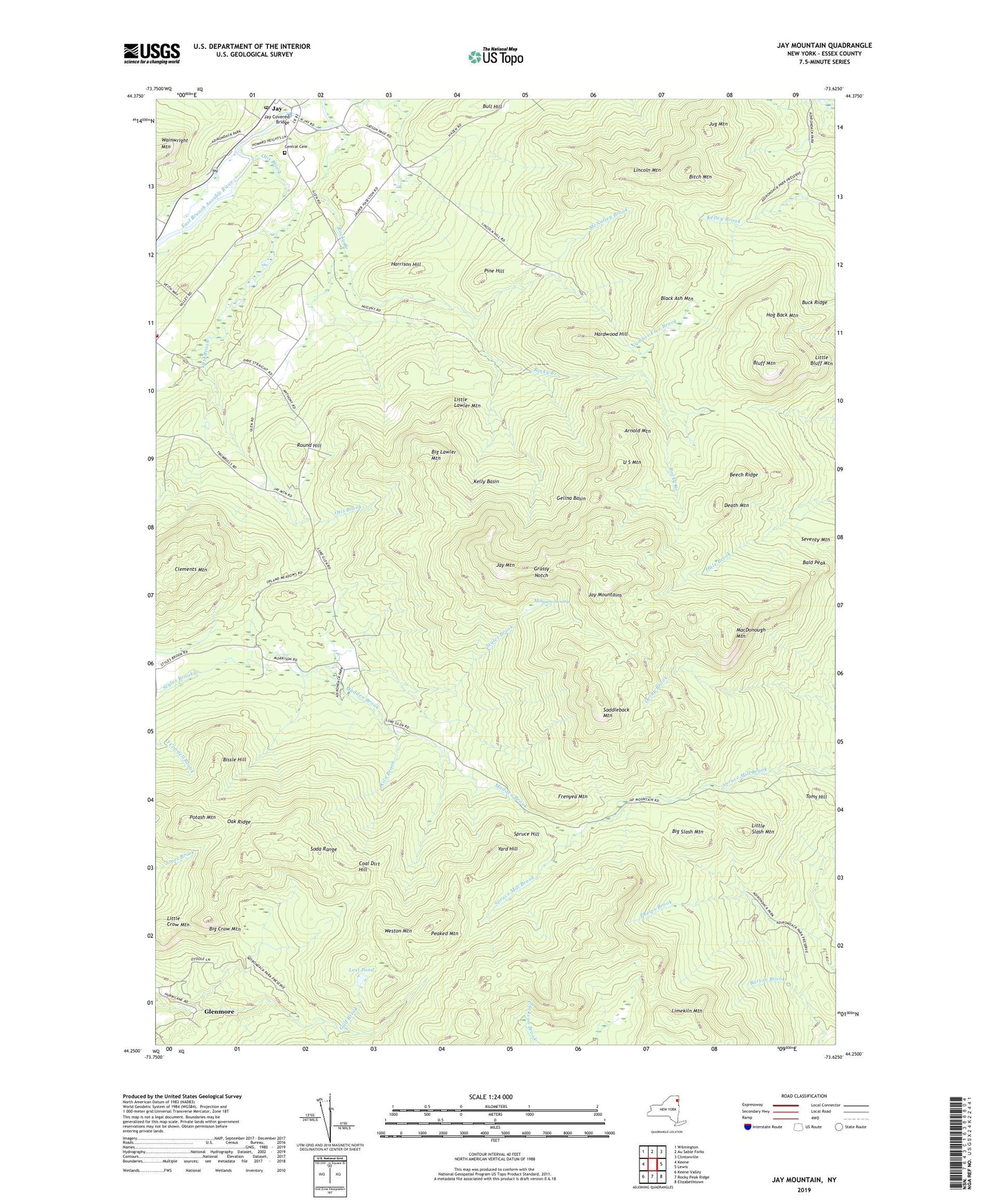
2019 topographic map quadrangle Jay Mountain in the state of New York. Scale: 1:24000. Based on the newly updated USGS 7.5' US Topo map series, this map is in the following counties: Essex. The map contains contour data, water features, and other items you are used to seeing on USGS maps, but also has updated roads and other features. This is the next generation of topographic maps. Printed on high-quality waterproof paper with UV fade-resistant inks.
Quads adjacent to this one:
West: Keene
Northwest: Wilmington
North: Au Sable Forks
Northeast: Clintonville
East: Lewis
Southeast: Elizabethtown
South: Rocky Peak Ridge
Southwest: Keene Valley
Contains the following named places: Arnold Mountain, Bald Peak, Beech Ridge, Big Crow Mountain, Big Lawler Mountain, Big Slash Mountain, Bissle Hill, Bitch Mountain, Black Ash Mountain, Bluff Mountain, Buck Ridge, Bull Hill, Central Cemetery, Clements Mountain, Coal Dirt Hill, Death Mountain, Frenyea Mountain, Gelina Basin, Glenmore, Grassy Notch, Hardwood Hill, Harrison Hill, Hog Back Mountain, Jay Covered Bridge, Jay Mountain, Jay Mountains, Jay Post Office, Jug Mountain, Kelly Basin, Kiln Brook, Limekiln Mountain, Lincoln Mountain, Little Bluff Mountain, Little Crow Mountain, Little Lawler Mountain, Little Slash Mountain, Lost Pond, MacDonough Mountain, Madden Brook, McNalley Brook, Merriam Swamp, Number Five Brook, Oak Ridge, O'Connell Brook, Otis Brook, Peaked Mountain, Pine Hill, Potash Mountain, Rocky Branch, Round Hill, Saddleback Mountain, Soda Range, Spruce Hill, The Glen, Toms Hill, Town of Jay, U S Mountain, Upper Jay Volunteer Fire Department, Weston Mountain, Yard Hill, ZIP Code: 12941