MyTopo
Wilmington New York US Topo Map
Couldn't load pickup availability
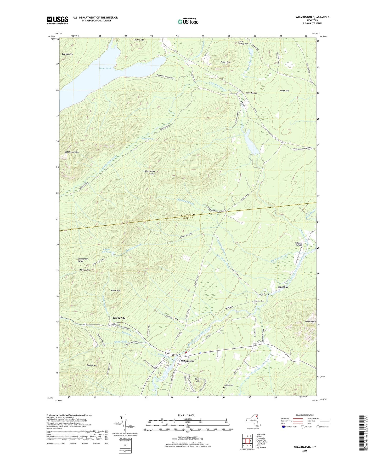
2023 topographic map quadrangle Wilmington in the state of New York. Scale: 1:24000. Based on the newly updated USGS 7.5' US Topo map series, this map is in the following counties: Clinton, Essex. The map contains contour data, water features, and other items you are used to seeing on USGS maps, but also has updated roads and other features. This is the next generation of topographic maps. Printed on high-quality waterproof paper with UV fade-resistant inks.
Quads adjacent to this one:
West: Franklin Falls
Northwest: Alder Brook
North: Redford
Northeast: Peasleeville
East: Au Sable Forks
Southeast: Jay Mountain
South: Keene
Southwest: Lake Placid
This map covers the same area as the classic USGS quad with code k44073d7.
Contains the following named places: Bear Brook, Beaver Brook, Big Brown Brook, Calvary Baptist Church, Carmel Mountain, Catalano Airfield, Catamount Mountain, Cooper Kill Pond, Douglas Mountain, East Kilns, Hamlin Mountain, Haselton, Haselton Cemetery, Hearn Swamp, Little Black Brook, Little Pelkey Mountain, Malbone Cemetery, Marble Mountain, Middle Kilns, Middle Kilns Brook, Morgan Mountain, New Bridge Brook, Newberry Pond, North Hill, North Pole, North Pole Resorts, Paleface Ski Center, Pelkey Mountain, Pettigrew Brook, Quaker Mountain, Red Brook, Stephenson Brook, Stephenson Range, Taylor Pond, Town of Wilmington, White Brook, Wilmington, Wilmington Census Designated Place, Wilmington E M Cooper Memorial Public Library, Wilmington Post Office, Wilmington Range, Wilmington Volunteer Fire Department, Winch Mountain, ZIP Code: 12912