MyTopo
Keene New York US Topo Map
Couldn't load pickup availability
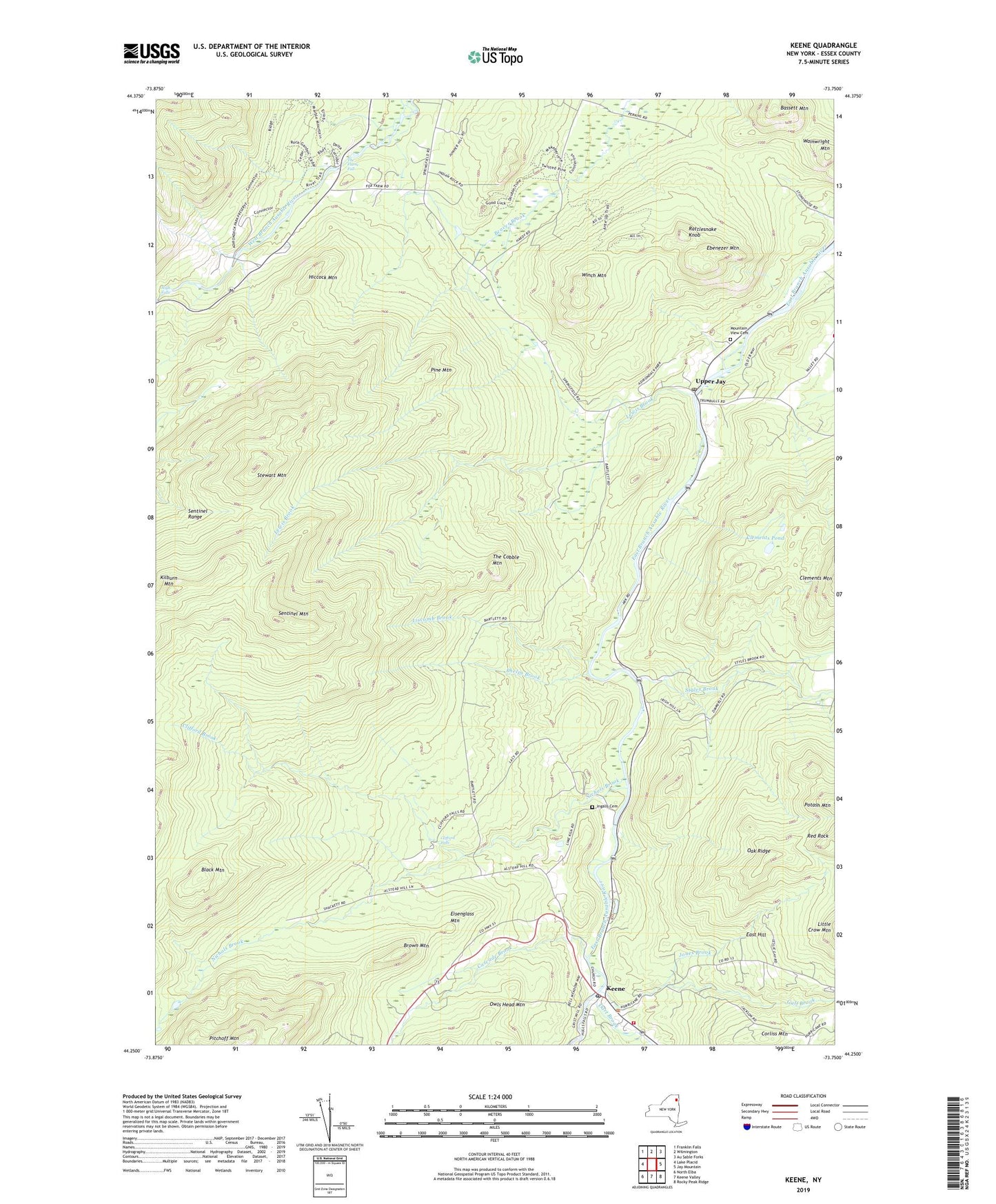
2023 topographic map quadrangle Keene in the state of New York. Scale: 1:24000. Based on the newly updated USGS 7.5' US Topo map series, this map is in the following counties: Essex. The map contains contour data, water features, and other items you are used to seeing on USGS maps, but also has updated roads and other features. This is the next generation of topographic maps. Printed on high-quality waterproof paper with UV fade-resistant inks.
Quads adjacent to this one:
West: Lake Placid
Northwest: Franklin Falls
North: Wilmington
Northeast: Au Sable Forks
East: Jay Mountain
Southeast: Rocky Peak Ridge
South: Keene Valley
Southwest: North Elba
Contains the following named places: Bassett Mountain, Black Mountain, Brown Mountain, Cascade Brook, Clements Pond, Clifford Brook, Clifford Falls, Corliss Mountain, Dart Brook, East Hill, Ebenezer Mountain, Eisenglass Mountain, Gulf Brook, Hiccock Mountain, High Falls, High Falls Gorge, Ingalls Cemetery, Jones Brook, Keene, Keene Post Office, Keene Public Library, Keene Volunteer Fire Department, Lake Placid - Whiteface Mountain Campground, Lewis Brook, Liscomb Brook, Mountain View Cemetery, Nichols Brook, Oak Ridge, Owls Head Mountain, Phelps Brook, Pine Mountain, Rattlesnake Knob, Red Rock, Saint Brendan's Catholic Church, Sentinel Mountain, Sentinel Range, Stewart Mountain, Styles Brook, The Cobble Mountain, The Flume Fall, Upper Jay, Upper Jay Post Office, Wainwright Mountain, Wells Memorial Library, Whiteface Mountain Ski Center, Winch Mountain, ZIP Code: 12987