MyTopo
Kaaterskill Clove New York US Topo Map
Couldn't load pickup availability
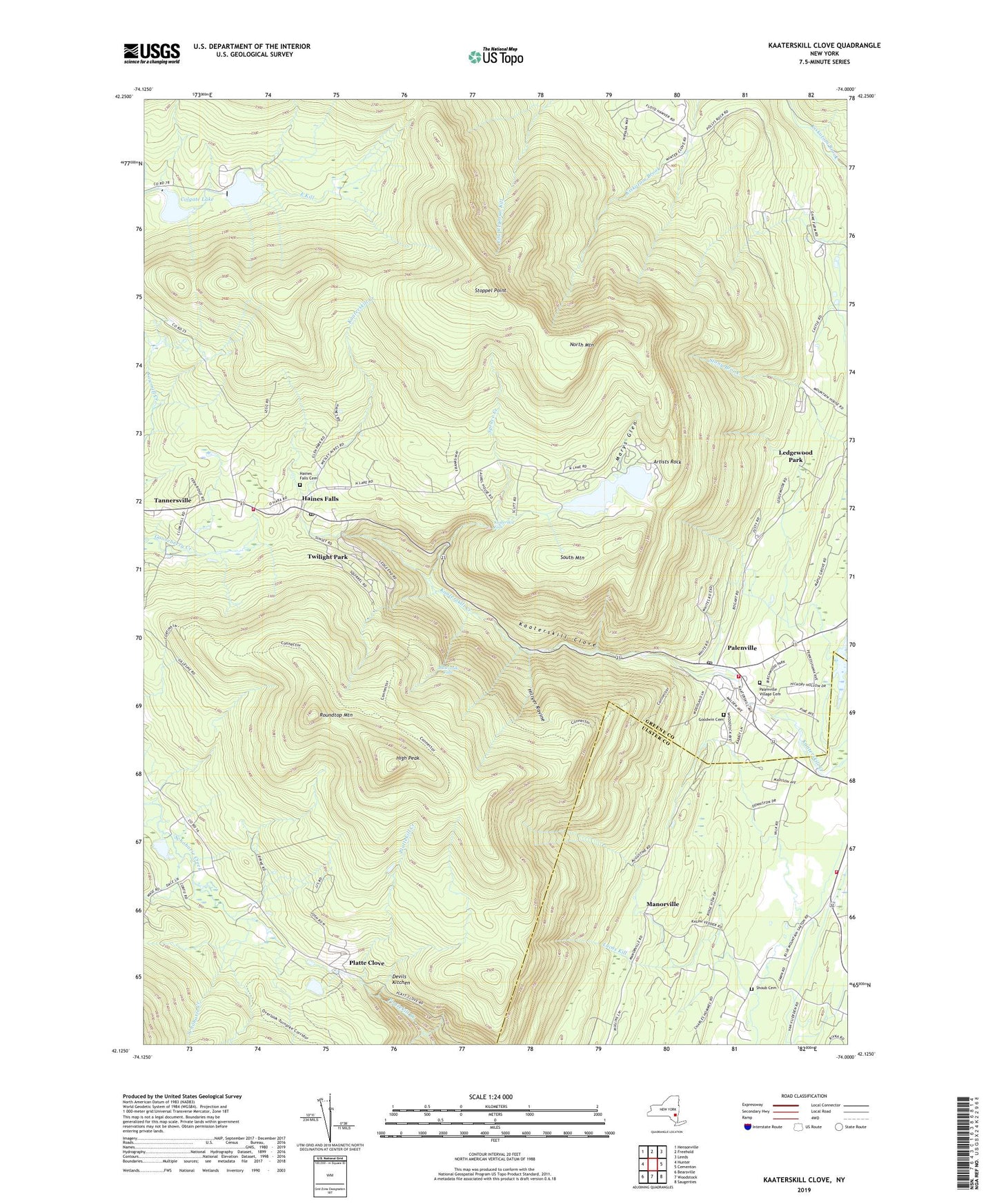
2023 topographic map quadrangle Kaaterskill Clove in the state of New York. Scale: 1:24000. Based on the newly updated USGS 7.5' US Topo map series, this map is in the following counties: Greene, Ulster. The map contains contour data, water features, and other items you are used to seeing on USGS maps, but also has updated roads and other features. This is the next generation of topographic maps. Printed on high-quality waterproof paper with UV fade-resistant inks.
Quads adjacent to this one:
West: Hunter
Northwest: Hensonville
North: Freehold
Northeast: Leeds
East: Cementon
Southeast: Saugerties
South: Woodstock
Southwest: Bearsville
Contains the following named places: All Angels Episcopal Church, Artists Rock, Buttermilk Falls, Catskill Public Library Palenville Branch, Colgate Lake, Devils Kitchen, Goodwin Cemetery, Haines Falls, Haines Falls Cemetery, Haines Falls Census Designated Place, Haines Falls Free Library, Haines Falls Post Office, Haines Falls Volunteer Fire Company, High Peak, Hillyer Ravine, Hunter Ambulance Service, Immaculate Conception Church, Kaaterskill Clove, Kaaterskill Falls, Ledgewood Park, Manorville, Marys Glen, Mountain House, North Lake, North Mountain, Palenville, Palenville Census Designated Place, Palenville Fire Department, Palenville Fire District, Palenville Post Office, Palenville Village Cemetery, Platte Clove, Platte Clove Church, Rip Van Winkle Hollow, Roaring Kill, Roundtop Mountain, Sacred Heart Church, Santa Cruz Ravine, Saxton Katsbaan Volunteer Fire Company Saxton Station, Saxton Sandstone Quarry, School Number 2, Shoub Cemetery, South Lake, South Mountain, Spruce Creek, Stoppel Point, Twilight Park, Wildcat Ravine, ZIP Codes: 12424, 12436, 12463