MyTopo
Freehold New York US Topo Map
Couldn't load pickup availability
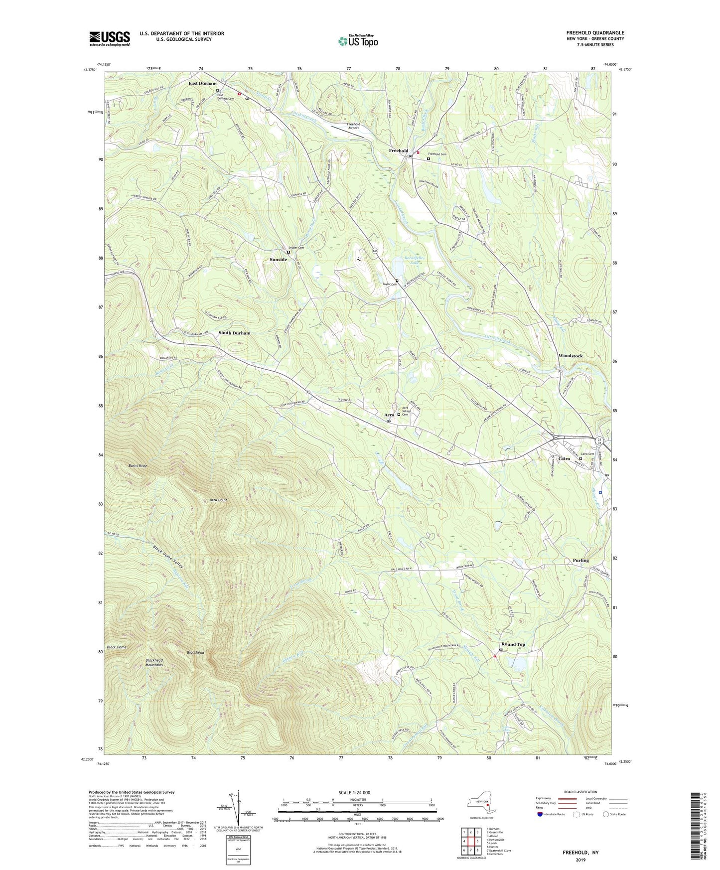
2023 topographic map quadrangle Freehold in the state of New York. Scale: 1:24000. Based on the newly updated USGS 7.5' US Topo map series, this map is in the following counties: Greene. The map contains contour data, water features, and other items you are used to seeing on USGS maps, but also has updated roads and other features. This is the next generation of topographic maps. Printed on high-quality waterproof paper with UV fade-resistant inks.
Quads adjacent to this one:
West: Hensonville
Northwest: Durham
North: Greenville
Northeast: Alcove
East: Leeds
Southeast: Cementon
South: Kaaterskill Clove
Southwest: Hunter
This map covers the same area as the classic USGS quad with code o42074c1.
Contains the following named places: Acra, Acra Methodist Church, Acra Point, Acra Post Office, Acra Village Cemetery, Armstrongs Elk Farm, Basic Creek, Black Dome, Blackhead, Bowery Creek, Burnt Knob, Burroughs Creek, Cairo - Durham High School, Cairo - Durham Middle School, Cairo Ambulance Service, Cairo Cemetery, Cairo Census Designated Place, Cairo Post Office, Calvary Episcopal Church, Catskill State Park, Cornwallville Creek, Countryman Kill, East Durham, East Durham Cemetery, East Durham Census Designated Place, East Durham Post Office, East Durham Volunteer Fire Company, Freehold, Freehold Airport, Freehold Cemetery, Freehold Post Office, Freehold Volunteer Fire Company, Glen Falls, God Grace Assembly, Greene County, Platte Kill, Purling, Rockefeller Lake, Round Top, Round Top Census Designated Place, Round Top Methodist Church, Round Top Post Office, Round Top Volunteer Fire Company, Saint Edmunds Chapel, Saint Marys Church, Snyder Cemetery, South Durham, Sunside, Taylor Cemetery, Thorp Creek, Town of Cairo, Trout Brook, Winter Clove, Woodstock, ZIP Codes: 12405, 12413, 12431, 12470, 12473