MyTopo
Kendall New York US Topo Map
Couldn't load pickup availability
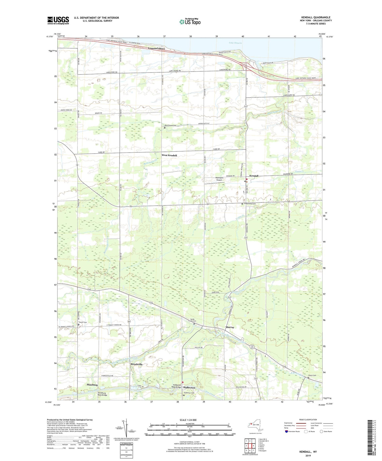
2023 topographic map quadrangle Kendall in the state of New York. Scale: 1:24000. Based on the newly updated USGS 7.5' US Topo map series, this map is in the following counties: Orleans. The map contains contour data, water features, and other items you are used to seeing on USGS maps, but also has updated roads and other features. This is the next generation of topographic maps. Printed on high-quality waterproof paper with UV fade-resistant inks.
Quads adjacent to this one:
West: Kent
Northwest: Kent OE N
North: Kendall OE N
East: Hamlin
Southeast: Brockport
South: Holley
Southwest: Albion
This map covers the same area as the classic USGS quad with code o43078c1.
Contains the following named places: Bald Eagle Creek, Bald Eagle Marina, Beechwood Cemetery, Billings Farms, Brockville, Concordia Lutheran Church, East Branch Sandy Creek, Fancher Hulberton Murray Fire Company, Greenwood Cemetery, Hatch Cemetery, Hindsburg Road Bridge, Hinsburg, Hulberton, Hulberton Cemetery, Hulberton Road Bridge, Kendall, Kendall Central School, Kendall Fire Department, Kendall Junior - Senior High School, Kendall Post Office, Kludt Farms, Locust Grove Farm, Lomond Shore, Maynard's Airport, Murray, Oak Orchard Beach, Radtke Farms, Saint Mark's Roman Catholic Church, Sample Farm, Sandy Creek Academy, Sandy Creek Cemetery, School Number 11, School Number 12, School Number 13, School Number 2, School Number 3, School Number 6, School Number 9, Silver Creek Farms, Town of Kendall, Town of Murray, Transit Cemetery, Transit Church, Vendetti Farms, West Branch Sandy Creek, West Kendall, Zingler Farms, ZIP Code: 14476