MyTopo
Knapp Creek New York US Topo Map
Couldn't load pickup availability
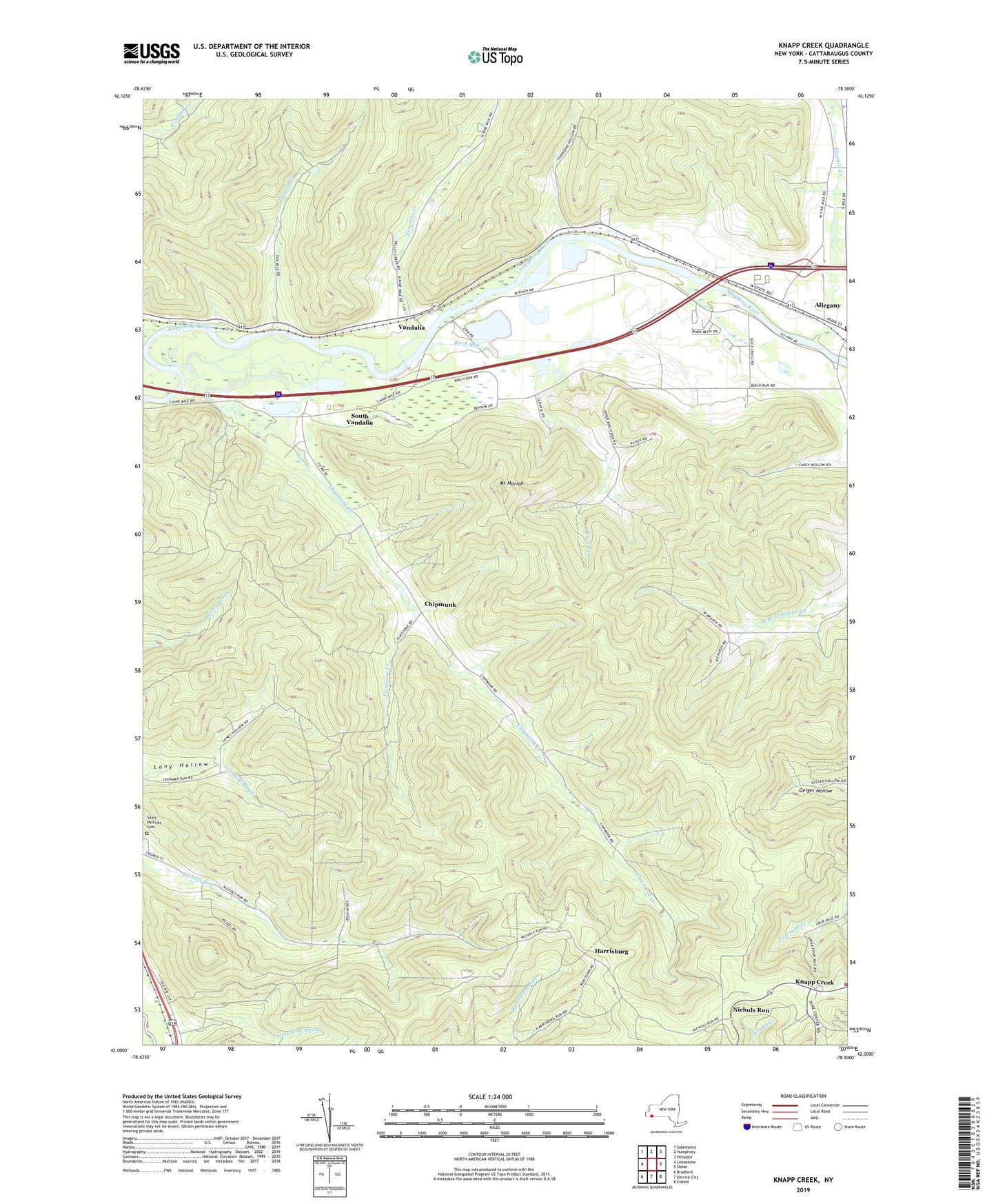
2023 topographic map quadrangle Knapp Creek in the state of New York. Scale: 1:24000. Based on the newly updated USGS 7.5' US Topo map series, this map is in the following counties: Cattaraugus. The map contains contour data, water features, and other items you are used to seeing on USGS maps, but also has updated roads and other features. This is the next generation of topographic maps. Printed on high-quality waterproof paper with UV fade-resistant inks.
Quads adjacent to this one:
West: Limestone
Northwest: Salamanca
North: Humphrey
Northeast: Hinsdale
East: Olean
Southeast: Eldred
South: Derrick City
Southwest: Bradford
This map covers the same area as the classic USGS quad with code o42078a5.
Contains the following named places: Allegany Drive-In, Allegany Fire Department, Birch Run, Birch Run Country Club, Bradford Oil Field, Carey Hollow, Chipmunk, Chipmunk Creek, Colonial Village Mobile Home Park, Eagle Rod and Gun Club, First Free Methodist Church, Fivemile Creek, Flatstone Creek, Harrisburg, Knapp Creek, Knapp Creek Volunteer Fire Department, Long Acres Mobile Home Park, Mount Moriah, Nichols Run, Ninemile Creek, Sacred Heart Church, Saint Johns Church, Saint Patricks Cemetery, South Vandalia, Tenmile Creek, Town of Allegany, Townsend Hollow, Valley View Estates Mobile Home Park, Vandalia, WQRT-FM (Salamanca), ZIP Code: 14706