MyTopo
Sylvan Falls New York US Topo Map
Couldn't load pickup availability
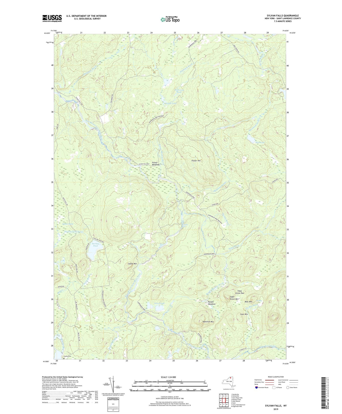
2023 topographic map quadrangle Sylvan Falls in the state of New York. Scale: 1:24000. Based on the newly updated USGS 7.5' US Topo map series, this map is in the following counties: St. Lawrence. The map contains contour data, water features, and other items you are used to seeing on USGS maps, but also has updated roads and other features. This is the next generation of topographic maps. Printed on high-quality waterproof paper with UV fade-resistant inks.
Quads adjacent to this one:
West: Rainbow Falls
Northwest: Parishville
North: Nicholville
Northeast: Saint Regis Falls
East: Lake Ozonia
Southeast: Augerhole Falls
South: Carry Falls Reservoir
Southwest: Stark
This map covers the same area as the classic USGS quad with code o44074e6.
Contains the following named places: Balsam Brook, Bear Mountain, Bruner Falls, Coffee Mountain, Cooperage Club, Coulon Cemetery, Dead Creek, Fenner Meadow Brook, Fenner Meadows, Flower Hill, Hamilton Mountain, Harper School, Hogback Brook, Hopkinton Pond, Kingsley Falls, Loon Mountain, Mud Pond, Mud Pond Outlet, Randle Meadow Brook, Randle Meadows, Saint Lawrence State Forest Number 8, Santimaw Brook, School Number 13, Slough Pond, Sterling Pond, Sterling Pond Outlet, Stony Brook, Sugar Grove Mountain, Sugar Grove Pass, Sylvan Falls, The Bog, The Bog Outlet, Thomas Brook, Town of Hopkinton, Twin Ponds, Welch Brook, Wick School, Willis Brook