MyTopo
Langford New York US Topo Map
Couldn't load pickup availability
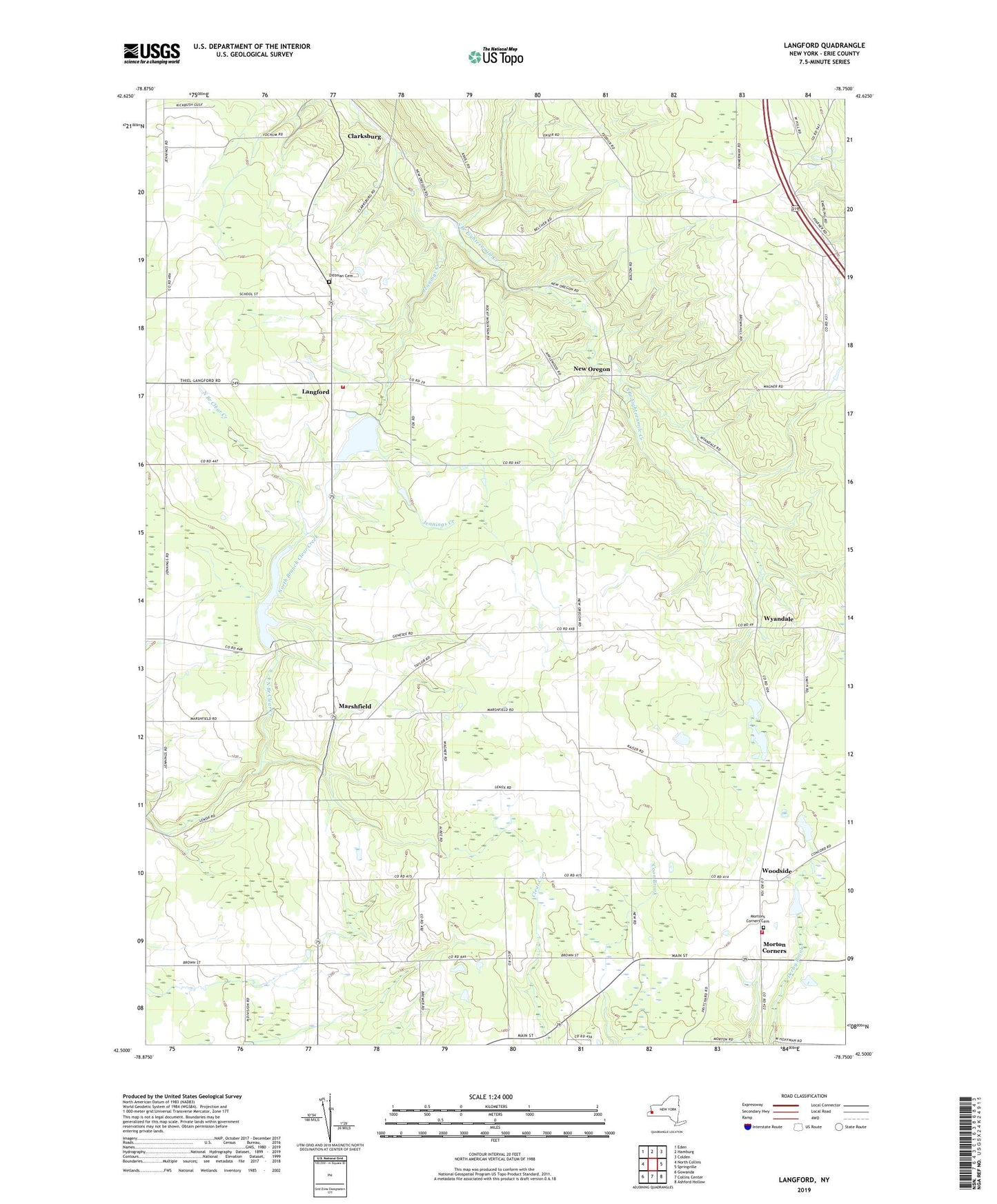
2023 topographic map quadrangle Langford in the state of New York. Scale: 1:24000. Based on the newly updated USGS 7.5' US Topo map series, this map is in the following counties: Erie. The map contains contour data, water features, and other items you are used to seeing on USGS maps, but also has updated roads and other features. This is the next generation of topographic maps. Printed on high-quality waterproof paper with UV fade-resistant inks.
Quads adjacent to this one:
West: North Collins
Northwest: Eden
North: Hamburg
Northeast: Colden
East: Springville
Southeast: Ashford Hollow
South: Collins Center
Southwest: Gowanda
This map covers the same area as the classic USGS quad with code o42078e7.
Contains the following named places: Boston Volunteer Fire Company Station 2, Camp Hemlock Ridge, Clarksburg, Clear Lake, Dittman Cemetery, Eden Valley Golf Course, Jennings Creek, Langford, Langford - New Oregon Volunteer Fire Company, Marshfield, Morton Corners, Mortons Corners Baptist Church, Mortons Corners Cemetery, Mortons Corners Volunteer Fire Department, New Oregon, Richmond Farms Dairy, Saint Martins Church, Saint Marys Church, Town of North Collins, Whites Corners, Woodside, Wyandale, ZIP Code: 14034