MyTopo
Little Valley New York US Topo Map
Couldn't load pickup availability
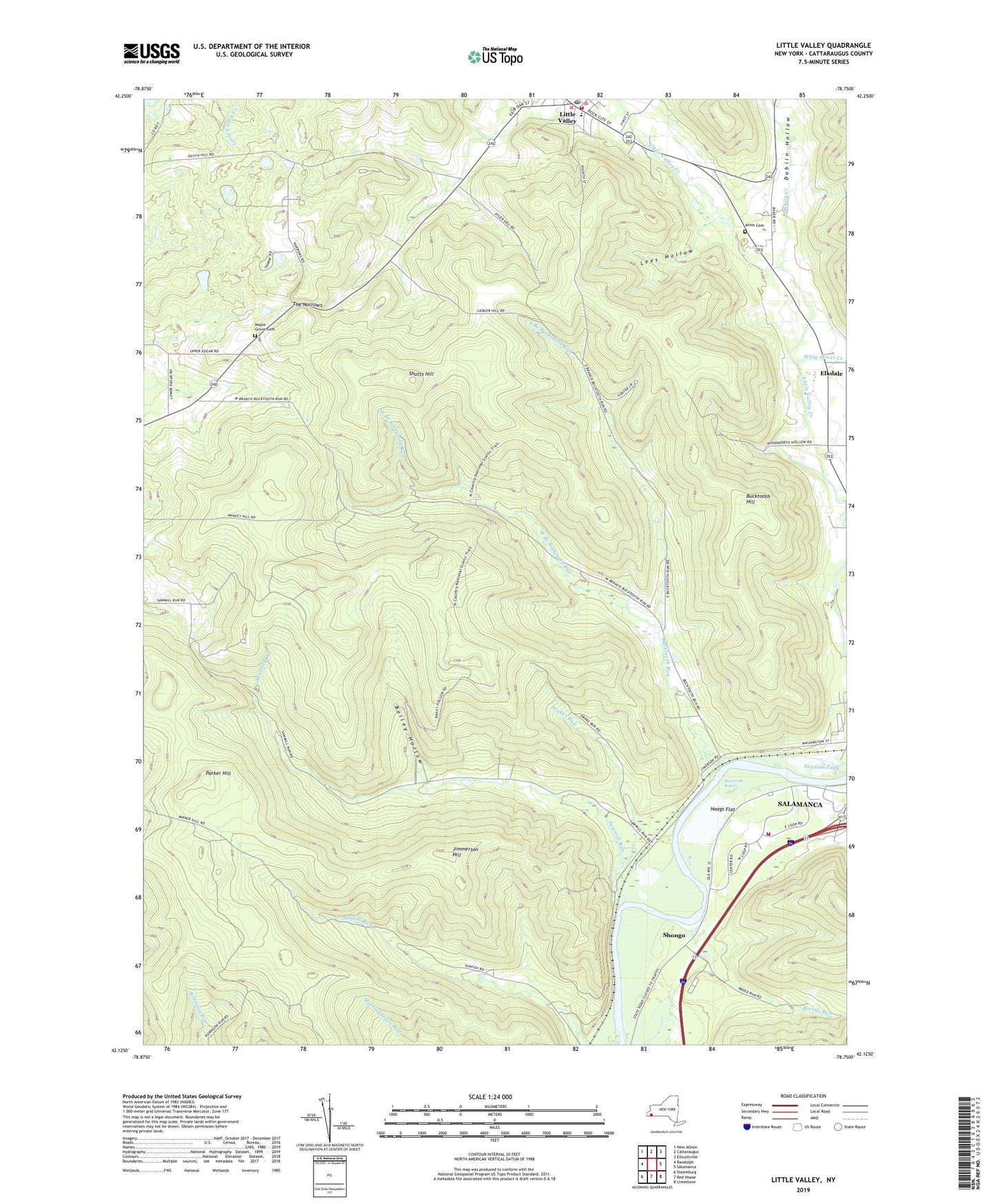
2023 topographic map quadrangle Little Valley in the state of New York. Scale: 1:24000. Based on the newly updated USGS 7.5' US Topo map series, this map is in the following counties: Cattaraugus. The map contains contour data, water features, and other items you are used to seeing on USGS maps, but also has updated roads and other features. This is the next generation of topographic maps. Printed on high-quality waterproof paper with UV fade-resistant inks.
Quads adjacent to this one:
West: Randolph
Northwest: New Albion
North: Cattaraugus
Northeast: Ellicottville
East: Salamanca
Southeast: Limestone
South: Red House
Southwest: Steamburg
This map covers the same area as the classic USGS quad with code o42078b7.
Contains the following named places: Allegany Indian Reservation Fire Department, Annis Cemetery, Bailey Hollow, Breeds Run, Bucktooth Hill, Bucktooth Island, Bucktooth Rapids, Bucktooth Run, Camp Liloli, Drakes Run, Dublin Creek, Dublin Hollow, East Branch Bucktooth Run, Elkdale, First Congregational Church, Full Gospel Mission, Hillside Acres, Hoags Flat, Jimmerson Hill, Jimmersontown Church, Lees Hollow, Little Valley Campus Elementary School, Little Valley Post Office, Little Valley Rod and Gun Club, Little Valley Volunteer Fire Department, Maple Grove Cemetery, Memorial Library of Little Valley, Missionary Indian Church, Newtons Eddy, Parker Hill, Saint Michaels Lutheran Church, Sawmill Run, Shongo, Shutts Hill, The Narrows, Town of Coldspring, Town of Little Valley, Town of Salamanca, Valley View Baptist Church, Village of Little Valley, West Branch Bucktooth Run, Whig Street Creek, Woodworth Hollow, ZIP Code: 14755