MyTopo
Red House New York US Topo Map
Couldn't load pickup availability
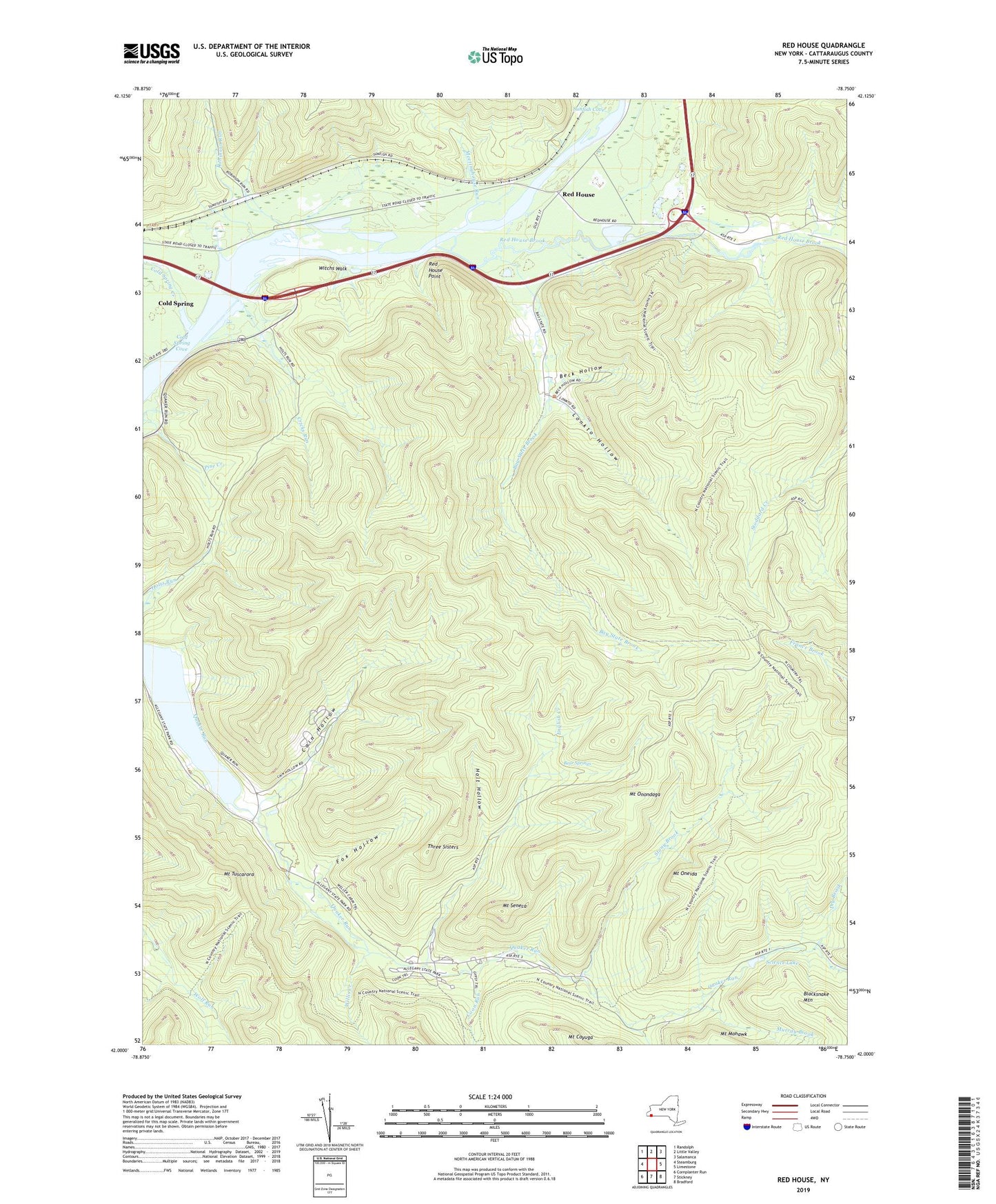
2023 topographic map quadrangle Red House in the state of New York. Scale: 1:24000. Based on the newly updated USGS 7.5' US Topo map series, this map is in the following counties: Cattaraugus. The map contains contour data, water features, and other items you are used to seeing on USGS maps, but also has updated roads and other features. This is the next generation of topographic maps. Printed on high-quality waterproof paper with UV fade-resistant inks.
Quads adjacent to this one:
West: Steamburg
Northwest: Randolph
North: Little Valley
Northeast: Salamanca
East: Limestone
Southeast: Bradford
South: Stickney
Southwest: Cornplanter Run
This map covers the same area as the classic USGS quad with code o42078a7.
Contains the following named places: Allegany Reservation, Allegany State Park, Bay State Brook, Bear Springs, Beck Hollow, Black School, Blacksnake Mountain, Cain Hollow, Camp Number Five, Camp Turner, Cold Spring, Cold Spring Cove, Cold Spring Creek, Coon Run, Cricks Run, Dry Brook, English Creek, Fox Hollow, Holt Hollow, Lonkto Hollow, Meetinghouse Run, Mount Cayuga, Mount Mohawk, Mount Oneida, Mount Onondaga, Mount Seneca, Mount Tuscarora, Murray Brook, Quaker Run Area, Quaker Run Chapel, Red House, Red House Brook, Red House Chapel, Red House Free Church, Red House Point, Robinson Run, Saint Johns Church, Science Lake, Seneca Church, Slide Hollow, Stony Brook, Sunfish Cove, Sunfish Run, Three Sisters, Town of Red House, Trail Number 1, Trail Number 10, Trail Number 2, Trail Number 4, Trail Number 4 A, Trail Number 5, Trail Number 9, Willis Creek, Witchs Walk, Yeager Brook, ZIP Code: 14779