MyTopo
Mattituck Hills New York US Topo Map
Couldn't load pickup availability
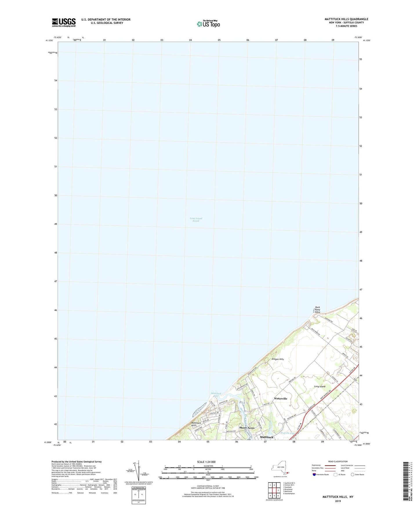
2019 topographic map quadrangle Mattituck Hills in the state of New York. Scale: 1:24000. Based on the newly updated USGS 7.5' US Topo map series, this map is in the following counties: Suffolk. The map contains contour data, water features, and other items you are used to seeing on USGS maps, but also has updated roads and other features. This is the next generation of topographic maps. Printed on high-quality waterproof paper with UV fade-resistant inks.
Quads adjacent to this one:
Northwest: Guilford OE S
North: Clinton OE S
East: Southold
Southeast: Southampton
South: Mattituck
Southwest: Riverhead
Contains the following named places: Castello Di Borghese Vineyards, Duck Pond Point, Mattituck Census Designated Place, Mattituck Creek, Mattituck Hills, Mattituck Inlet, Mattituck Light, Oregon Hills, Pellegrini Vineyards, Sherwood House Vineyards, Shinn Vineyard, Shore Acres, Waterville, Wolf Pit Lake, ZIP Code: 11952