MyTopo
Mattituck New York US Topo Map
Couldn't load pickup availability
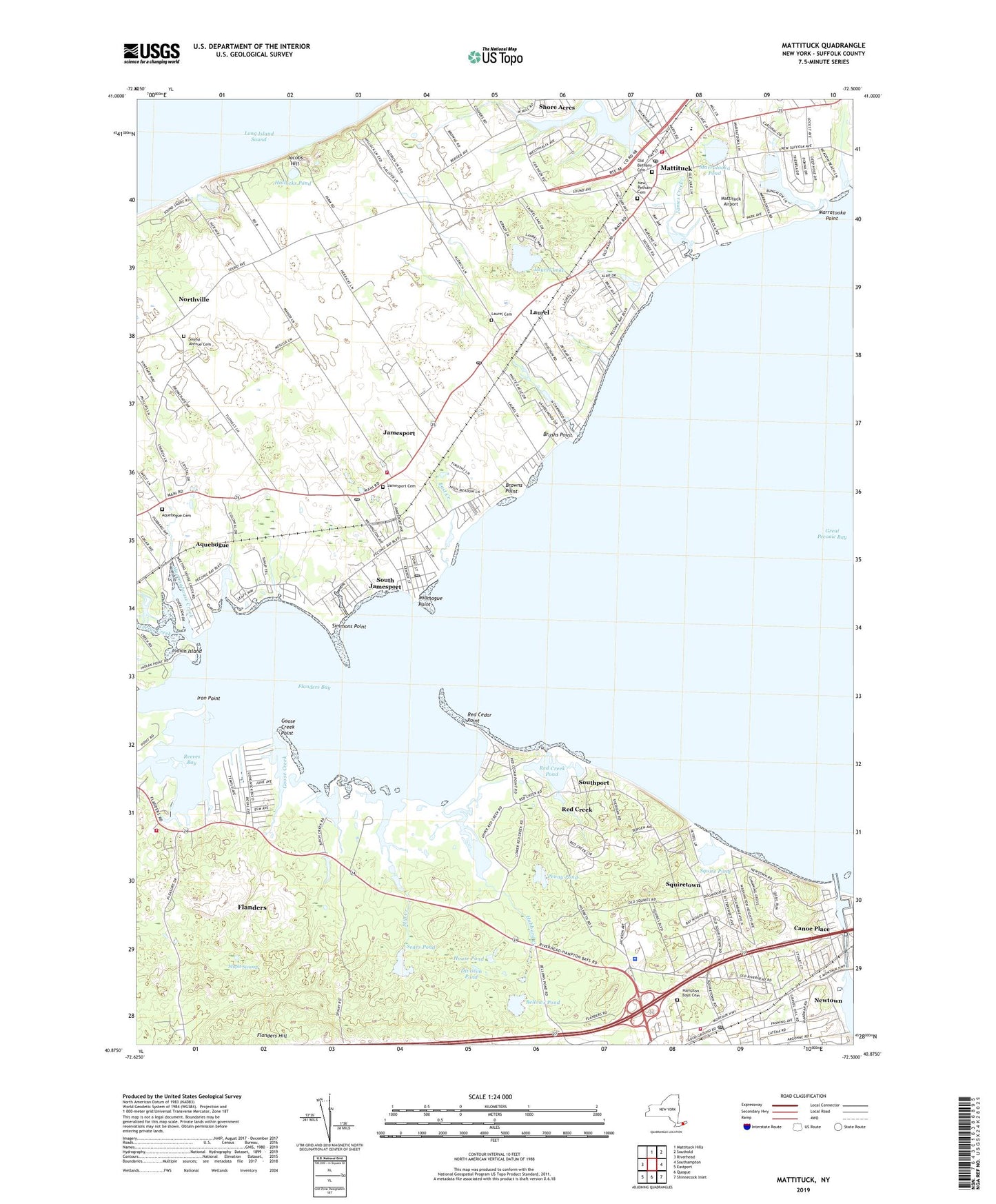
2019 topographic map quadrangle Mattituck in the state of New York. Scale: 1:24000. Based on the newly updated USGS 7.5' US Topo map series, this map is in the following counties: Suffolk. The map contains contour data, water features, and other items you are used to seeing on USGS maps, but also has updated roads and other features. This is the next generation of topographic maps. Printed on high-quality waterproof paper with UV fade-resistant inks.
Quads adjacent to this one:
West: Riverhead
North: Mattituck Hills
Northeast: Southold
East: Southampton
Southeast: Shinnecock Inlet
South: Quogue
Southwest: Eastport
Contains the following named places: Aquebogue Cemetery, Aquebogue Census Designated Place, Bellows Pond, Big E Farm, Birch Creek, Birch Creek Pond, Browns Point, Brushs Creek, Brushs Point, Camp Carey, Camp Immaculate, Camp Malloy, Canoe Place, Church of the Redeemer, Cow Yard, Crescent Duck Farm, Deep Hole Creek, Division Pond, Duffy Farms, East Creek, First Parish Church, Flanders, Flanders Bay, Flanders Census Designated Place, Flanders Fire Department, Flanders United Methodist Church, Golden Earthworm Organic Farm, Goose Creek, Goose Creek Point, Grass Pond, Great Peconic Bay, Hallocks Pond, Hallockville Museum Farm, Hampton Bays Cemetery, Hampton Bays Fire Station, Hampton Bays Post Office, Hampton Bays Station, Hampton Bays United Methodist Church, Hampton Bays Volunteer Ambulance, Horton Creek, House Pond, Hubbard County Park, Hubbard Creek, Indian Island, Iron Point, Jacobs Hill, James Creek, Jamesport, Jamesport Cemetery, Jamesport Census Designated Place, Jamesport Fire Department Headquarters, Jamesport Post Office, Jamesport Vineyards, Laurel, Laurel Cemetery, Laurel Census Designated Place, Laurel Lake, Laurel Lake Vineyards, Laurel Links Country Club, Laurel Post Office, Lily Pond, Long Creek, Luce Landing, Macari Vineyards, Maple Swamp, Marratooka Point, Marratooka Pond, Martha Clara Vineyards, Mattituck, Mattituck - Laurel Library, Mattituck Airport, Mattituck Fire Department, Mattituck High School, Mattituck Park District Beach, Mattituck Post Office, Mattituck Presbyterian Church, Meetinghouse Creek, Meschutt Beach County Park, Miamogue Lagoon, Miamogue Point, Mill Creek, New Bethany Cemetery, Newtown, North Fork Unitarian Universalist Fellowship, North Wind Farm, Northville, Northville Census Designated Place, Old Bethany Cemetery, Old Steeple Community Church, Palmer Vineyards, Paumanok Vineyards, Peconic River, Penny Pond, Red Cedar Point, Red Creek, Red Creek Pond, Reeves Bay, Reeves Creek, Riverhaven Park, Saint Rosalies Mission Church, Sears - Bellows Pond County Park, Sears Pond, Shinnecock Canal, Shinnecock County Marina, Shinnecock Light, Simmons Point, Sound Avenue Cemetery, South Jamesport, South Jamesport Post Office, Southampton Town Police Department, Southport, Squire Pond, Squiretown, Terrys Creek, Wehrman Pond, ZIP Codes: 11931, 11947, 11948, 11970