MyTopo
Shinnecock Inlet New York US Topo Map
Couldn't load pickup availability
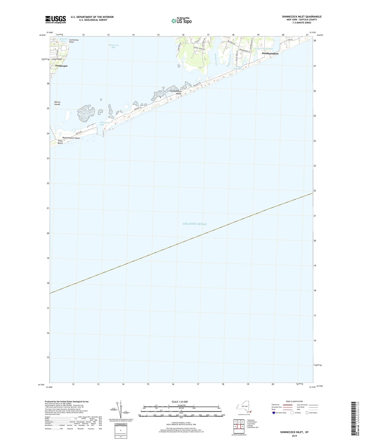
2023 topographic map quadrangle Shinnecock Inlet in the state of New York. Scale: 1:24000. Based on the newly updated USGS 7.5' US Topo map series, this map is in the following counties: Suffolk. The map contains contour data, water features, and other items you are used to seeing on USGS maps, but also has updated roads and other features. This is the next generation of topographic maps. Printed on high-quality waterproof paper with UV fade-resistant inks.
Quads adjacent to this one:
West: Quogue
Northwest: Mattituck
North: Southampton
Northeast: Sag Harbor
East: Sag Harbor OE S
This map covers the same area as the classic USGS quad with code o40072g4.
Contains the following named places: Agawan Lake, Bennett Cove, Coopers Neck Pond, Cormorant Point, Halsey Neck Pond, Heady Creek, Meadow Club, Ruth Wales DuPont Sanctuary, Saint Andrews Church, Shinecock Presbyterian Church, Shinnecock Bay, Shinnecock Coast Guard Station, Shinnecock East County Park, Shinnecock Indian Cemetery, Shinnecock Inlet, Shinnecock Reservation, Shinnecock School, Southampton Beach, Southampton Heliport, Southampton Village Heliport, Taylor Creek, Town of Southampton, Warner Islands