MyTopo
Mount Morris New York US Topo Map
Couldn't load pickup availability
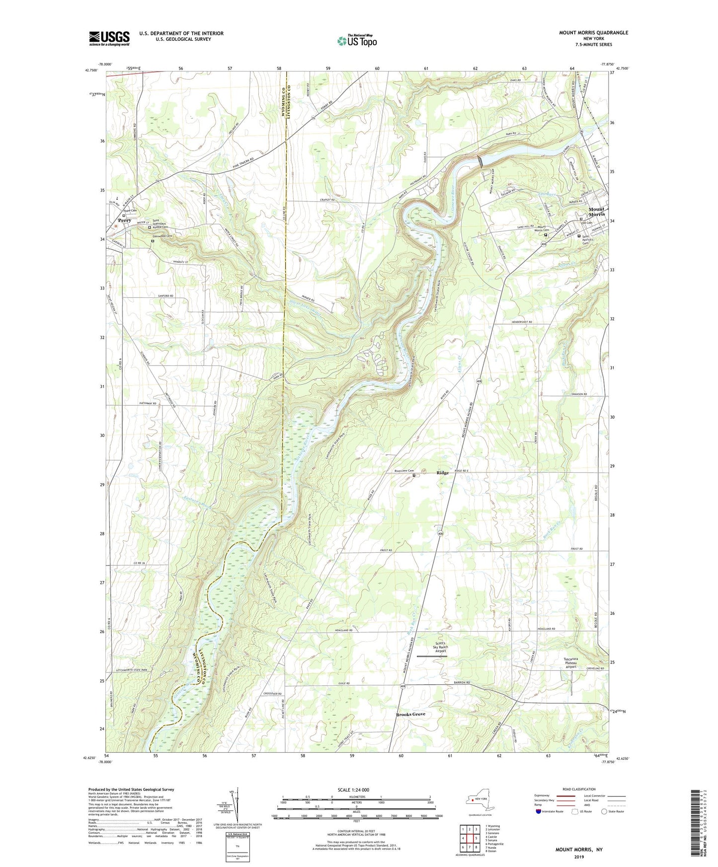
2023 topographic map quadrangle Mount Morris in the state of New York. Scale: 1:24000. Based on the newly updated USGS 7.5' US Topo map series, this map is in the following counties: Livingston, Wyoming. The map contains contour data, water features, and other items you are used to seeing on USGS maps, but also has updated roads and other features. This is the next generation of topographic maps. Printed on high-quality waterproof paper with UV fade-resistant inks.
Quads adjacent to this one:
West: Castile
Northwest: Wyoming
North: Leicester
Northeast: Geneseo
East: Sonyea
Southeast: Ossian
South: Nunda
Southwest: Portageville
This map covers the same area as the classic USGS quad with code o42077f8.
Contains the following named places: Beau View Farms, Brooks Grove, Eastover Brook, Fitch Farms, Five Corners, Gardeau Crest Farm, Gardeau Overlook, Glenwood Cemetery, Highbanks Campgrounds, Highbanks Recreation Area, Hope Cemetery, Lacy Creek, Letchworth State Park, Mount Morris Cemetery, Mount Morris Dam, Mount Morris Elementary - Middle School, Mount Morris Hospital, Mount Morris Lake, Old Acres Farm, Old Cemetery, Park View Farms, Parkway Mobile Home Park, Perry Elementary School, Perry Middle School, Perry Village Wastewater Treatment Plant, Ridge, River Road Forks, Riverview Cemetery, Saint John's Episcopal Church, Saint Patrick's Cemetery, Saint Patricks Holy Angel Catholic Church, Saint Stanislaus Kostka Cemetery, Saint Stanislaus Roman Catholic Church, Scott's Sky Ranch Airport, Silver Lake Outlet, Simmons Corners, The Baptist Church of Perry, Town of Mount Morris, Tuscarora Plateau Airport, United Church of Mount Morris, Village of Mount Morris, ZIP Code: 14530