MyTopo
Natural Bridge New York US Topo Map
Couldn't load pickup availability
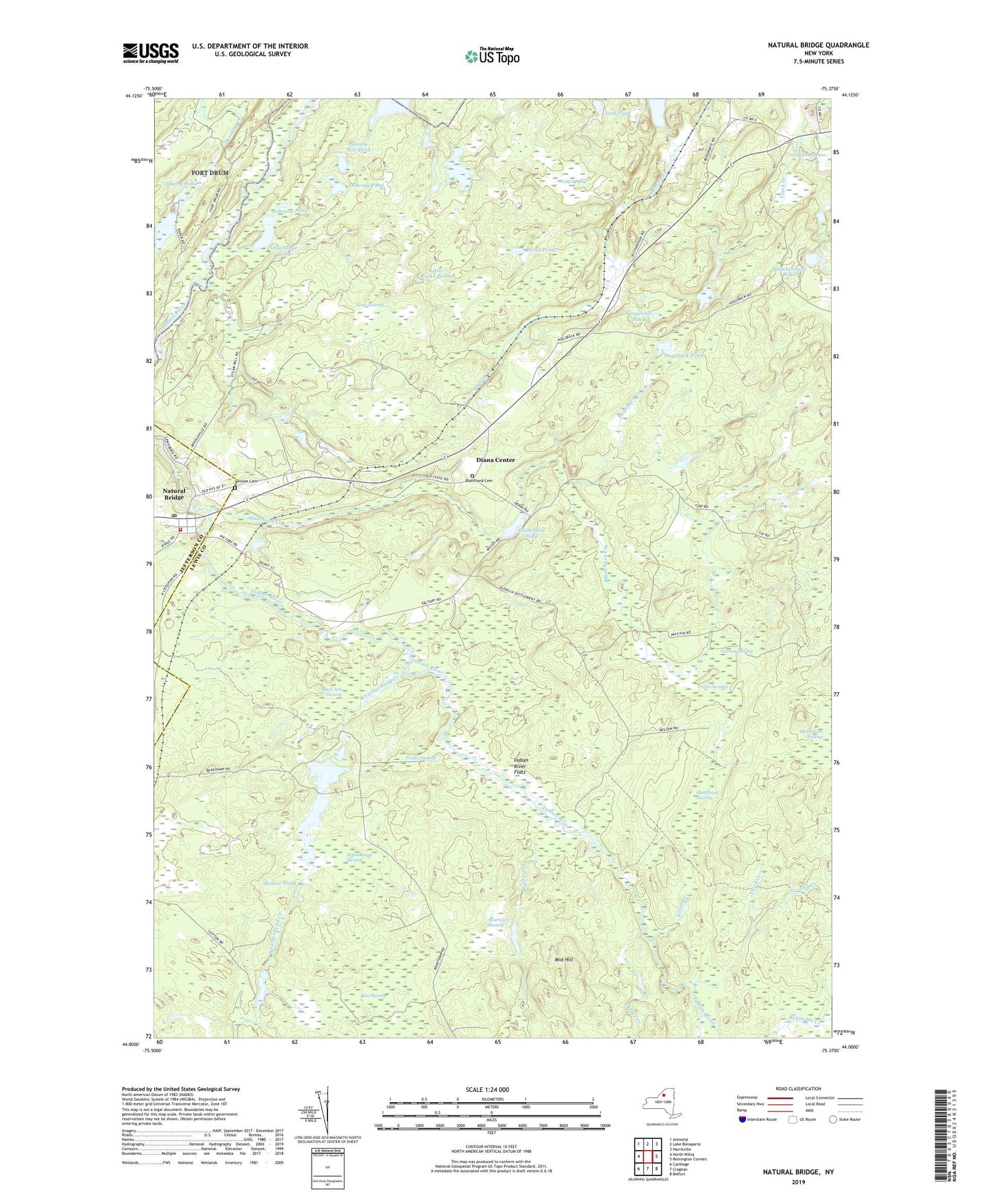
2019 topographic map quadrangle Natural Bridge in the state of New York. Scale: 1:24000. Based on the newly updated USGS 7.5' US Topo map series, this map is in the following counties: Lewis, Jefferson. The map contains contour data, water features, and other items you are used to seeing on USGS maps, but also has updated roads and other features. This is the next generation of topographic maps. Printed on high-quality waterproof paper with UV fade-resistant inks.
Quads adjacent to this one:
West: North Wilna
Northwest: Antwerp
North: Lake Bonaparte
Northeast: Harrisville
East: Remington Corners
Southeast: Belfort
South: Croghan
Southwest: Carthage
Contains the following named places: Alder Creek, Ashcraft Pond, Bartlett Corners, Beartown Swamp, Beaver Pond, Black Ash Swamp, Blanchard Cemetery, Blanchard Corners, Blanchard Creek, Blanchard Pond, Blanchard Swamp, Blue Swamp, Burnt Pond, Clark Pond, Cold Swamp, Crooked Pond, Diana Center, Doherty Pond, Fitzgerald Pond, Fourth Creek, Hillside Cemetery, Hogsback Creek, Hogsback Pond, Indian River Flats, Johnson Pond, Little Rocks Ponds, Long Swamp, Middle Hill, Natural Bridge, Natural Bridge Census Designated Place, Natural Bridge Post Office, Natural Bridge Station, Natural Bridge Volunteer Fire Company, North Croghan Crossing, Onjebonge Pond, Patchin Swamp, Pine Creek, Prittie Swamp, Punky Swamp, Quackenbush Pond, Quarry Pond, Schoolhouse Swamp, Second Creek, Steam Mill Pond, Third Creek, Weatherhead Creek, ZIP Code: 13665