MyTopo
Antwerp New York US Topo Map
Couldn't load pickup availability
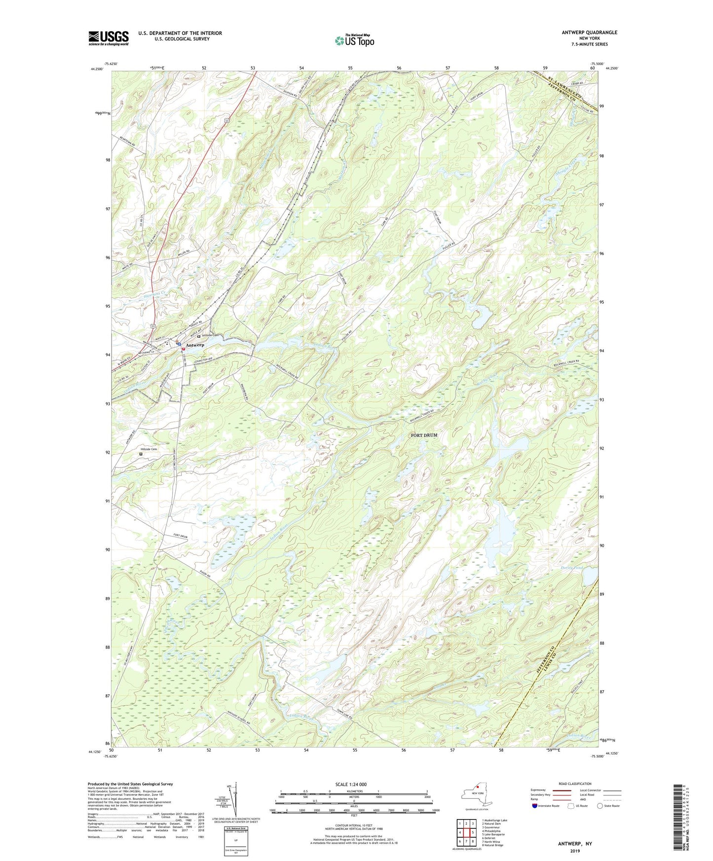
2023 topographic map quadrangle Antwerp in the state of New York. Scale: 1:24000. Based on the newly updated USGS 7.5' US Topo map series, this map is in the following counties: Jefferson, Lewis, St. Lawrence. The map contains contour data, water features, and other items you are used to seeing on USGS maps, but also has updated roads and other features. This is the next generation of topographic maps. Printed on high-quality waterproof paper with UV fade-resistant inks.
Quads adjacent to this one:
West: Philadelphia
Northwest: Muskellunge Lake
North: Natural Dam
Northeast: Gouverneur
East: Lake Bonaparte
Southeast: Natural Bridge
South: North Wilna
Southwest: Deferiet
This map covers the same area as the classic USGS quad with code o44075b5.
Contains the following named places: Antwerp, Antwerp High School, Antwerp Post Office, Antwerp Town Hall, Antwerp Village Police Department, Antwerp Volunteer Fire Department Number 04, Cold Creek, Crosby Public Library, Dority Pond, First Congregation Church of Christ, Hawkins Creek, Hillside Cemetery, Indian River Grange Hall, Monument Park, Rockwell Creek, School Number 15, School Number 3, Town of Antwerp, Village of Antwerp