MyTopo
Harrisville New York US Topo Map
Couldn't load pickup availability
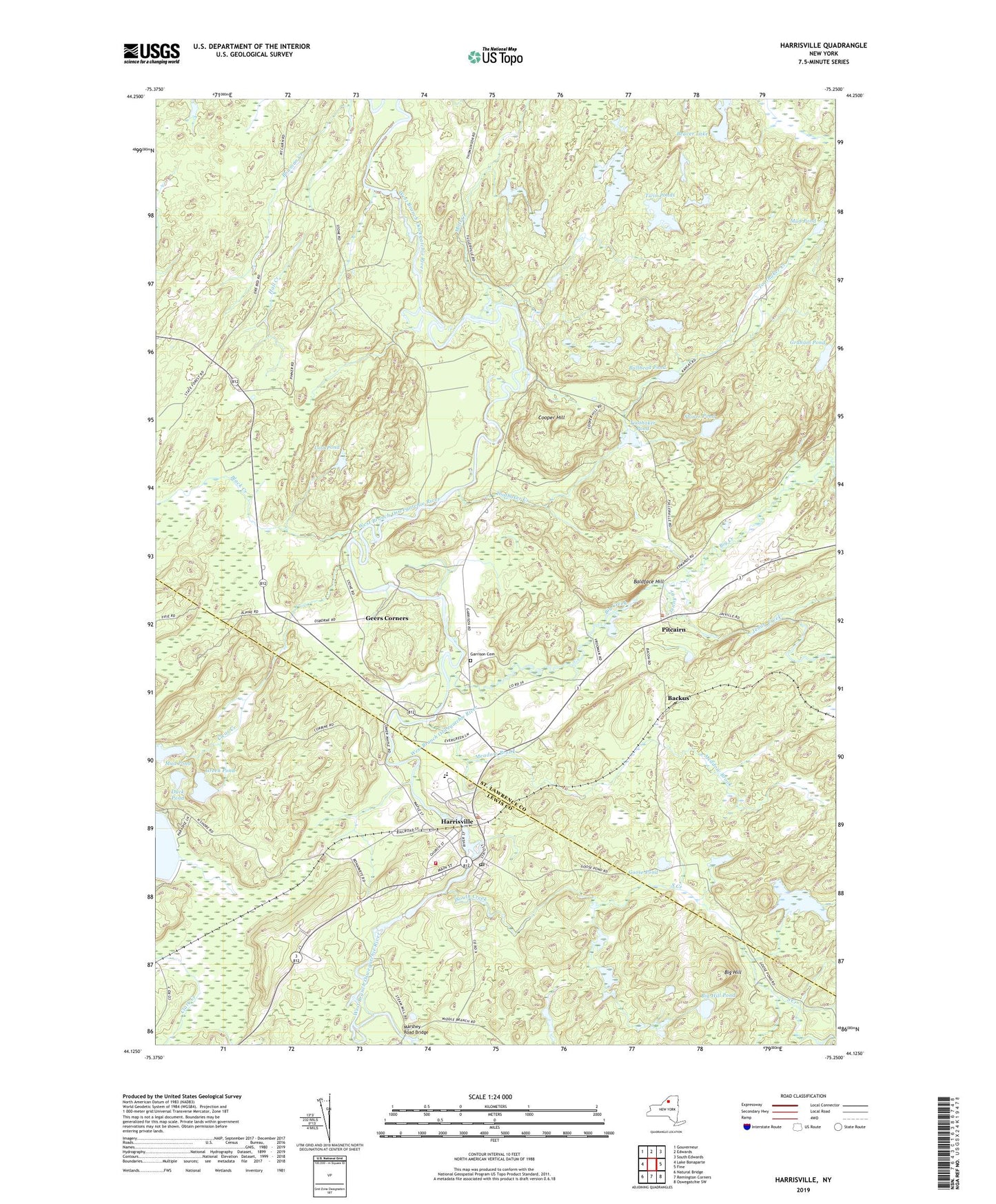
2023 topographic map quadrangle Harrisville in the state of New York. Scale: 1:24000. Based on the newly updated USGS 7.5' US Topo map series, this map is in the following counties: St. Lawrence, Lewis. The map contains contour data, water features, and other items you are used to seeing on USGS maps, but also has updated roads and other features. This is the next generation of topographic maps. Printed on high-quality waterproof paper with UV fade-resistant inks.
Quads adjacent to this one:
West: Lake Bonaparte
Northwest: Gouverneur
North: Edwards
Northeast: South Edwards
East: Fine
Southeast: Oswegatchie SW
South: Remington Corners
Southwest: Natural Bridge
This map covers the same area as the classic USGS quad with code o44075b3.
Contains the following named places: Backus, Baldface Hill, Beaver Lake, Big Creek, Big Hill, Big Hill Pond, Black Creek, Bowman Creek, Bullhead Pond, Clear Creek, Cooper Hill, Duck Pond, Garrison Cemetery, Geers Corners, Goose Pond, Graham Pond, Green Pond, Harrisville, Harrisville Census Designated Place, Harrisville Elementary School, Harrisville Junior - Senior High School, Harrisville Post Office, Harrisville Volunteer Fire Department, Jenny Creek, Lost Pond, Marshey Road Bridge, Meadow Brook, Mud Pond, Pine Hill Pond, Pitcairn, Saint Francis Solanus Church, Shiner Pond, South Creek, Toothaker Creek, Toothaker Pond, Town of Pitcairn, Twin Ponds, Village of Harrisville, ZIP Code: 13648