MyTopo
Newton Falls New York US Topo Map
Couldn't load pickup availability
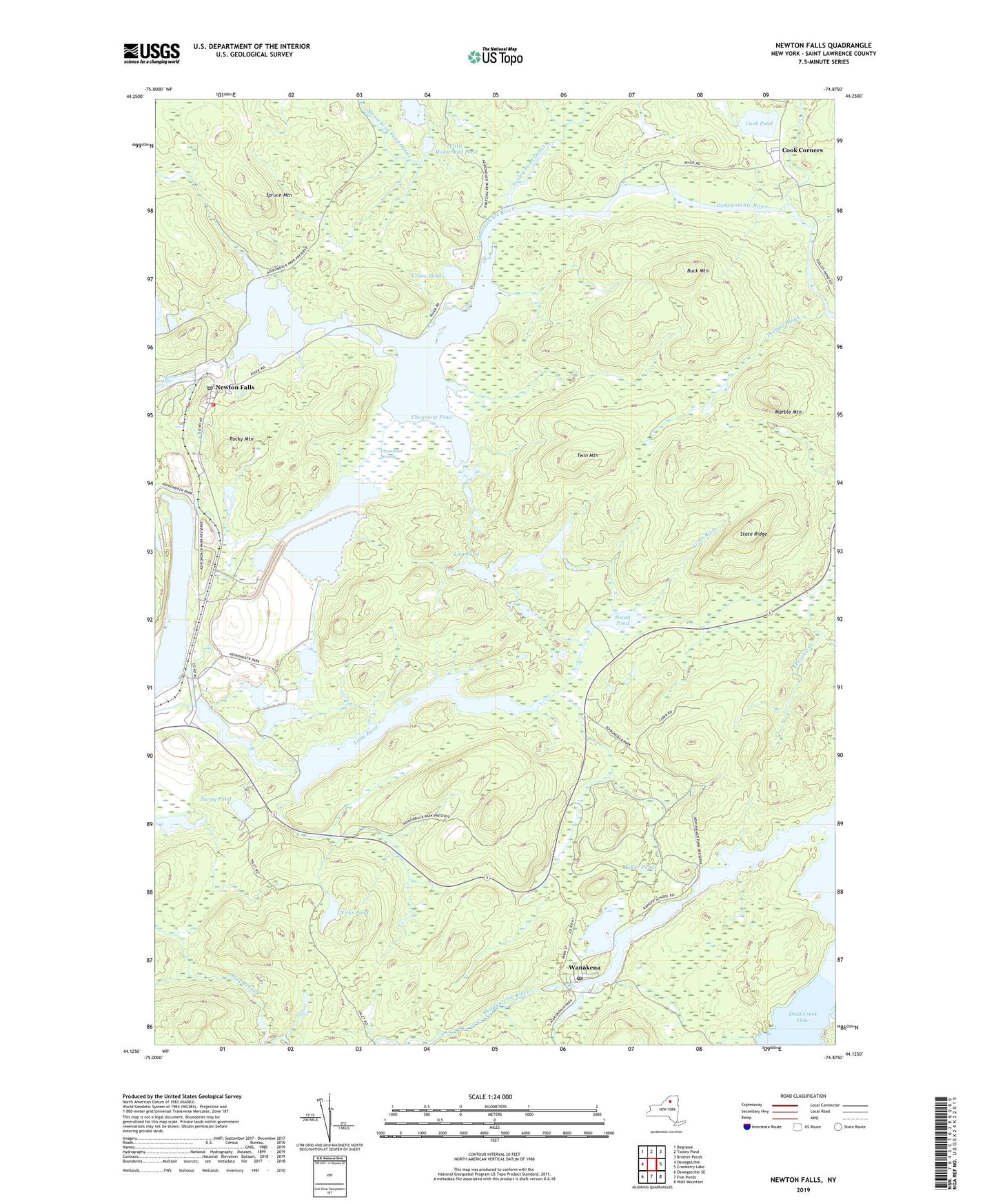
2019 topographic map quadrangle Newton Falls in the state of New York. Scale: 1:24000. Based on the newly updated USGS 7.5' US Topo map series, this map is in the following counties: St. Lawrence. The map contains contour data, water features, and other items you are used to seeing on USGS maps, but also has updated roads and other features. This is the next generation of topographic maps. Printed on high-quality waterproof paper with UV fade-resistant inks.
Quads adjacent to this one:
West: Oswegatchie
Northwest: Degrasse
North: Tooley Pond
Northeast: Brother Ponds
East: Cranberry Lake
Southeast: Wolf Mountain
South: Five Ponds
Southwest: Oswegatchie SE
Contains the following named places: Buck Mountain, Chaumont Pond, Chaumont Swamp, Cook Corners, Cook Pond, Cranberry Lake, Crane Pond, Eskar Pond, Flatiron Point, Heath Pond, Little Moosehead Pond, Lost Pond, Marble Mountain, Muskrat Pond, Newton Falls, Newton Falls Post Office, Nicks Pond, Post Henderson Trail, Rocky Mountain, Skate Creek, Spruce Mountain, State Ridge, Sunny Pond, Thomas Brook, Tooley Pond Outlet, Town of Clifton, Twin Mountain, Wanakena, Wanakena Post Office, ZIP Code: 13666