MyTopo
Degrasse New York US Topo Map
Couldn't load pickup availability
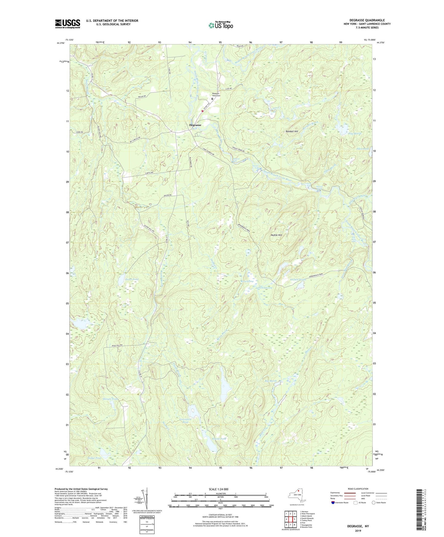
2023 topographic map quadrangle Degrasse in the state of New York. Scale: 1:24000. Based on the newly updated USGS 7.5' US Topo map series, this map is in the following counties: St. Lawrence. The map contains contour data, water features, and other items you are used to seeing on USGS maps, but also has updated roads and other features. This is the next generation of topographic maps. Printed on high-quality waterproof paper with UV fade-resistant inks.
Quads adjacent to this one:
West: South Edwards
Northwest: Hermon
North: West Pierrepont
Northeast: Albert Marsh
East: Tooley Pond
Southeast: Newton Falls
South: Oswegatchie
Southwest: Fine
This map covers the same area as the classic USGS quad with code o44075c1.
Contains the following named places: Allen Brook, Allen Pond Outlet, Basford Falls, Berry Brook, Berry Swamp, Big Marsh, Camp Flat-Rock, Clarksboro, Clifton Hunt Club Airport, Colton Creek, Degrasse, Degrasse Clare and South Russell Volunteer Fire Department, Degrasse State Forest, Dodge Pond, Flat Rock Falls, Greenfield Pond, Huftle Hill, Long Pond, Orebed Creek, Orebed Creek State Forest, Orebed Ponds, Orebed Swamp, Pine Marsh, Pleasant View Cemetery, Randall Brook, Randall Hill, Round Pond, Shingle Pond, Silver Hill State Forest, Sinclair Falls, Steep Bank Brook, Stewart Rapids, Sweet Pond, Twin Falls, ZIP Code: 13684