MyTopo
Otisco Valley New York US Topo Map
Couldn't load pickup availability
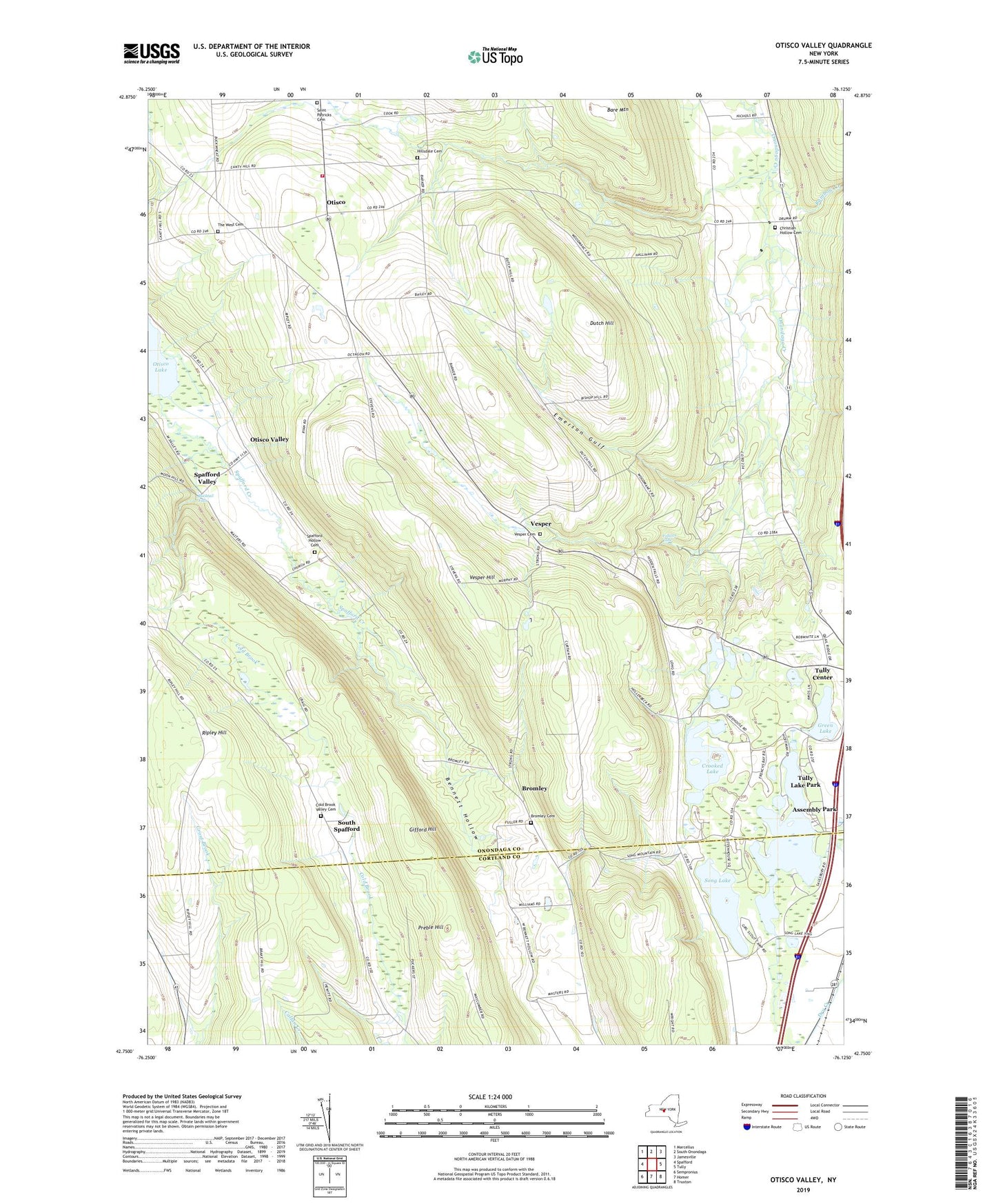
2019 topographic map quadrangle Otisco Valley in the state of New York. Scale: 1:24000. Based on the newly updated USGS 7.5' US Topo map series, this map is in the following counties: Onondaga, Cortland. The map contains contour data, water features, and other items you are used to seeing on USGS maps, but also has updated roads and other features. This is the next generation of topographic maps. Printed on high-quality waterproof paper with UV fade-resistant inks.
Quads adjacent to this one:
West: Spafford
Northwest: Marcellus
North: South Onondaga
Northeast: Jamesville
East: Tully
Southeast: Truxton
South: Homer
Southwest: Sempronius
Contains the following named places: Assembly Park, Bare Mountain, Bennett Hollow, Bromley, Bromley Cemetery, Bucktail Falls, Camp Hoover, Christian Hollow Cemetery, Cold Brook Valley Cemetery, Crooked Lake, Dutch Hill, Dutch Hill School, Emerson Gulf, Fellows Falls, Gatehouse Pond, Gifford Hill, Green Lake, Hillsdale Cemetery, Mary Christmas Tree Farm, Neumans Corners, Otisco, Otisco Fire Department, Otisco Valley, Preble Hill, Rainbow Creek, Rattlesnake Gulf, Ripley Hill, Royal Acres, Saint Patricks Cemetery, School Number 10, School Number 11, School Number 12, School Number 2, School Number 3, School Number 7, Song Lake, South Spafford, Spafford Creek, Spafford Hollow Cemetery, Spafford Valley, The West Cemetery, Town of Otisco, Town of Tully, Tracy Lake, Tully Lake, Tully Lake Park, Tully Valley, Vesper, Vesper Cemetery, Vesper Hill, Vesper Hills Golf Club, Vesper United Methodist Church, ZIP Code: 13141