MyTopo
Otisville New York US Topo Map
Couldn't load pickup availability
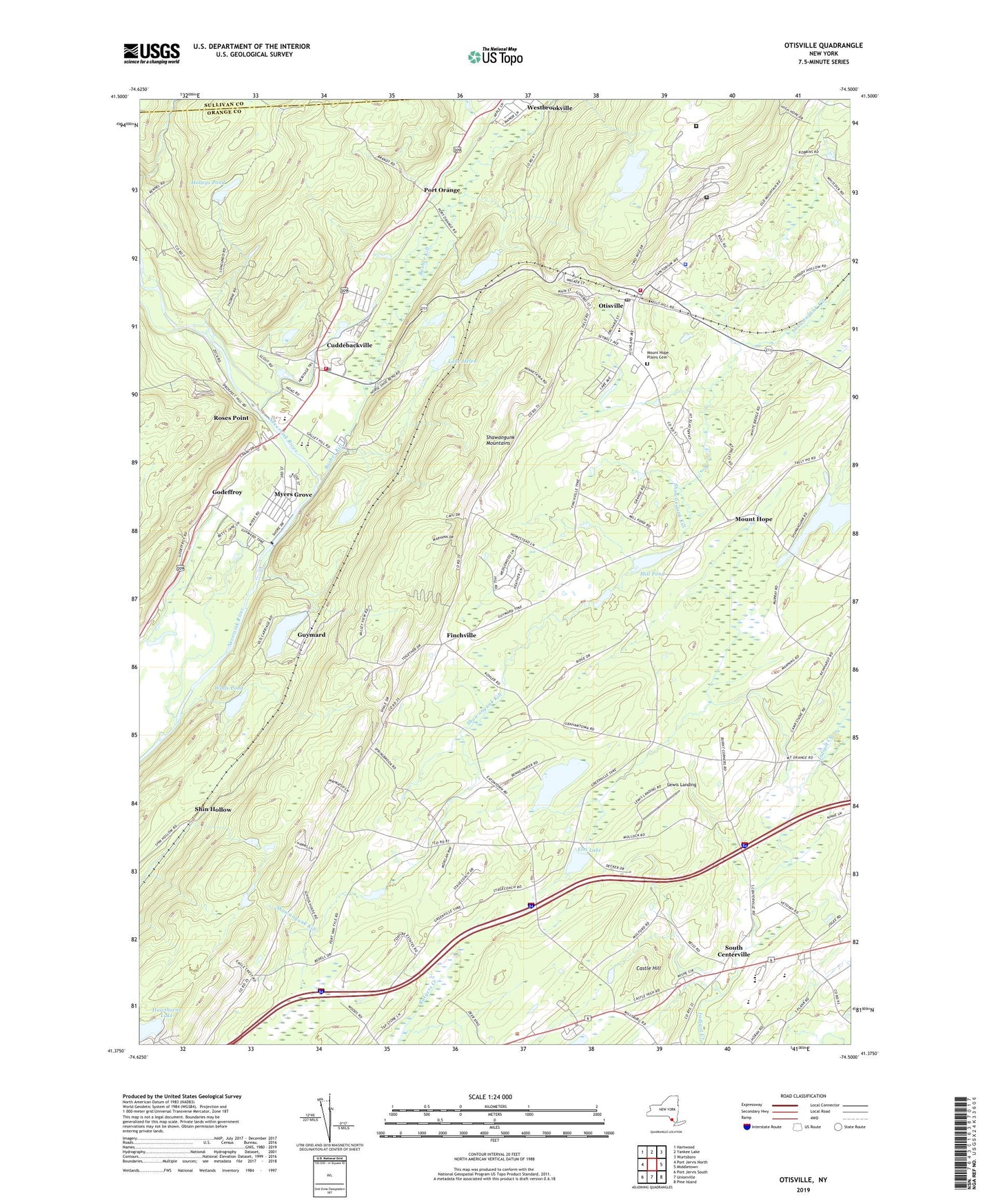
2023 topographic map quadrangle Otisville in the state of New York. Scale: 1:24000. Based on the newly updated USGS 7.5' US Topo map series, this map is in the following counties: Orange, Sullivan. The map contains contour data, water features, and other items you are used to seeing on USGS maps, but also has updated roads and other features. This is the next generation of topographic maps. Printed on high-quality waterproof paper with UV fade-resistant inks.
Quads adjacent to this one:
West: Port Jervis North
Northwest: Hartwood
North: Yankee Lake
Northeast: Wurtsboro
East: Middletown
Southeast: Pine Island
South: Unionville
This map covers the same area as the classic USGS quad with code o41074d5.
Contains the following named places: Basher Kill, Binnewater Pond, Birch Ridge Camp, Camp Ackvah, Camp Hayes, Castle High Estates, Castle Hill, Cuddebackville, Cuddebackville Fire Department, Cuddebackville Post Office, Cuddleback Schoolhouse, Delaware And Hudson Canal County Park, Eaton School, Elm Lake, Federal Correctional Institution Otisville, Finchville, Finchville School, Godeffroy, Godeffroy School Number 12, Graham Station, Guymard, Guymard Lake, Hawthorne Lake, Holleys Pond, Holy Cross Catholic Church, Holy Name of Jesus Church, Kirby Farm, Lake Helen, Lewis Landing, Metro-North Otisville Station, Mill Pond, Minisink Valley Central School, Mount Hope, Mount Hope Plains Cemetery, Mount Hope Presbyterian Church, Mount Hope Reservoir, Myers Grove, Neversink Valley Area Museum, New York Board of Health Research Laboratory, New York City Municipal Sanitorium, Nial A Hamilton Bicentennial School, Oak Ridge Park, Oakland Valley Campground, Oakland Valley Race Park, Otisville, Otisville Correctional Facility, Otisville Country Fair, Otisville Elementary School, Otisville Fire Department, Otisville Post Office, Otisville Village Hall, Piersons Evergreen Farm, Pine Grove, Pine Kill, Port Orange, Roses Point, Seokwang Korean Presbyterian Church, Shawangunk Lake, Shin Hollow, South Centerville, Town of Mount Hope, Valley Junction, Village of Otisville, Walls Pond, West Brookville Station, Westbrookville, WXHD-FM (Mount Hope), ZIP Codes: 10963, 12729