MyTopo
Yankee Lake New York US Topo Map
Couldn't load pickup availability
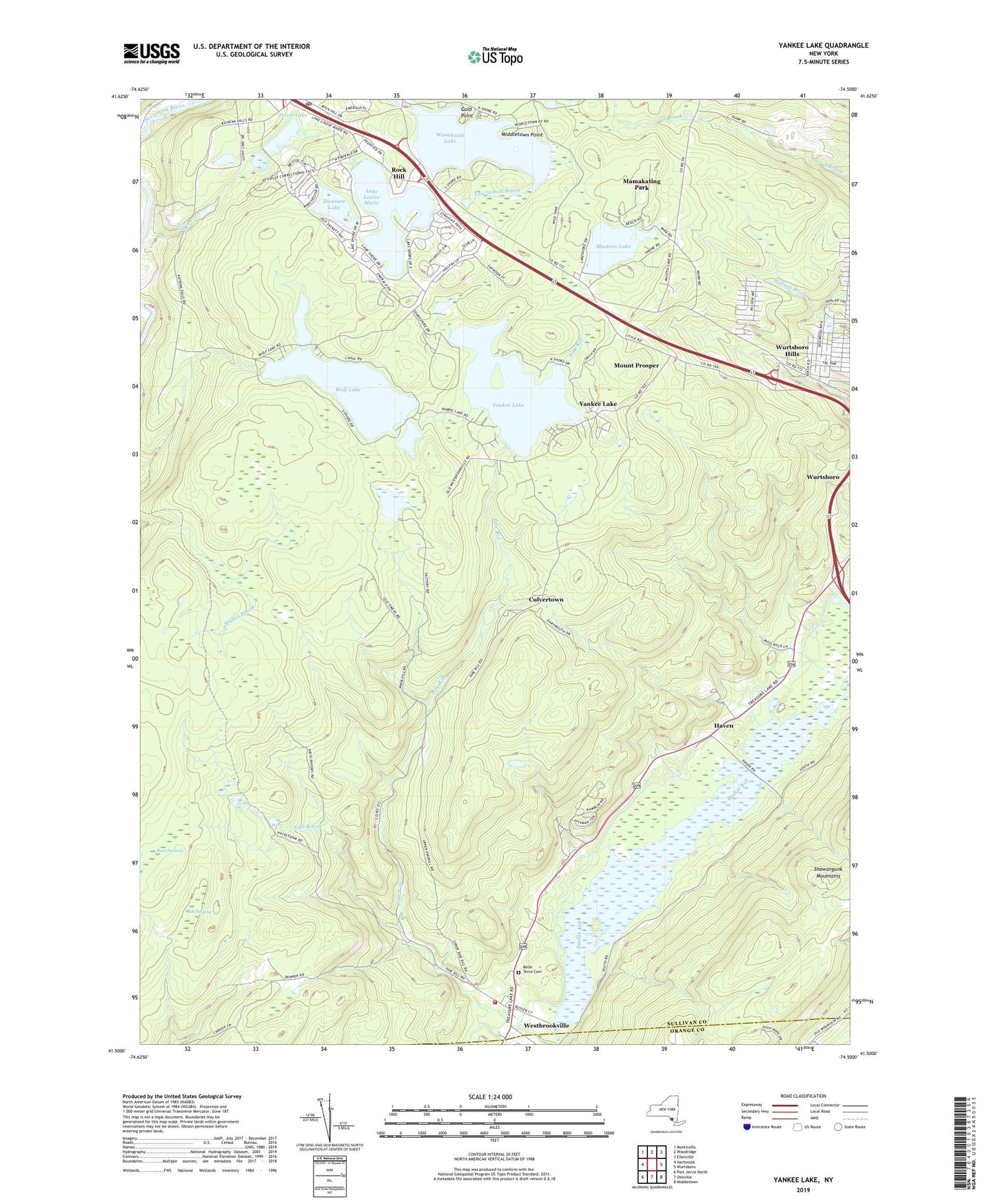
2023 topographic map quadrangle Yankee Lake in the state of New York. Scale: 1:24000. Based on the newly updated USGS 7.5' US Topo map series, this map is in the following counties: Sullivan, Orange. The map contains contour data, water features, and other items you are used to seeing on USGS maps, but also has updated roads and other features. This is the next generation of topographic maps. Printed on high-quality waterproof paper with UV fade-resistant inks.
Quads adjacent to this one:
West: Hartwood
Northwest: Monticello
North: Woodridge
Northeast: Ellenville
East: Wurtsboro
Southeast: Middletown
South: Otisville
Southwest: Port Jervis North
This map covers the same area as the classic USGS quad with code o41074e5.
Contains the following named places: Ash Swamp, Bear Swamp, Belle Terre Cemetery, Culvertown, Davis Lake, Fall Brook, Gold Point, Haven, Katrina Falls, Lake Louise Marie, Mamakating Park, Mastens Lake, Middletown Point, Mount Prosper, Rock Hill Census Designated Place, Rock Hill Post Office, Treasure Lake, Wanaksink Lake, Westbrookville Volunteer Fire Company 1, Wolf Lake, Wurtsboro Hills, Wurtsboro Hills Census Designated Place, WZAD-FM (Wurtsboro), Yankee Lake, ZIP Codes: 12775, 12785, 12790