MyTopo
Owls Head New York US Topo Map
Couldn't load pickup availability
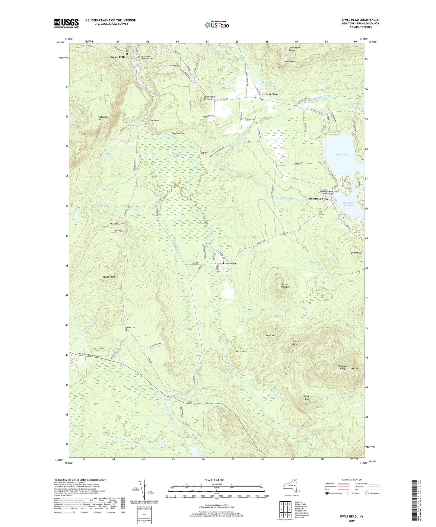
2019 topographic map quadrangle Owls Head in the state of New York. Scale: 1:24000. Based on the newly updated USGS 7.5' US Topo map series, this map is in the following counties: Franklin. The map contains contour data, water features, and other items you are used to seeing on USGS maps, but also has updated roads and other features. This is the next generation of topographic maps. Printed on high-quality waterproof paper with UV fade-resistant inks.
Quads adjacent to this one:
West: Lake Titus
Northwest: Malone
North: Chasm Falls
Northeast: Brainardsville
East: Ragged Lake
Southeast: Loon Lake
South: Debar Mountain
Southwest: Meacham Lake
Contains the following named places: Barnes Brook, Barnes Pinnacle, Bell Brook, Brickyard Brook, Burnt Hill, Chasm Falls Methodist Cemetery, Childs Ponds, Debar Brook, Doctor Hill, Duane Stream, Fishpole Pond, Franklin State Forest Number One, Goldsmith Range, Hatch Brook, High Falls, Hoose Cemetery, Huckleberry Marsh, Indian Lake, Ingraham Stream, Mount Tom, Mountain View, Mountain View Lake, Mountain View Road Bridge, Needles Eye, Owls Head, Owls Head Mountain View Volunteer Fire Department Station 1, Owls Head Pinnacle, Owls Head Pond, Owls Head Post Office, Owls Head Range, Oxbow, Papoose Lake, Peak Mountain, Plumadore Range, Porcaville, Saint Helen's Cemetery, Saint Helens Church, Saint Josephs Church, Studley Hill, Sugar Hill, The Bend, Titusville Mountain, Townline Brook