MyTopo
Brainardsville New York US Topo Map
Couldn't load pickup availability
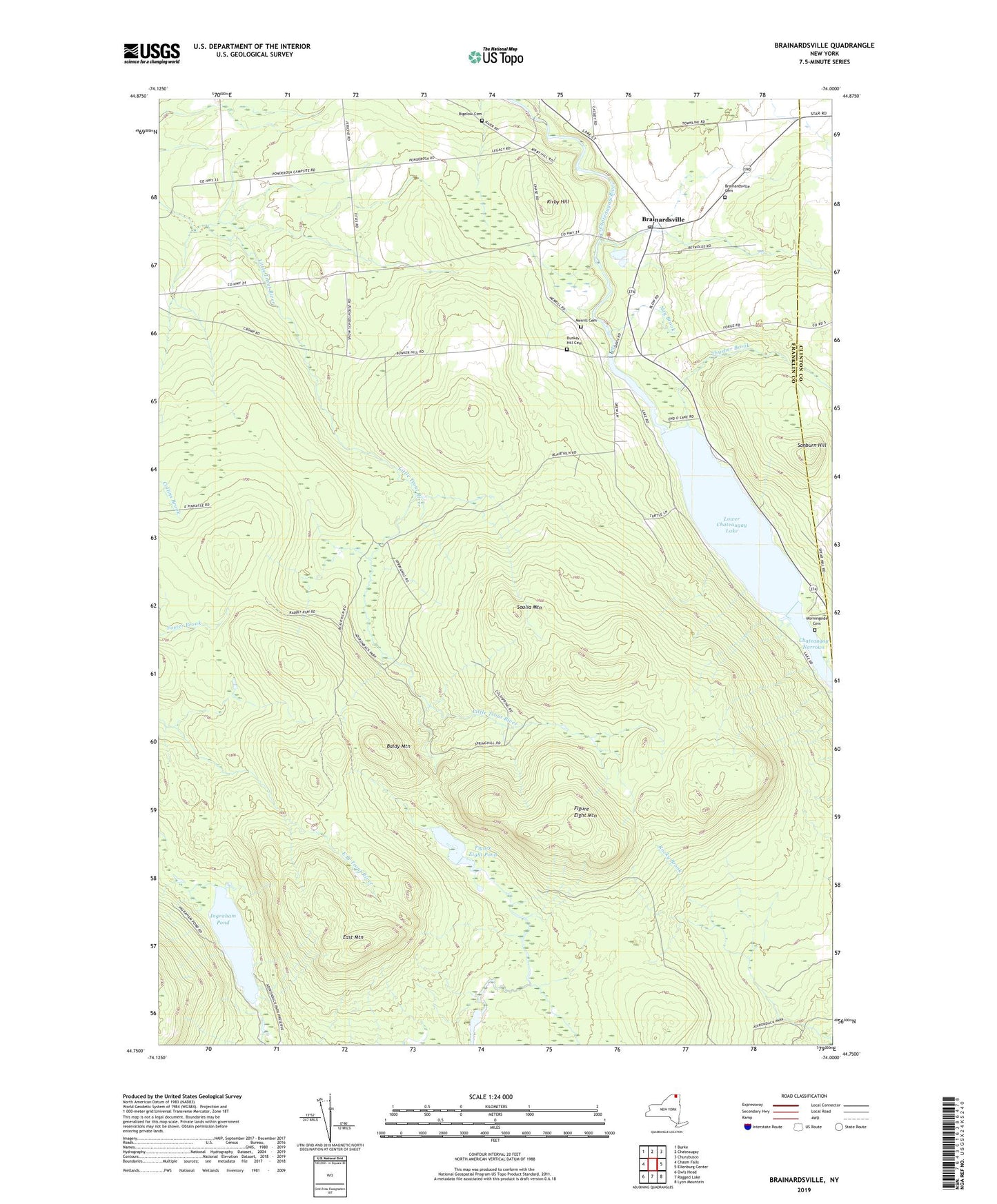
2023 topographic map quadrangle Brainardsville in the state of New York. Scale: 1:24000. Based on the newly updated USGS 7.5' US Topo map series, this map is in the following counties: Franklin, Clinton. The map contains contour data, water features, and other items you are used to seeing on USGS maps, but also has updated roads and other features. This is the next generation of topographic maps. Printed on high-quality waterproof paper with UV fade-resistant inks.
Quads adjacent to this one:
West: Chasm Falls
Northwest: Burke
North: Chateaugay
Northeast: Churubusco
East: Ellenburg Center
Southeast: Lyon Mountain
South: Ragged Lake
Southwest: Owls Head
This map covers the same area as the classic USGS quad with code o44074g1.
Contains the following named places: Baldy Mountain, Bigelow Cemetery, Blairs Kiln, Brainardsville, Brainardsville Cemetery, Brainardsville Post Office, Brainardsville Sewer District 1 Wastewater Treatment Plant, Bunker Hill Cemetery, Chateaugay River, East Mountain, Figure Eight Mountain, Figure Eight Pond, Ingraham Pond, Kirby Hill, Lilypad Pond, Lower Chateaugay Lake, Merrill Cemetery, Morningside Cemetery, Nay Brook, Ponderosa Campsite, Sanburn Hill, School Number 15, Soulia Mountain, Thurber Brook, Whites Kiln