MyTopo
Edgemere Pennsylvania US Topo Map
Couldn't load pickup availability
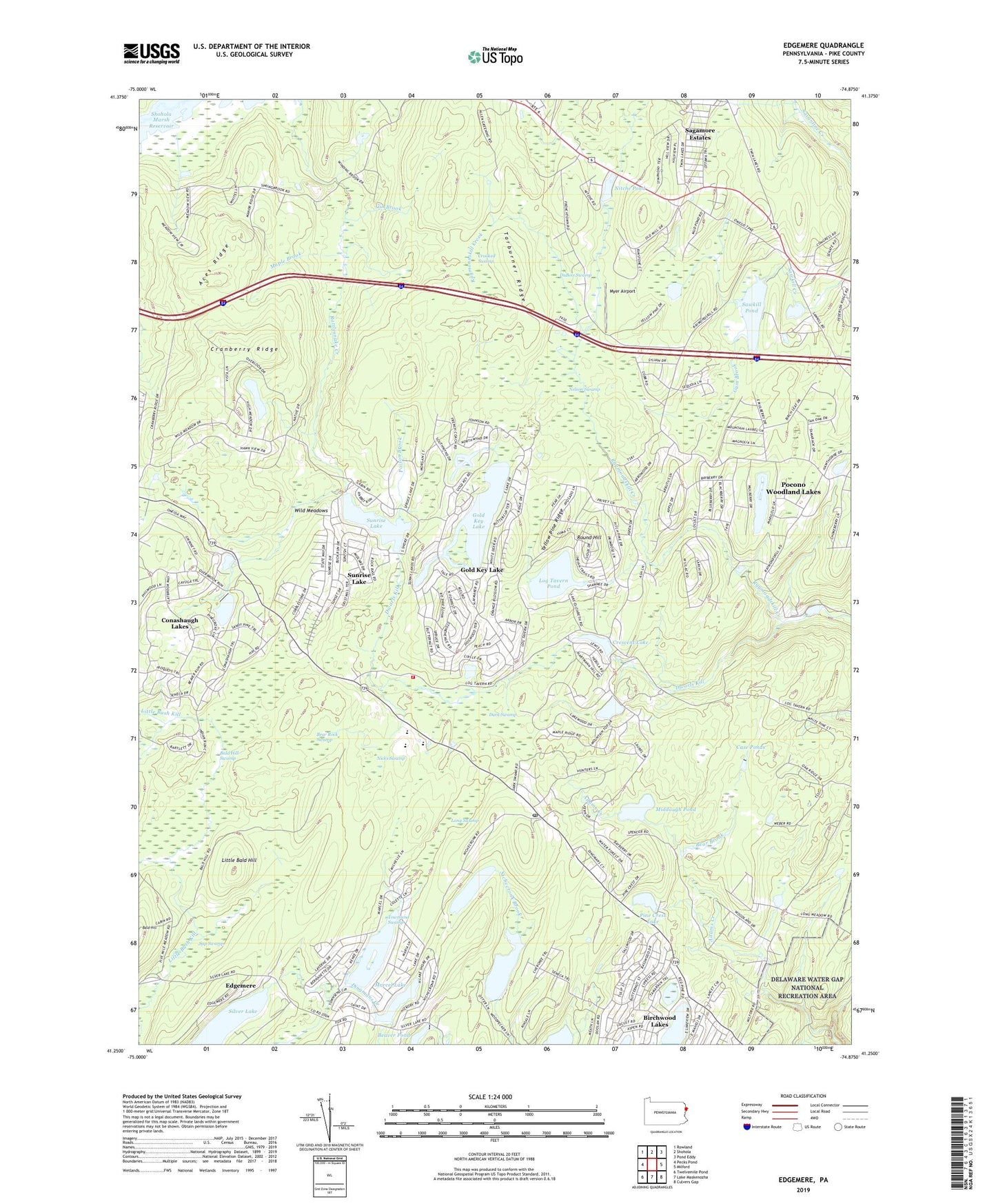
2023 topographic map quadrangle Edgemere in the state of Pennsylvania. Scale: 1:24000. Based on the newly updated USGS 7.5' US Topo map series, this map is in the following counties: Pike. The map contains contour data, water features, and other items you are used to seeing on USGS maps, but also has updated roads and other features. This is the next generation of topographic maps. Printed on high-quality waterproof paper with UV fade-resistant inks.
Quads adjacent to this one:
West: Pecks Pond
Northwest: Rowland
North: Shohola
Northeast: Pond Eddy
East: Milford
Southeast: Culvers Gap
South: Lake Maskenozha
Southwest: Twelvemile Pond
This map covers the same area as the classic USGS quad with code o41074c8.
Contains the following named places: Aces Ridge, Adams Brook Dam, Adams Brook Reservoir, Bald Hill, Bald Hill Swamp, Bald Hill Trail, Bear Brook, Bear Rock Swamp, Beaver Pond, Beaver Pond Dam, Birchwood Lakes, Birchwood Lakes Census Designated Place, Camp Massad Dam, Camp Netimus Dam, Camp Netimus Lake, Camp Speers, Case Ponds, Conashaugh Lakes, Conashaugh Lakes Census Designated Place, Cranberry Ridge, Crescent Lake, Cresent Lake Dam, Crooked Swamp, Dark Swamp, Dark Swamp School, Dingman Delaware Elementary School, Dingman Township Volunteer Fire Department 26, Dingmans Ferry Post Office, DuBois Swamp, Dwarfs Kill, Edgemere, Felix Fold Dam, Frenchtown, German School, Gin Brook, Gold Key Lake, Gold Key Lake Census Designated Place, Gum Brook, Gun Club Dam, Little Bald Hill, Log Tavern Pond, Long Meadow Brook, Long Meadow School, Long Swamp, Maple Brook, Maple Brook Trail, Marcel Lake, Marcel Lake Dam, Marcel Lake Estate, Middaugh Pond, Myer Airport, Nelson Swamp, New Jersey Camp, Nichecronk Pond, Nicks Swamp, Nitche Pond, Pine Crest Lake, Pocono Mountain Water Forest, Pocono Mountain Woodland Lakes, Pocono Woodland Lake, Pocono Woodland Lake Dam, Pocono Woodland Lakes Census Designated Place, Poison Brook, Round Hill, Sagamore Estates, Sap Swamp, Sawkill Dam, Sawkill Pond, Sawkill Pond Dam, Sawkill School, Silver Lake, Spencer Corner, Spring Brook School, Stillwater Natural Area, Sunrise Lake, Sunrise Lake Census Designated Place, Tarburner Ridge, Townsend Swamp, Township of Dingman, Wild Meadows, Woodpecker Lake, Yellow Pine Ridge