MyTopo
Port Douglass New York US Topo Map
Couldn't load pickup availability
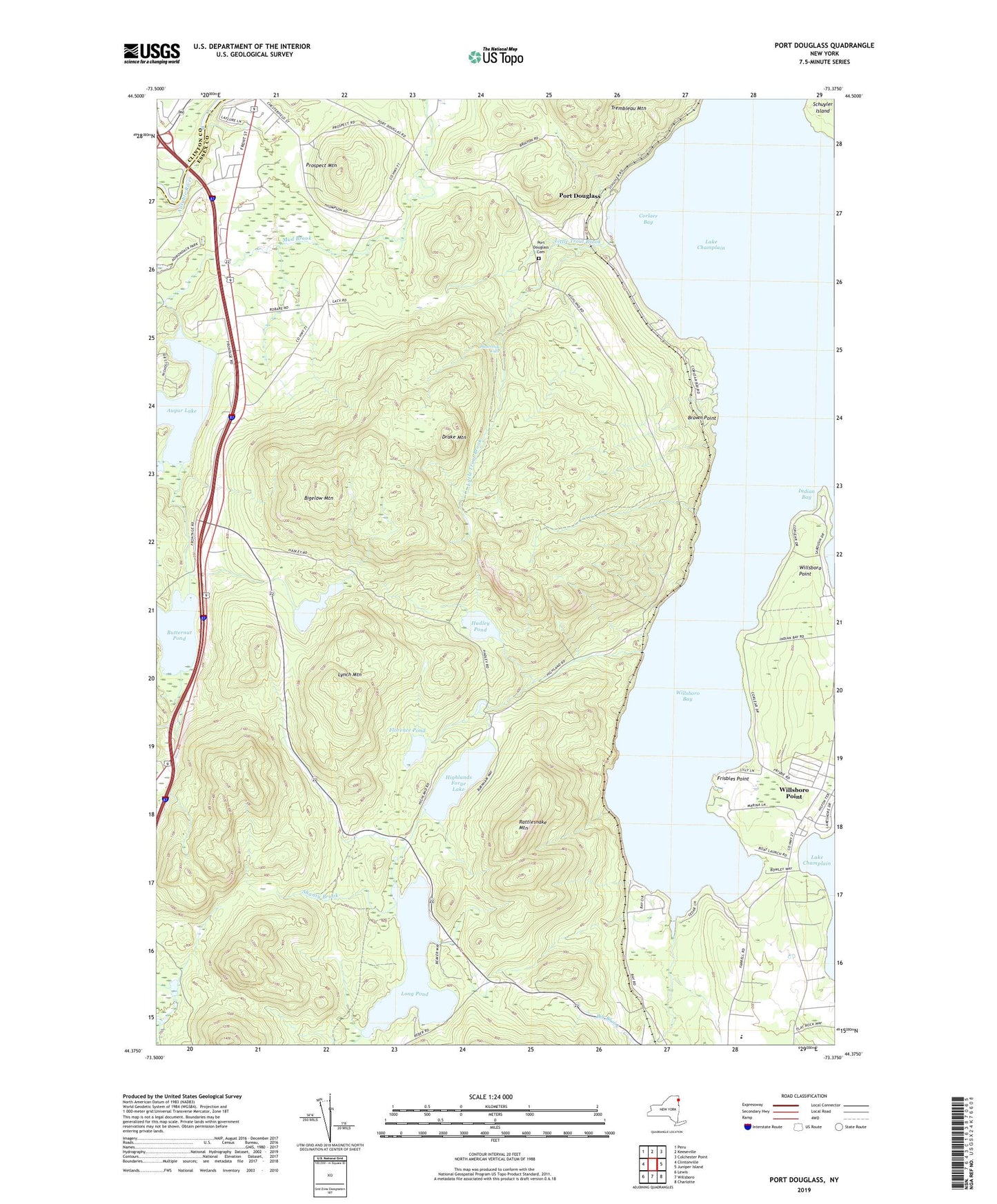
2019 topographic map quadrangle Port Douglass in the state of New York. Scale: 1:24000. Based on the newly updated USGS 7.5' US Topo map series, this map is in the following counties: Essex, Clinton. The map contains contour data, water features, and other items you are used to seeing on USGS maps, but also has updated roads and other features. This is the next generation of topographic maps. Printed on high-quality waterproof paper with UV fade-resistant inks.
Quads adjacent to this one:
West: Clintonville
Northwest: Peru
North: Keeseville
Northeast: Colchester Point
East: Juniper Island
Southeast: Charlotte
South: Willsboro
Southwest: Lewis
Contains the following named places: Augur Lake, Ausable River Campsite, Big Brook, Bigelow Mountain, Brown Point, Buttermilk Falls, Butternut Pond, Corlaer Bay, Drake Mountain, Florence Pond, Frisbies Point, Hadley Pond, Hatch Point, Highlands Forge Lake, Indian Bay, Indian Bay Marina, Keenan Pond, Little Trout Brook, Long Pond, Lynch Mountain, McGuire Brook, Port Douglass, Port Douglass Cemetery, Prospect Mountain, Rattlesnake Mountain, Schuyler Island, Shanty Brook, Sugarloaf Mountain, Town of Chesterfield, Town of Willsboro, Willsboro Bay, Willsboro Bay Marina, Willsboro Central School, Willsboro Golf Club, Willsboro Point, Willsboro Point Census Designated Place