MyTopo
Charlotte Vermont US Topo Map
Couldn't load pickup availability
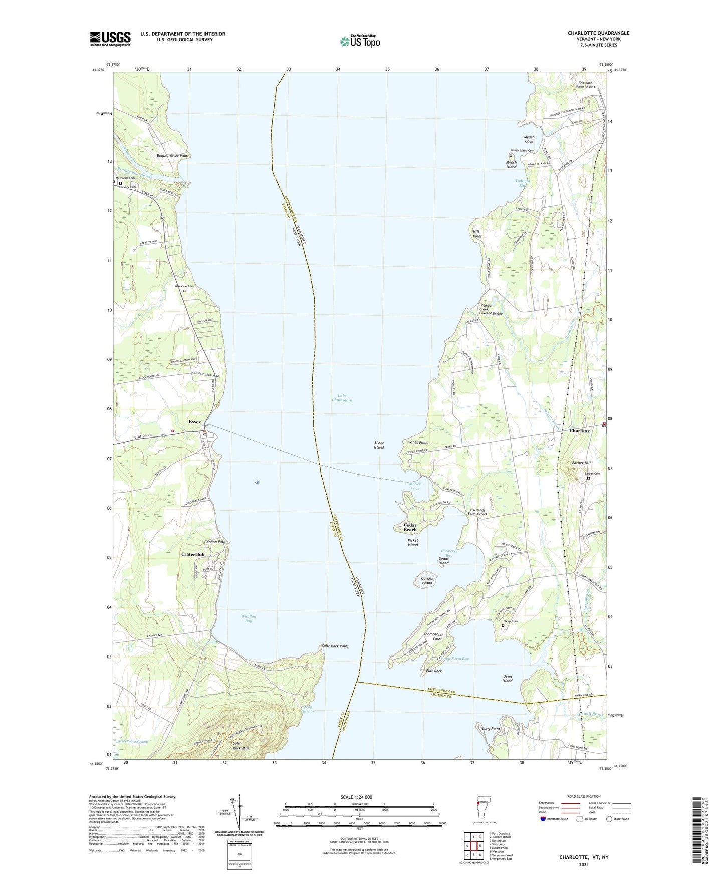
2024 topographic map quadrangle Charlotte in the states of Vermont, New York. Scale: 1:24000. Based on the newly updated USGS 7.5' US Topo map series, this map is in the following counties: Chittenden, Essex, Addison. The map contains contour data, water features, and other items you are used to seeing on USGS maps, but also has updated roads and other features. This is the next generation of topographic maps. Printed on high-quality waterproof paper with UV fade-resistant inks.
Quads adjacent to this one:
West: Willsboro
Northwest: Port Douglass
North: Juniper Island
Northeast: Burlington
East: Mount Philo
Southeast: Vergennes East
South: Vergennes West
Southwest: Westport
Contains the following named places: Barber Cemetery, Barber Hill, Belden Noble Memorial Library, Boquet River, Boquet River Point, Bostwick Farm Airport, Brandywine Brook, Calvary Cemetery, Camp Kinloch, Cannon Point, Cedar Beach, Cedar Island, Charlotte, Charlotte Center Historic District, Charlotte Congregational Church, Charlotte Fire Station, Charlotte Post Office, Converse Bay, Craterclub, Dean Island, E A Deeds Farm Airport, Essex, Essex Boatworks Seaplane Base, Essex Community Church, Essex Ferry, Essex Post Office, Essex Volunteer Fire Department, Flat Rock, Garden Island, Gardiner Island, Grog Harbor, Hill Point, Holmes Creek, Holmes Creek Covered Bridge, Justin Morgan Memorial Museum, Kimball Brook, Lady of Hope Shrine, Lakeview Cemetery, Long Point, McNeil Cove, Meach Cove, Meach Island, Meach Island Cemetery, Memorial Cemetery, National Museum of the Morgan Horse Library, North Ferrisburgh Station, Picket Island, Point Bay Marina, Pringle Brook, Saint Johns Episcopal Church, Saint Josephs Church, Sloop Island, Split Rock Point, Split Rock Point Light, Thompsons Point, Thorp Brook, Thorp Cemetery, Town Farm Bay, Twilight Bay, West Charlotte, West Charlotte Census Designated Place, Whallon Bay, Whallon Bay School, Wings Point


