MyTopo
Peru New York US Topo Map
Couldn't load pickup availability
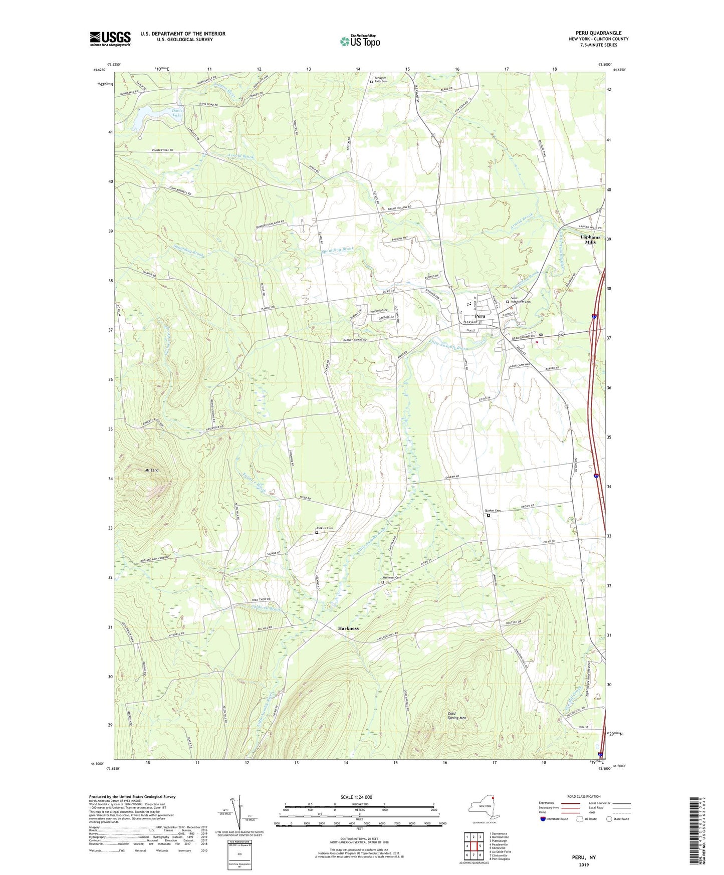
2023 topographic map quadrangle Peru in the state of New York. Scale: 1:24000. Based on the newly updated USGS 7.5' US Topo map series, this map is in the following counties: Clinton. The map contains contour data, water features, and other items you are used to seeing on USGS maps, but also has updated roads and other features. This is the next generation of topographic maps. Printed on high-quality waterproof paper with UV fade-resistant inks.
Quads adjacent to this one:
West: Peasleeville
Northwest: Dannemora
North: Morrisonville
Northeast: Plattsburgh
East: Keeseville
Southeast: Port Douglass
South: Clintonville
Southwest: Au Sable Forks
This map covers the same area as the classic USGS quad with code o44073e5.
Contains the following named places: Adirondack Farms, Applejacks Orchard, Arnold Brook, Caldwell Brook, Calkins Cemetery, Calkins School, Central School, Clark Corners, Clark School, Cold Spring Mountain, Conwells Mobile Home Park, Covel's Tree Farm And Nursery, Davis Lake, Forrence Orchards, Furnace Brook, Harkness, Harkness Cemetery, Hart Apple Farms, Laphams Mills, Maplegrand Farms, Mother Cabrini Shrine, Mount Etna, Peru, Peru Census Designated Place, Peru Community Church, Peru Post Office, Peru Town Hall, Peru Volunteer Fire Department, Quaker Cemetery, Saint Augustine Cemetery, Saint Augustine Church, Saint Patricks Church, Schuyler Falls Cemetery, Spaulding Brook, Town of Au Sable, Town of Peru, ZIP Code: 12972