MyTopo
Rainbow Falls New York US Topo Map
Couldn't load pickup availability
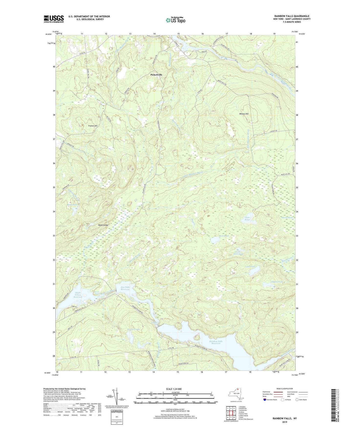
2019 topographic map quadrangle Rainbow Falls in the state of New York. Scale: 1:24000. Based on the newly updated USGS 7.5' US Topo map series, this map is in the following counties: St. Lawrence. The map contains contour data, water features, and other items you are used to seeing on USGS maps, but also has updated roads and other features. This is the next generation of topographic maps. Printed on high-quality waterproof paper with UV fade-resistant inks.
Quads adjacent to this one:
West: Colton
Northwest: Potsdam
North: Parishville
Northeast: Nicholville
East: Sylvan Falls
Southeast: Carry Falls Reservoir
South: Stark
Southwest: Albert Marsh
Contains the following named places: Clear Pond, Close Pond, Dead Creek, Five Falls, Five Falls Reservoir, French Hill, Gain Twist Falls, Harvey Brook, Hawk Ledge, Horton Ponds, Lilypad Pond, Little Falls, Little Rock Pond, Long Pond, Morgan Rapids, Pickettville, Rainbow Brook, Rainbow Falls, Rainbow Falls Reservoir, Rock Pond, Saint Lawrence State Forest, School Number 11, School Number 13, School Number 8, South Colton Reservoir, Town of Parishville, Wheeler Marsh, Whites Hill