MyTopo
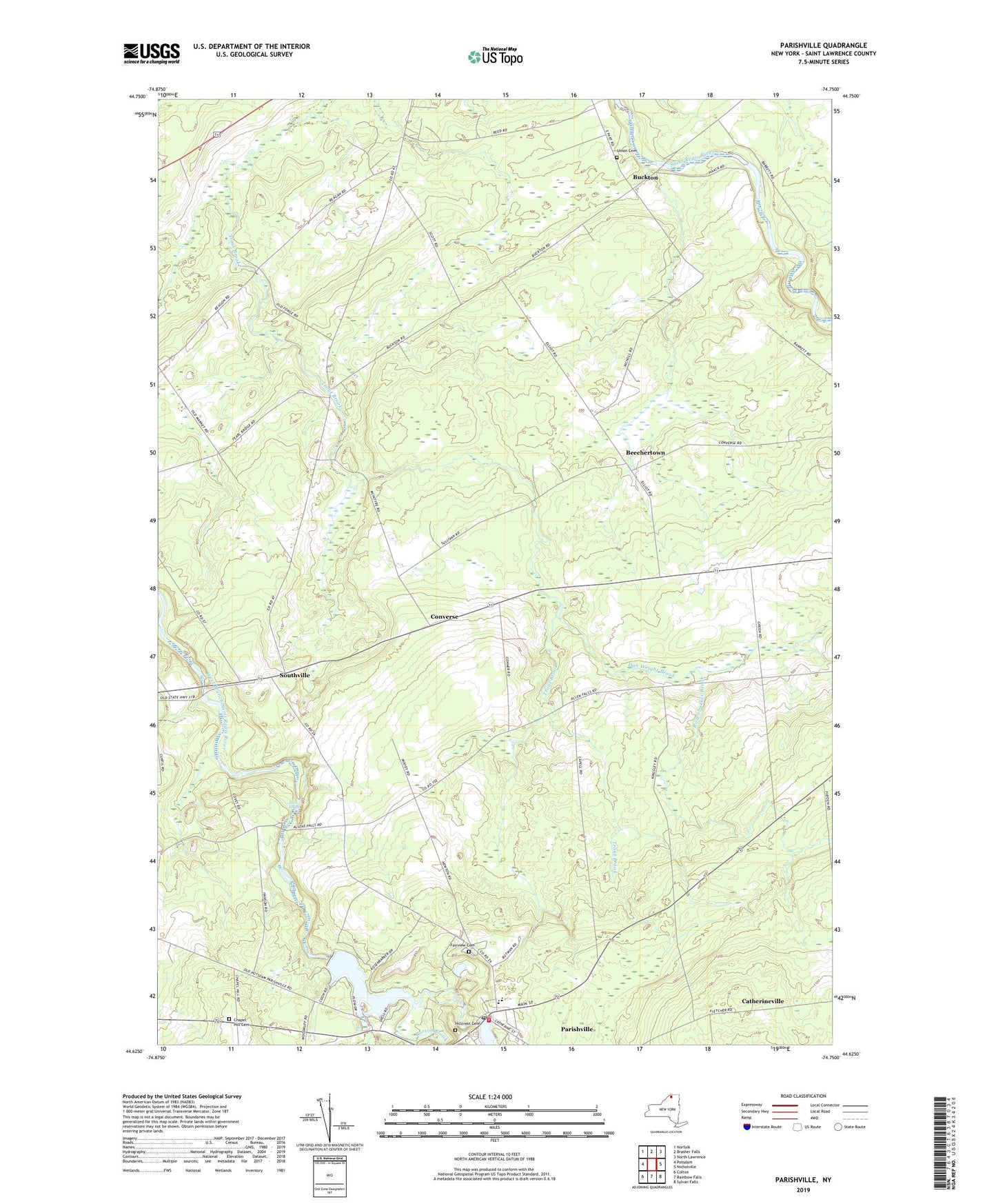
Parishville New York US Topo Map
Couldn't load pickup availability
2023 topographic map quadrangle Parishville in the state of New York. Scale: 1:24000. Based on the newly updated USGS 7.5' US Topo map series, this map is in the following counties: St. Lawrence. The map contains contour data, water features, and other items you are used to seeing on USGS maps, but also has updated roads and other features. This is the next generation of topographic maps. Printed on high-quality waterproof paper with UV fade-resistant inks.
Quads adjacent to this one:
West: Potsdam
Northwest: Norfolk
North: Brasher Falls
Northeast: North Lawrence
East: Nicholville
Southeast: Sylvan Falls
South: Rainbow Falls
Southwest: Colton
This map covers the same area as the classic USGS quad with code o44074f7.
Contains the following named places: Alder Meadow Brook, Allen Falls, Allen Falls Reservoir, Barton Brook, Beechertown, Buckton, Catherineville, Chapel Hill Cemetery, Converse, Dan Wright Brook, Fairview Cemetery, Hillcrest Cemetery, Parishville, Parishville Census Designated Place, Parishville Post Office, Parishville Volunteer Fire Company Station 1, Parishville-Hopkinton School, Rosenbarker Brook, Saint Lawrence State Forest Number 2, Saint Lawrence State Forest Number 31, School Number 1, School Number 19, School Number 2, School Number 25, School Number 3, School Number 6, School Number 9, Southville, Town of Stockholm, Union Cemetery