MyTopo
Remington Corners New York US Topo Map
Couldn't load pickup availability
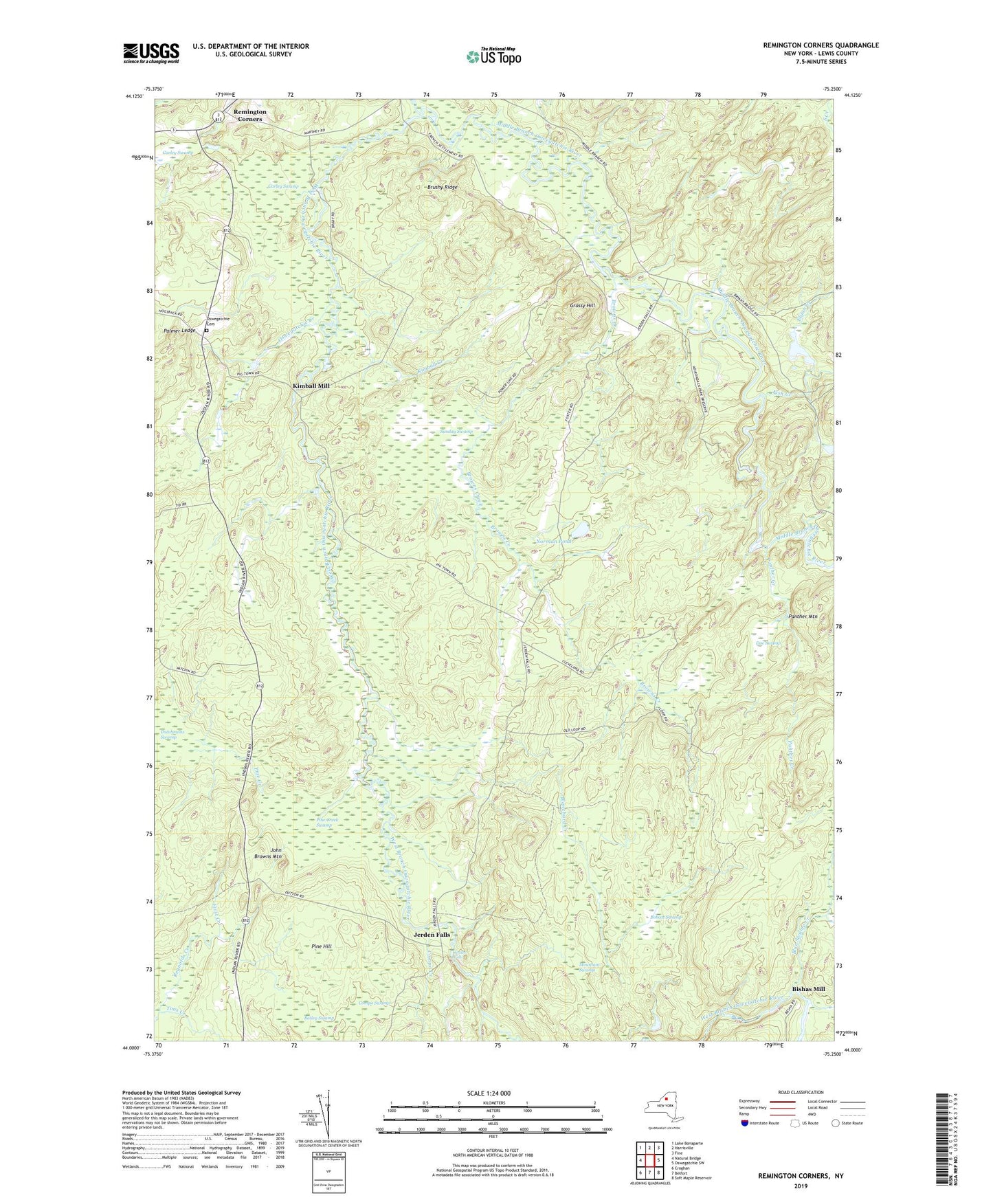
2019 topographic map quadrangle Remington Corners in the state of New York. Scale: 1:24000. Based on the newly updated USGS 7.5' US Topo map series, this map is in the following counties: Lewis. The map contains contour data, water features, and other items you are used to seeing on USGS maps, but also has updated roads and other features. This is the next generation of topographic maps. Printed on high-quality waterproof paper with UV fade-resistant inks.
Quads adjacent to this one:
West: Natural Bridge
Northwest: Lake Bonaparte
North: Harrisville
Northeast: Fine
East: Oswegatchie SW
Southeast: Soft Maple Reservoir
South: Belfort
Southwest: Croghan
Contains the following named places: Bailey Swamp, Bishas Mill, Blanchard Creek, Blue Swamp Creek, Bobcat Swamp, Browns Creek, Brushy Ridge, Carley Swamp, Compo Creek, Compo Swamp, Doe Swamp, Dutchmans Swamp, Dutton Corners, Elijah Creek, First Creek, Fish Creek, Grassy Hill, Jerden Falls, John Browns Mountain, Kimball Creek, Kimball Mill, Middle Branch Corners, Middle Branch Oswegatchie River, Mountain Swamp, Norman Pond, Oswegatchie Cemetery, Oswegatchie Corners, Oswegatchie Creek, Palmer Ledge, Panther Creek, Panther Mountain, Pine Creek, Pine Creek Swamp, Pine Hill, Remington Corners, Sunday Swamp, Tims Creek, Tinney Corners, Town of Diana, Tylers Corners