MyTopo
Rexville New York US Topo Map
Couldn't load pickup availability
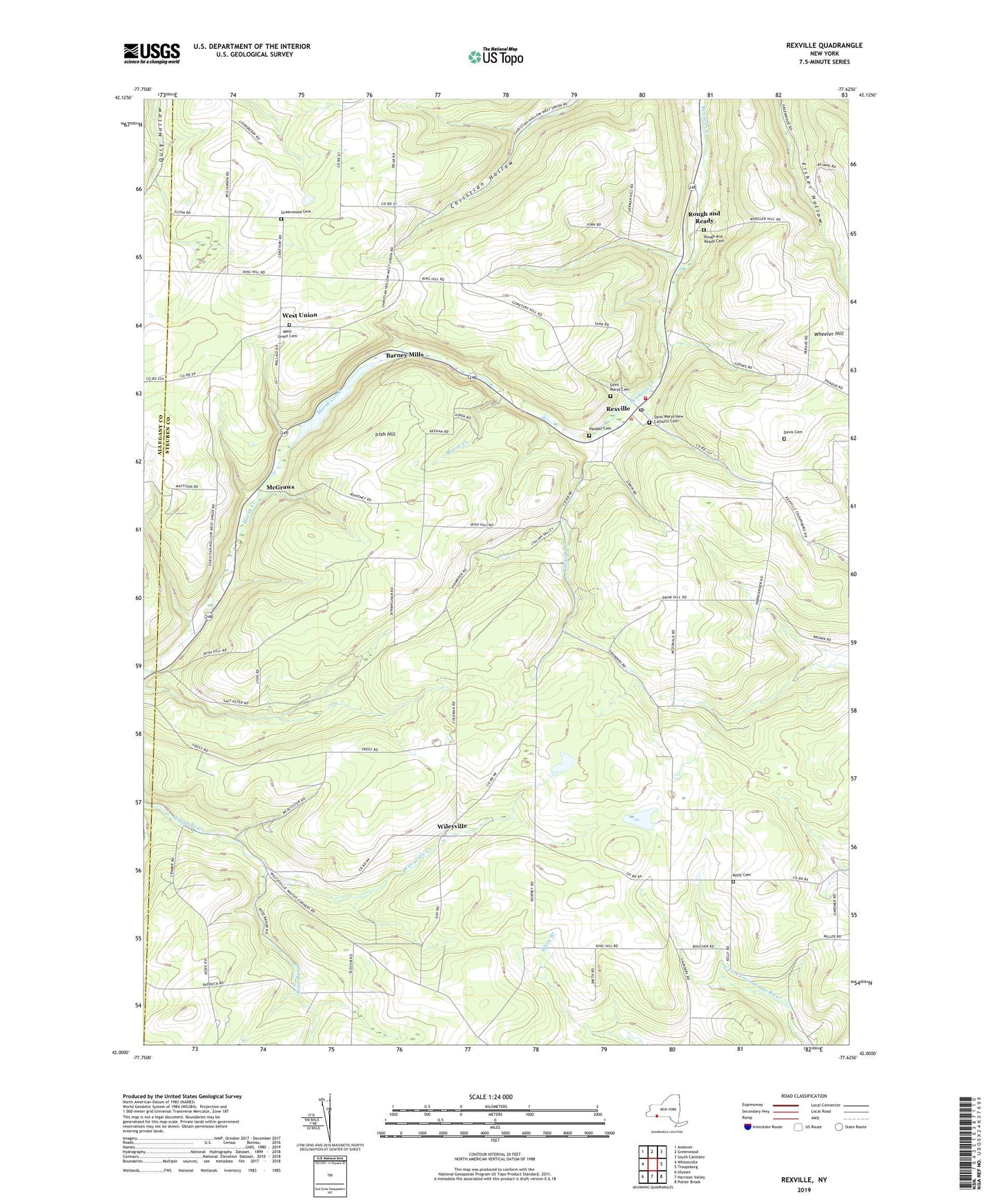
2019 topographic map quadrangle Rexville in the state of New York. Scale: 1:24000. Based on the newly updated USGS 7.5' US Topo map series, this map is in the following counties: Steuben, Allegany. The map contains contour data, water features, and other items you are used to seeing on USGS maps, but also has updated roads and other features. This is the next generation of topographic maps. Printed on high-quality waterproof paper with UV fade-resistant inks.
Quads adjacent to this one:
West: Whitesville
Northwest: Andover
North: Greenwood
Northeast: South Canisteo
East: Troupsburg
Southeast: Potter Brook
South: Harrison Valley
Southwest: Ulysses
Contains the following named places: A C Rochester Engineering Center Heliport, Barney Mills, Catholic Church School, Davis Cemetery, Gilbert Hill School, Greenwood Cemetery, Hauber Cemetery, Irish Hill, Irish Hill School, Kelly Cemetery, King Hill School, McGraw School, McGraws, Rexville, Rexville Post Office, Rose Brook, Rose School, Rough and Ready, Rough And Ready Cemetery, Saint Marys Cemetery, Saint Marys Church, Saint Marys New Catholic Cemetery, Saunders School, Town of West Union, West Union, West Union Cemetery, West Union Church, West Union Grange Hall, West Union Volunteer Fire Department, Wheeler Hill, Wileyville, ZIP Codes: 14839, 14877